|
|

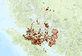
Cadastral Property Parcels  Received from SRD Feb 6, 2014
|
This is a spatial layer that reflects operational activities for cut blocks contained within harvesting authorities. The Forest Tenures Section (FTS) is responsible for the creation and maintenance of digital Forest Atlas files for the province of British Columbia encompassing Forest and Range Act Tenures. It also supports the forest resources programs delivered by MoFR. Each feature contains a Ministry of Forests and Range (MoFR) FEATURE_CLASS_SKEY (number) column that further defines the type of that feature. The layer contains cut block boundaries for the following feature classes: Forest Licence Cut Block (555), Licence to Cut Cut Block (616), Timber Licence Cut Block (810), Timber Sale Licence Major Cut Block...
|

This is a spatial layer showing Ministry of Forests Managed LIcences. These are Community Forest Schedule A and B, Woodlot License Schedule A and B. The Forest Tenures Section (FTS) is responsible for the creation and maintenance of digital Forest Atlas files for the province of British Columbia encompassing Forest and Range. Date of data creation: 2008-01-15 Update Cycel: Daily Downloaded from the LRDW Oct 16, 2013 Metadata URL: https://apps.gov.bc.ca/pub/geometadata/metadataDetail.do?recordUID=51020&recordSet=ISO19115
|

contains Parks and protected areas managed for important conservation values and are dedicated for the preservation of their natural environments for the inspiration, use and enjoyment of the public. Places of special ecological importance are designated as ecological reserves for scientific research and educational purposes. date of data creation: 2008update Cycle: Daily Downloaded: Jan 2012 Metadata: http://apps.gov.bc.ca/pub/geometadata/metadataDetail.do?recordUID=61319&recordSet=ISO19115
|

1:20,000 contours Received Feb 4, 2014 from the Strathcona Regional District
|
View more...
|