|
|
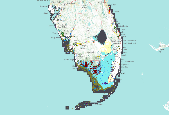
This is a land cover dataset developed by Florida Natural Areas Inventory for coastal conservation planning purposes. It is derived from two primary sources: 1) The Florida Cooperative Land Cover Map(CLC), v.2, a hybrid land cover that combines best available statewide and local land cover data sources; and 2) a revision of the CLC based on review of 2009 – 2011 high resolution aerial photography for a subset of remaining natural uplands that correspond to areas identified in the Assessment of Florida’s Remaining Coastal Upland Natural Communities (Johnson and Gulledge 2005). All data were clipped to a coastal analysis zone defined as 3 m elevation plus 1 kmbuffer. The classification scheme is a modified version...
|

This dataset represents the suitability of various potential corridors between habitat heterogeneity sources and habitat heterogeneity refuges. (See datasets FL_HabHetSources_FNAI and FL_HabHetRefuges_FNAI.) It divides these potential corridors into 20 quantiles (of roughly equal area), where quantile 1 contains the most suitable corridors and quantile 20 the least suitable corridors. For this project, corridor suitability was based on cost distance from sources and refuges; these cost distances were in turn based on euclidean distance, elevation, land use intensity, and habitat heterogeneity.
|

This dataset represents areas of high habitat heterogeneity within the Re-evaluating Florida's Ecological Conservation Priorities in the Face of Sea Level Rise project study area. Features in this dataset are those portions of the project study area where more than 6 unique natural land cover classes exist within a 25 hectare window. These features were identified through a focal statistics raster analysis of the FL_LandCoverCoastal_FNAI dataset within a coastal analysis zone defined as areas in Florida of equal to or less than 3 meters elevation plus a 1 kilometer buffer. The features in this dataset are considered "sources" because they contain areas of less than 1 meter and do not intersect areas of equal to...
|

This dataset represents areas of high habitat heterogeneity within the Re-evaluating Florida's Ecological Conservation Priorities in the Face of Sea Level Rise project study area. Features in this dataset are those portions of the project study area where more than 6 unique natural land cover classes exist within a 25 hectare window. These features were identified through a focal statistics raster analysis of the FL_LandCoverCoastal_FNAI dataset within a coastal analysis zone defined as areas in Florida of equal to or less than 3 meters elevation plus a 1 kilometer buffer. The features in this dataset are considered "refuges" because they intersect areas of equal to or greater than 3 meters. Because of their high...
|
|