|
|

Utah Wilderness Coalition's Citizens' Wilderness Proposal for BLM lands in Utah updated in 2008. All proposed lands and human impacts were visited by staff and volunteers and documented on 1:24000 USGS quadrangles through field checking of each area by land or by aerial photo. This coverage shows all lands in the legislative proposal and lands that have wilderness quality but are not yet a part of the legislative proposal, America's Red Rock Wilderness Act. Note: To display this coverage make certain that those routes that are excluded from the wilderness proposal are displayed on top of the polygons. To do this, make certain to load the polygon and arc components of this coverage. Set polygon attribute uwc_prop...
|

Utah Forest Network's Citizens' Wilderness Proposal for National Forest lands in Utah, and some abutting units on BLM lands in Utah. All proposed lands and human impacts were visited by staff and volunteers and documented on 1:24,000 USGS quadrangles through field checking of each area by land or by aerial photo. Field checking involved visits to every potentially significant human impact in surveyed roadless areas. These were photographed and made part of a continuing paper data file.
|

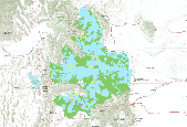
The UWRM proposal represents the uplands wildlands network in the Heart of the West Proposal. Utah_Wyoming Rocky Mountains Ecoregion (UWRM) core areas and linkages shapefile. This GIS dataset provides core areas and linkages that includes all the components of a three track approach (special elements, representation, and focal species) used during the planning process. This is the result of a study contract by The Nature Conservancy to design an ecoregional plan for Northern Utah, Western Wyoming, Southeastern Idaho, Northwest Colorado and South-central Montana. The study was developed in 2001 by Reed Noss, George Wuerthner, Ken Vance-Borland, and Carlos Carroll from Conservation Science, Inc.
|
Heart of the West wildlands network This dataset represents the lowlands wildlands network of core areas, linkages and compatible use areas recommended to define land management and land use based on a biological basis consistent with sustaining the health of this region's ecosystems.
|
|