|
|
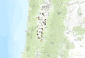
Points from Bob Altman, Aug 2013
|

Points from BISON, mostly ebird
|

The zip file below contains raw input and output files for the 4 final version of the ALI Marxan model. The versions all have the same number of runs (100), number of iterations (35 million), SPF factor for each conservation feature,(100) and BLM (0.35). They vary in overall goal levels and whether or not facets were targeted. The four versions are: (1) high overall goal levels, facets not targeted;(2) medium overall goal levels, facets not targeted; (3) medium overall goal levels, facets not targeted; (4) medium overall goal levels, facets targeted at 15%. Please see the associated report (ALI 2013) for further details, and contact Madeline with any questions.
Categories: Data;
Types: Map Service,
OGC WFS Layer,
OGC WMS Layer,
OGC WMS Service;
Tags: Data,
EARTH SCIENCE > LAND SURFACE > LANDSCAPE,
Federal resource managers,
LCC Network Science Catalog,
Regional & county planners, All tags...
State agencies,
completed,
environment, Fewer tags
|

This project identifies priority areas in the Columbia Plateau Ecoregion to implement conservation strategies for riverine and riparian habitat. This is tailored towards the Arid Lands Initiative (ALI) conservation goals and objectives, and provides the foundation for adaptation to a changing climate. This project adopts a “zoned” approach to identifying focal areas, connectivity management zones and zones for riparian habitat and ecological representation. Through a series of workshops and webinars, the ALI articulated its freshwater conservation goals and targets. Key aspects of these goals included: a focus on non-anadromous salmonid (salmon and steelhead) species, include riparian birds and waterfowl as key...
Categories: Data;
Types: ArcGIS REST Map Service,
ArcGIS Service Definition,
Downloadable,
Map Service,
OGC WFS Layer,
OGC WMS Layer,
OGC WMS Service;
Tags: Arid Lands,
Arid Lands Initiative,
Columbia Plateau,
Data,
EARTH SCIENCE > LAND SURFACE > LANDSCAPE, All tags...
Federal resource managers,
LCC Network Science Catalog,
Landscape conservation design,
Prioritization,
Regional & county planners,
State agencies,
completed,
environment, Fewer tags
|

This geodatabase contains the ALI Marxan 500-acre hexagons, which have fields representing all Marxan targets. An analysis area footprint is also included.
Categories: Data;
Types: Map Service,
OGC WFS Layer,
OGC WMS Layer,
OGC WMS Service;
Tags: ALI,
ALI,
Data,
Data.gov Great Northern Landscape Conservation Cooperative,
EARTH SCIENCE > LAND SURFACE > LANDSCAPE, All tags...
Federal resource managers,
GNLCC,
LCC Network Science Catalog,
Regional & county planners,
State agencies,
completed,
environment,
spatial prioritization analysis,
spatial prioritization analysis, Fewer tags
|
View more...
|