Buffer Percentages for Multiple PCAs: Biodiversity 3

Dates

Original Data Basin Creation Date
2014-03-18 18:00:00
Original Data Basin Modified Date
2014-04-16 10:24:06

Summary

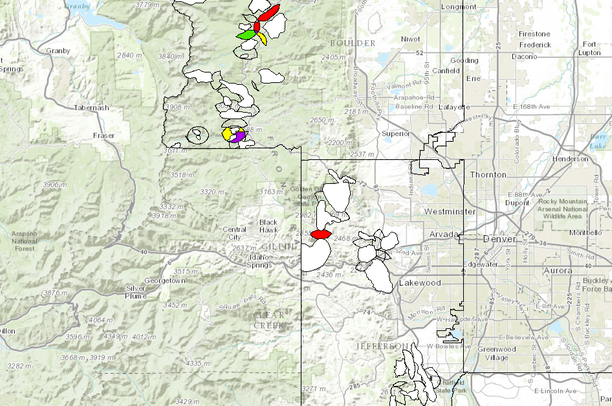
This data set includes Biodiversity 3 PCAs, Level 2 and 3 buffer areas, and the study region. Buffer polygons are areas where multiple one-mile buffers for a given PCA overlap. Level 2 provides a buffer for two PCAs and Level 3 provides a buffer for three PCAs. Buffer poylgons are categorized based on the extent conservation easements fall within them. These buffers are important conservation areas because they create wildlife corridors between multiple PCA habitats. Potential Conservation Areas (PCAs) are “land areas that can provide the habitat and ecological processes upon which a particular element (i.e. rare plant and animal species and significant plant communities) occurrence, or suite of element occurrences, depends for [...]

Contacts

Data Owner :
Gregory Stavish

Attached Files

Preview Image

Map

Communities

  • Data Basin

Tags

Provenance

Data source
<div>Gregory Stavish, M.S.</div><div><br/></div>Colorado Natural Heritage Program<div><br/></div><div>Colorado State University's Colorado Ownership, Management, and Protection (COMap) </div>
Harvested on Fri May 23 09:34:12 MDT 2014 from Data Basin Service
Additional Information

Identifiers

Type Scheme Key
UniqueKey Data Basin ee4aa8ffc1974aa19ba4e37e655db133

Item Actions

View Item as ...

Save Item as ...

View Item...