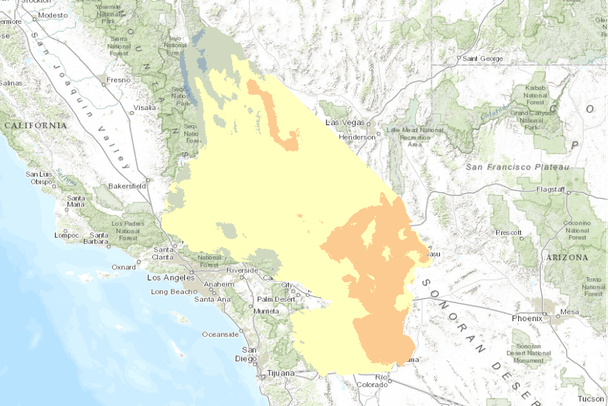
This dataset is a
Basin Characterization Model (BCM) output using the PCM A2 Scenario for annual Minimum Temperature, 2040-2069, clipped to the DRECP 12 km buffered boundary.
Minimum Temperature:Â The modeled daily maximum and minimum are averaged to give daily average; the minimum daily average in a calendar month becomes the monthly minimum; this is averaged over a 30 year period to determine TMin for each month of the year, and for the water year.
The California Basin Characterization Model (BCM) climate dataset provides historical and projected climate surfaces for the state at a 270 meter resolution. The historical data is based on 4 kilometer PRISM data, and the projected climate surfaces are based on the A2 and B1 scenarios of the PCM and GFDL GCMs. The BCM approach uses a regional water balance model based on high resolution downscaled precipitation and temperature as well as elevation, geology, and soils to produce surfaces for a wide range of variables. These variables include maximum temperature, minimum temperature, precipitation, potential evapotranspiration, runoff, recharge, climatic water deficit, actual evapotranspiration, sublimation, soil water storage, snowfall, snowpack, snowmelt, and excess water. Data is distributed as 30-year monthly summaries and 30-year water year summaries, with month-by-month data for each year available by special request.
Creator: Flint, Lorraine E. and Flint, Alan L.
Contributor: Thorne, James, and Boynton, Ryan
Publisher:Â Public Interest Energy Research Program (PIER), California Energy Commission