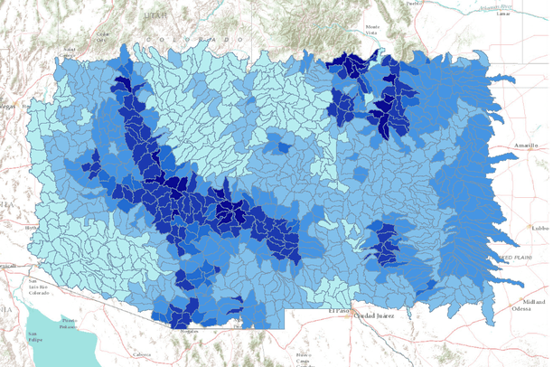
This dataset represents the average annual amount of water contributed to the stream network for each watershed, simulated by the model MC1 for the 30-year period 1971-2000.
Simulated mean streamflow (stormflow + baseflow + runoff) was determined for each HUC5 watershed. Watersheds represent 5th level (HUC5, 10-digit) hydrologic unit boundaries and were acquired from the Natural Resources Conservation Service. Streamflow units are comparable to rainfall - millimeters of water per year.
Background:
The dynamic global vegetation model MC1 (see Bachelet et al. 2001) was used to simulate vegetation dynamics, associated carbon and nitrogen cycle, water budget, and wild fire impacts for OR, WA, AZ and NM, for a project funded by the USDA Forest Service (PNW09-JV-11261900-003).
The MC1 model was run using historical data and future climate change projections from three general circulation models: CSIRO Mk3, MIROC 3.2 medres, and Hadley CM3. Future scenario datasets were generated through statistical downscaling using a simple anomaly method. Historical climate input data were provided by the PRISM group (Chris Daly, Oregon State University) at a 30 arc-second (~800 m) spatial grain.
This project was funded through the U.S. Forest Service by the American Recovery and Reinvestment Act and also in part by the Western Wildland Environmental Threat Center.