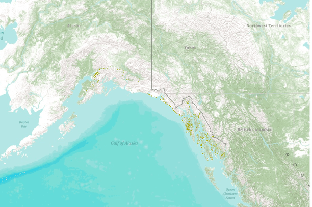
This data represents areas of forest damage due to insect infestation, fire, flood, landslides, windthrow and other mortalities. The information was collected by aerial surveys by both the USFS and ADNR, Div. of Forestry in cooperation with the Forest Health Protection (FHP) project. Surveys are conducted in July and August so that pest "signatures" may be obtained during the optimal period for symptom development of ocular estimation. The aerial survey is coordinated with known pest outbreaks so that the maximum extent of recent bark beetle damage (fading trees) and insect defoliation (discoloration, foliage loss) patterns may be determined. Aerial survey flights are termed as "local" if they can be completed within 1 day from the [...]
Summary
This data represents areas of forest damage due to insect infestation,
fire, flood, landslides, windthrow and other mortalities. The information was
collected by aerial surveys by both the USFS and ADNR, Div. of Forestry in
cooperation with the Forest Health Protection (FHP) project.
Surveys are conducted in July and August so that pest "signatures" may
be obtained during the optimal period for symptom development of ocular estimation.
The aerial survey is coordinated with known pest outbreaks so that the maximum extent
of recent bark beetle damage (fading trees) and insect defoliation (discoloration,
foliage loss) patterns may be determined. Aerial survey flights are termed as
"local" if they can be completed within 1 day from the survey base and "regional'
if more than 1 day is required to complete the survey reconnaissance.