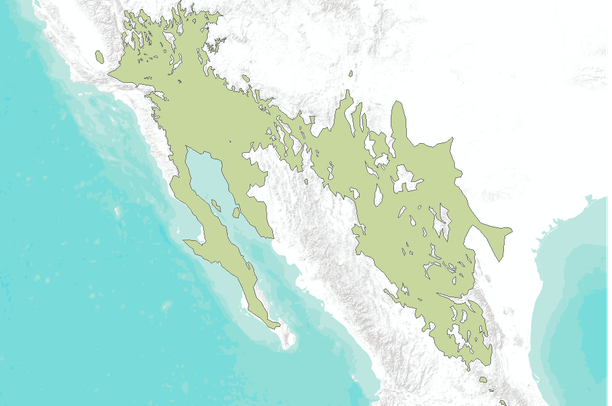
Range Map of Creosote Bush (Larrea tridentata)

Dates

Original Data Basin Creation Date
2011-03-16 11:03:42
Original Data Basin Modified Date
2011-05-13 21:11:10

Summary

This data set represent the digital range map of Creosote Bush (Larrea tridentata) in western North America. Data from multiple sources, including existing digitized maps, tabular data, personal communication, and figures from other publications, were synthesized to create a single digital distribution. The distribution was peer reviewed and iteratively revised based on personal observations of regional authorities.

Contacts

Attached Files

Preview Image

Map

Communities

  • Data Basin

Tags

Provenance

Data source
Kenneth L. Cole, George Ferguson, James Henrickson, Barry Prigge, Richard Spellenberg, Samantha Arundel, Tim Lowrey, W. Geoffrey Spaulding, Esteban Muldavin, Tom Huggins, and John Cannella.
Harvested on Fri May 23 09:39:34 MDT 2014 from Data Basin Service
Additional Information

Identifiers

Type Scheme Key
UniqueKey Data Basin a259c898644440c596e5d58d93e9eecc

Item Actions

View Item as ...

Save Item as ...

View Item...