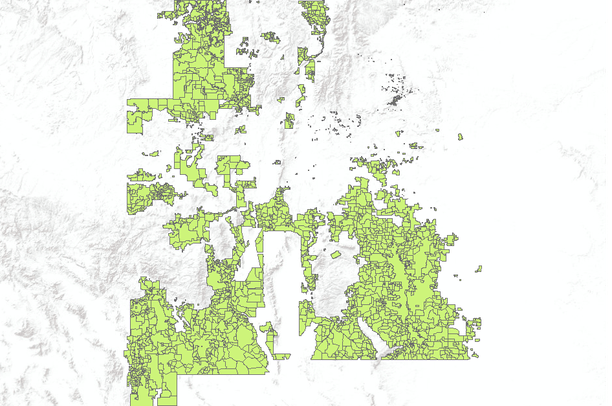
Bureau of Land Management (BLM) Grazing Allotments in New Mexico
Dates
Original Data Basin Creation Date
2011-03-09 11:40:14
Original Data Basin Modified Date
2011-05-11 18:05:37
Summary
This data has been collected by the U.S. Bureau of Land Management (BLM) in New Mexico at both the New Mexico State Office and the various field offices. Collection began in the 1980's using the BLM's ADS software to digitize data m the original case files. In the mid to late 1990's the data was converted from ADS to ArcInfo software. Collection continued into the 1990s and has been updated regularly until June 2000 when it was merged into a statewide coverage. In this edition, all updates were made in the area managed by the Carlsbad Field Office. Allotments not included in the first edition were added using on-screen digitizing from case file maps at various scales. Corrections were also made to many allotment boundaries where overlaps [...]
Summary
This data has been collected by the U.S. Bureau of Land Management (BLM) in New Mexico at both the New Mexico State Office and the various field offices. Collection began in the 1980's using the BLM's ADS software to digitize data m the original case files. In the mid to late 1990's the data was converted from ADS to ArcInfo software. Collection continued into the 1990s and has been updated regularly until June 2000 when it was merged into a statewide coverage.
In this edition, all updates were made in the area managed by the Carlsbad Field Office. Allotments not included in the first edition were added using on-screen digitizing from case file maps at various scales. Corrections were also made to many allotment boundaries where overlaps and gaps had previously been shown.