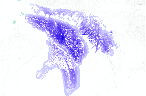
NOAA is engaged in a program to compile Great Lakes bathymetric data and make them readily available to the public, especially to the communities concerned with Great Lakes science, pollution, coastal erosion, response to climate changes, threats to lake ecosystems, and health of the fishing industry. This program is managed by NGDC and it relies on the cooperation of NOAA/Great Lakes Environmental Research Laboratory, NOAA/National Ocean Service, the Canadian Hydrographic Service, other agencies, and academic laboratories.
Compilation of new bathymetry for the Great Lakes is an important part of this program, being carried out cooperatively between NOAA (NGDC and GLERL), and the Canadian Hydrographic Service. This new bathymetry provides a more detailed portrayal of lakefloor topography, and reveals some lakefloor features seen for the first time.