BlackBearHumanConflict is an ESRI SDE Feature Class showing human/bear conflict areas for Black Bear (Ursus americanus) in Colorado. Human/bear Conflict Areas are defined as that portion of the overall range where two or more confirmed black bear complaints per season were received which resulted in Colorado Division of Wildlife investigation, damage to persons or property (cabins, tents, vehicles, etc.), and/or the removal of the problem bear(s). This does not include damage caused by bears to livestock. This information was derived from field personnel. A variety of data capture techniques were used including drawing on mylar overlays at 1:50,000 scale USGS county mapsheets and implementation of the SmartBoard Interactive Whiteboard [...]
Summary
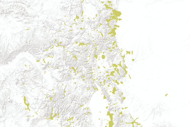
BlackBearHumanConflict is an ESRI SDE Feature Class showing human/bear conflict areas for Black Bear (Ursus americanus) in Colorado. Human/bear Conflict Areas are defined as that portion of the overall range where two or more confirmed black bear complaints per season were received which resulted in Colorado Division of Wildlife investigation, damage to persons or property (cabins, tents, vehicles, etc.), and/or the removal of the problem bear(s). This does not include damage caused by bears to livestock.
This information was derived from field personnel. A variety of data capture techniques were used including drawing on mylar overlays at 1:50,000 scale USGS county mapsheets and implementation of the SmartBoard Interactive Whiteboard using stand-up, real-time digitizing at various scales (Cowardin, M., M. Flenner. March 2003. Maximizing Mapping Resources. GeoWorld 16(3):32-35).
Dataset was acquired from a third party distributor who obtained it from CDOW in January 2011. The authoritative data source is available on ArcGIS.com (http://www.arcgis.com/home/item.html?id=357b67e80978450cbdef820d66d91564) and will be updated from that location.