Protected areas of the Eastern United States of America (USA) 2008 - Commission for Environmental Cooperation (CEC)
Dates
Original Data Basin Creation Date
2010-04-30 21:16:24
Original Data Basin Modified Date
2010-04-30 21:31:56
Summary
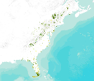
This polygon data set includes the protected areas of the Eastern United States of America that are managed by national, state, provincial, or territorial authorities. As defined by the International Union for the Conservation of Nature (IUCN), a protected area is an area of land and/or sea especially dedicated to the protection and maintenance of biological diversity, and of natural and associated cultural resources, and managed through legal or other effective means. The data set was assembled for the Commission for Environmental Cooperation (CEC) from other public data sets containing data on protected areas in Canada, Mexico, and the United States. Protected area data was obtained from Natural Resources Canada for areas in Canada; [...]
Summary
This polygon data set includes the protected areas of the Eastern United States of America that are managed by national, state, provincial, or territorial authorities. As defined by the International Union for the Conservation of Nature (IUCN), a protected area is an area of land and/or sea especially dedicated to the protection and maintenance of biological diversity, and of natural and associated cultural resources, and managed through legal or other effective means. The data set was assembled for the Commission for Environmental Cooperation (CEC) from other public data sets containing data on protected areas in Canada, Mexico, and the United States. Protected area data was obtained from Natural Resources Canada for areas in Canada; the National Commission of Natural Protected Areas (CONANP) and the Nature Conservancy, Pronatura, and the National Commission for Knowledge and Use of Biodiversity (CONABIO) for areas in Mexico; and the Conservation Biology Institute (CBI) for areas in the United States. This is an updated version of the March, 2008 data set. States included in this dataset: Connecticut, Delaware, Florida, Georgia, Maine, Maryland, Massachusetts, New Hampshire, New Jersey, New York, North Carolina, Ohio, Pennsylvania, Rhode Island, South Carolina, Vermont, Virginia, and West Virginia.
