USGS 1:25000-scale Quadrangle for Commonwealth of the Northern Mariana Islands Sheet 3 of 3, MP 2006
Dates
Publication Date
2006
Start Date
2005
End Date
2006
File Modification Date
2019-03-07 16:02:00
Citation
U.S. Geological Survey, 2006, USGS 1:25000-scale Quadrangle for Commonwealth of the Northern Mariana Islands Sheet 3 of 3, MP 2006: U.S. Geological Survey.
Summary
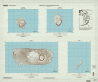
USGS Historical Quadrangle in PDF. This scanned map is different from most USGS scanned map products. The published paper map from which it is derived contained multiple independent geographic extents - multiple islands separated from one another by white space. For this reason, this digital version is a non-georeferenced PDF file instead of the GeoPDF that is standard for most of the Historical Topographic Map Collection. This also means that there are multiple GNIS Cells associated with this product.
Summary
USGS Historical Quadrangle in PDF. This scanned map is different from most USGS scanned map products. The published paper map from which it is derived contained multiple independent geographic extents - multiple islands separated from one another by white space. For this reason, this digital version is a non-georeferenced PDF file instead of the GeoPDF that is standard for most of the Historical Topographic Map Collection. This also means that there are multiple GNIS Cells associated with this product.
The USGS Historical Quadrangle Scanning Project (HQSP) is scanning all scales and all editions of topographic maps published by the U.S. Geological Survey (USGS) since the inception of the topographic mapping program in 1884. This map is provided as a general purpose map in PDF for users who are not GIS experts.