U.S. Geological Survey, 20200901, USGS US Topo 7.5-minute map for Upatoi, GA 2020: USGS - National Geospatial Technical Operations Center (NGTOC).
Summary
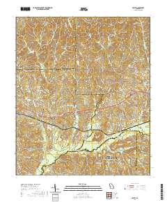
Layered geospatial PDF 7.5 Minute Quadrangle Map. Layers of geospatial data include orthoimagery, roads, grids, geographic names, elevation contours, hydrography, and other selected map features. This map is derived from GIS (geospatial information system) data. It represents a repackaging of GIS data in traditional map form, not creation of new information. The geospatial data in this map are from selected National Map data holdings and other government sources.
Summary
Layered geospatial PDF 7.5 Minute Quadrangle Map. Layers of geospatial data include orthoimagery, roads, grids, geographic names, elevation contours, hydrography, and other selected map features. This map is derived from GIS (geospatial information system) data. It represents a repackaging of GIS data in traditional map form, not creation of new information. The geospatial data in this map are from selected National Map data holdings and other government sources.
This map depicts geographic features on the surface of the earth. It is a general purpose map for users who are not GIS experts. One intended purpose is to support emergency response at all levels of government.