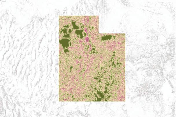
National Overview Road Metrics - Euclidean Distance (NORM-ED) to road (m), Utah
Dates
Original Data Basin Creation Date
2011-03-10 07:50:20
Original Data Basin Modified Date
2011-03-10 08:05:48
Summary
This state-organized dataset quantifies distance to the nearest road in the Lower 48 states of the United States using a set of selected colors. Distance To Roads (DTR) data are from the USGS National Overview Road Metrics - Euclidean Distance dataset, which covers the United States at 30-meter resolution. Euclidean distance (ED) is the straight line distance between two points. NORM-ED is the first national monitoring indicator developed specifically for evaluation of the ecological costs of the nation’s road network. DTR is a simple first indicator of landscape vulnerability to road-induced ecological change.