Alaska Digital Surface Models (DSMs) - USGS National Map 3DEP Downloadable Data Collection
Dates
Publication Date
2022
Start Date
2010
End Date
2022
Citation
U.S. Geological Survey, 2022, Alaska Digital Surface Models (DSMs) - USGS National Map 3DEP Downloadable Data Collection: U.S. Geological Survey.
Summary
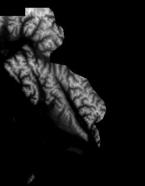
These data are Digital Surface Models (DSM) derived from interferometric synthetic aperture radar (ifsar) data. A DSM is a 3 dimensional representation of surface elevations in an area, including elevations of man-made structures and vegetation. The USGS performs minimal quality assurance and no reprocessing of the DSM data. USGS distributes the DSM data as received from the contractors, partners or contributing entities.
Summary
These data are Digital Surface Models (DSM) derived from interferometric synthetic aperture radar (ifsar) data. A DSM is a 3 dimensional representation of surface elevations in an area, including elevations of man-made structures and vegetation. The USGS performs minimal quality assurance and no reprocessing of the DSM data. USGS distributes the DSM data as received from the contractors, partners or contributing entities.