Filters: Types: Citation (X) > Tags: {"scheme":"ISO 19115 Topic Category"} (X)
19,994 results (41ms)|
Filters
Date Range
Extensions
Types Contacts
Categories Tag Types Tags (with Scheme=ISO 19115 Topic Category) |

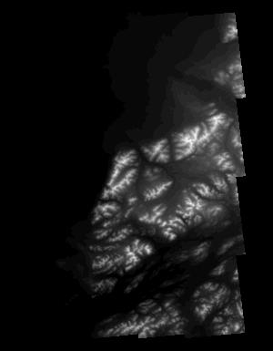
An orthoimage is remotely sensed image data in which displacement of features in the image caused by terrain relief and sensor orientation have been mathematically removed. Orthoimagery combines the image characteristics of a photograph with the geometric qualities of a map. There is no image overlap between adjacent files. Data received at Earth Resources Observation and Science Center (EROS) were reprojected from: Projection: NAD_1983_StatePlane_Puerto_Rico_Virgin_Islands_FIPS_5200 Resolution: 0.3048 m Type: Natural Color to: Standard Product Projection: NAD_1983_UTM_Zone_20N Standard Product Resolution: 0.3000 m Rows: 5,000 Columns: 5,000 and resampled to align to the U.S. National Grid (USNG). The naming convention...

An orthoimage is remotely sensed image data in which displacement of features in the image caused by terrain relief and sensor orientation have been mathematically removed. Orthoimagery combines the image characteristics of a photograph with the geometric qualities of a map. There is no image overlap between adjacent files. Data received at Earth Resources Observation and Science Center (EROS) were reprojected from: Projection: NAD_1983_StatePlane_Puerto_Rico_Virgin_Islands_FIPS_5200 Resolution: 0.3048 m Type: Natural Color to: Standard Product Projection: NAD_1983_UTM_Zone_20N Standard Product Resolution: 0.3000 m Rows: 5,000 Columns: 5,000 and resampled to align to the U.S. National Grid (USNG). The naming convention...

An orthoimage is remotely sensed image data in which displacement of features in the image caused by terrain relief and sensor orientation have been mathematically removed. Orthoimagery combines the image characteristics of a photograph with the geometric qualities of a map. There is no image overlap between adjacent files. Data received at Earth Resources Observation and Science Center (EROS) were reprojected from: Projection: NAD_1983_StatePlane_Puerto_Rico_Virgin_Islands_FIPS_5200 Resolution: 0.3048 m Type: Natural Color to: Standard Product Projection: NAD_1983_UTM_Zone_20N Standard Product Resolution: 0.3000 m Rows: 5,000 Columns: 5,000 and resampled to align to the U.S. National Grid (USNG). The naming convention...

An orthoimage is remotely sensed image data in which displacement of features in the image caused by terrain relief and sensor orientation have been mathematically removed. Orthoimagery combines the image characteristics of a photograph with the geometric qualities of a map. There is no image overlap between adjacent files. Data received at Earth Resources Observation and Science Center (EROS) were reprojected from: Projection: NAD_1983_StatePlane_Puerto_Rico_Virgin_Islands_FIPS_5200 Resolution: 0.3048 m Type: Natural Color to: Standard Product Projection: NAD_1983_UTM_Zone_20N Standard Product Resolution: 0.3000 m Rows: 5,000 Columns: 5,000 and resampled to align to the U.S. National Grid (USNG). The naming convention...

An orthoimage is remotely sensed image data in which displacement of features in the image caused by terrain relief and sensor orientation have been mathematically removed. Orthoimagery combines the image characteristics of a photograph with the geometric qualities of a map. There is no image overlap between adjacent files. Data received at Earth Resources Observation and Science Center (EROS) were reprojected from: Projection: NAD_1983_StatePlane_Puerto_Rico_Virgin_Islands_FIPS_5200 Resolution: 0.3048 m Type: Natural Color to: Standard Product Projection: NAD_1983_UTM_Zone_20N Standard Product Resolution: 0.3000 m Rows: 5,000 Columns: 5,000 and resampled to align to the U.S. National Grid (USNG). The naming convention...

An orthoimage is remotely sensed image data in which displacement of features in the image caused by terrain relief and sensor orientation have been mathematically removed. Orthoimagery combines the image characteristics of a photograph with the geometric qualities of a map. There is no image overlap between adjacent files. Data received at Earth Resources Observation and Science Center (EROS) were reprojected from: Projection: NAD_1983_StatePlane_Puerto_Rico_Virgin_Islands_FIPS_5200 Resolution: 0.3048 m Type: Natural Color to: Standard Product Projection: NAD_1983_UTM_Zone_20N Standard Product Resolution: 0.3000 m Rows: 5,000 Columns: 5,000 and resampled to align to the U.S. National Grid (USNG). The naming convention...

An orthoimage is remotely sensed image data in which displacement of features in the image caused by terrain relief and sensor orientation have been mathematically removed. Orthoimagery combines the image characteristics of a photograph with the geometric qualities of a map. There is no image overlap between adjacent files. Data received at Earth Resources Observation and Science Center (EROS) were reprojected from: Projection: NAD_1983_StatePlane_Puerto_Rico_Virgin_Islands_FIPS_5200 Resolution: 0.3048 m Type: Natural Color to: Standard Product Projection: NAD_1983_UTM_Zone_20N Standard Product Resolution: 0.3000 m Rows: 5,000 Columns: 5,000 and resampled to align to the U.S. National Grid (USNG). The naming convention...

An orthoimage is remotely sensed image data in which displacement of features in the image caused by terrain relief and sensor orientation have been mathematically removed. Orthoimagery combines the image characteristics of a photograph with the geometric qualities of a map. There is no image overlap between adjacent files. Data received at Earth Resources Observation and Science Center (EROS) were reprojected from: Projection: NAD_1983_StatePlane_Puerto_Rico_Virgin_Islands_FIPS_5200 Resolution: 0.3048 m Type: Natural Color to: Standard Product Projection: NAD_1983_UTM_Zone_20N Standard Product Resolution: 0.3000 m Rows: 5,000 Columns: 5,000 and resampled to align to the U.S. National Grid (USNG). The naming convention...

An orthoimage is remotely sensed image data in which displacement of features in the image caused by terrain relief and sensor orientation have been mathematically removed. Orthoimagery combines the image characteristics of a photograph with the geometric qualities of a map. There is no image overlap between adjacent files. Data received at Earth Resources Observation and Science Center (EROS) were reprojected from: Projection: NAD_1983_StatePlane_Puerto_Rico_Virgin_Islands_FIPS_5200 Resolution: 0.3048 m Type: Natural Color to: Standard Product Projection: NAD_1983_UTM_Zone_20N Standard Product Resolution: 0.3000 m Rows: 5,000 Columns: 5,000 and resampled to align to the U.S. National Grid (USNG). The naming convention...

An orthoimage is remotely sensed image data in which displacement of features in the image caused by terrain relief and sensor orientation have been mathematically removed. Orthoimagery combines the image characteristics of a photograph with the geometric qualities of a map. There is no image overlap between adjacent files. Data received at Earth Resources Observation and Science Center (EROS) were reprojected from: Projection: NAD_1983_StatePlane_Puerto_Rico_Virgin_Islands_FIPS_5200 Resolution: 0.3048 m Type: Natural Color to: Standard Product Projection: NAD_1983_UTM_Zone_19N Standard Product Resolution: 0.3000 m Rows: 5,000 Columns: 5,000 and resampled to align to the U.S. National Grid (USNG). The naming convention...
The basis for these features is U.S. Geological Survey Scientific Investigations Report 2017-5024 Flood Inundation Mapping Data for Johnson Creek near Sycamore, Oregon. The domain of the HEC-RAS hydraulic model is a 12.9-mile reach of Johnson Creek from just upstream of SE 174th Avenue in Portland, Oregon, to its confluence with the Willamette River. Some of the hydraulics used in the model were taken from Federal Emergency Management Agency, 2010, Flood Insurance Study, City of Portland, Oregon, Multnomah, Clackamas, and Washington Counties, Volume 1 of 3, November 26, 2010. The Digital Elevation Model (DEM) utilized for the project was developed from lidar data flown in 2015 and provided by the Oregon Department...
Types: Citation;
Tags: Johnson Creek,
Portland, Oregon,
Willamette Valley,
digital elevation models,
floods,
This dataset represents ease of access to bottomland areas for vegetation treatments. Access may be by road, 4x4 near road, hike in by field crews or requiring overnight camping or raft access. Access is considered for each side of the river separately.
Categories: Data;
Types: Citation,
Downloadable,
Map Service,
OGC WFS Layer,
OGC WMS Layer,
Shapefile;
Tags: Arches National Park,
Canyonlands National Park,
Colorado River,
Grand County,
Moab,
Future climates are simulated by general circulation models (GCM) using climate change scenarios (IPCC 2014). To project climate change for the sagebrush biome, we used 11 GCMs and two climate change scenarios from the IPCC Fifth Assessment, representative concentration pathways (RCPs) 4.5 and 8.5 (Moss et al. 2010, Van Vuuren et al. 2011). RCP4.5 scenario represents a future where climate policies limit and achieve stabilization of greenhouse gas concentrations to 4.5 W m-2 by 2100. RCP8.5 scenario might be called a business-as-usual scenario, where high emissions of greenhouse gases continue in the absence of climate change policies. The two selected time frames allow comparison of near-term (2020-2050) and longer-term...
Categories: Data;
Types: Citation,
Downloadable,
GeoTIFF,
Map Service,
Raster;
Tags: Arizona,
CRS,
California,
Climate,
Colorado,
This dataset includes the magnetotelluric (MT) sounding data collected in 2005 along an east-west profile north of Wells, Nevada. It is important to know whether major mining districts in the Northern Nevada Gold Province are underlain by rocks of the Archean Wyoming craton, which are known to contain orogenic gold deposits, or by accreted rocks of the Paleoproterozoic Mojave province. It is also important to know the location and orientation of the Archean/Proterozoic suture zone between these provinces as well as major basement structures within these terranes because they may influence subsequent patterns of sedimentation, deformation, magmatism, and hydrothermal activity. This study was funded by the U.S. Geological...

This part of DS 781 presents data for bathymetry for several seafloor maps of the Offshore of Point Conception Map Area, California. The vector data file is included in "BathymetryHS_OffshorePointConception.zip," which is accessible from https://doi.org/10.5066/F7QN64XQ. Shaded-relief bathymetry of the Offshore of Point Conception map area in southern California was generated largely from acoustic-bathymetry data collected by Fugro Pelagos Inc. Acoustic mapping was completed in 2008 using a combination of 400-kHz Reson 7125, 240-kHz Reson 8101, and 100-kHz Reson 8111 multibeam echosounders. Bathymetric-lidar data was collected in the nearshore area by the U.S. Army Corps of Engineers (USACE) Joint Lidar Bathymetry...
These data are Digital Surface Models (DSM) derived from interferometric synthetic aperture radar (ifsar) data. A DSM is a 3 dimensional representation of surface elevations in an area, including elevations of man-made structures and vegetation. The USGS performs minimal quality assurance and no reprocessing of the DSM data. USGS distributes the DSM data as received from the contractors, partners or contributing entities.
Types: Citation;
Tags: Cartography,
DSM,
Digital Mapping,
Digital Surface Model,
Digital Terrain Model,

An orthoimage is remotely sensed image data in which displacement of features in the image caused by terrain relief and sensor orientation have been mathematically removed. Orthoimagery combines the image characteristics of a photograph with the geometric qualities of a map. There is no image overlap between adjacent files. Data received at Earth Resources Observation and Science Center (EROS) were reprojected from: Projection: NAD_1983_StatePlane_Puerto_Rico_Virgin_Islands_FIPS_5200 Resolution: 0.3048 m Type: Natural Color to: Standard Product Projection: NAD_1983_UTM_Zone_20N Standard Product Resolution: 0.3000 m Rows: 5,000 Columns: 5,000 and resampled to align to the U.S. National Grid (USNG). The naming convention...
The data set consists of time, depth, reflection coefficient synthetic, sonic velocity, density, and amplitude used to create synthetic seismogram - City of Hollywood Utility, G-2961, (HOL-IW1), Broward County, Florida.
Categories: Data;
Types: Citation;
Tags: Broward County,
Miami-Dade County,
USA,
United States,
data preservation,

An orthoimage is remotely sensed image data in which displacement of features in the image caused by terrain relief and sensor orientation have been mathematically removed. Orthoimagery combines the image characteristics of a photograph with the geometric qualities of a map. There is no image overlap between adjacent files. Data received at Earth Resources Observation and Science Center (EROS) were reprojected from: Projection: NAD_1983_StatePlane_Puerto_Rico_Virgin_Islands_FIPS_5200 Resolution: 0.3048 m Type: Natural Color to: Standard Product Projection: NAD_1983_UTM_Zone_19N Standard Product Resolution: 0.3000 m Rows: 5,000 Columns: 5,000 and resampled to align to the U.S. National Grid (USNG). The naming convention...

An orthoimage is remotely sensed image data in which displacement of features in the image caused by terrain relief and sensor orientation have been mathematically removed. Orthoimagery combines the image characteristics of a photograph with the geometric qualities of a map. There is no image overlap between adjacent files. Data received at Earth Resources Observation and Science Center (EROS) were reprojected from: Projection: NAD_1983_StatePlane_Puerto_Rico_Virgin_Islands_FIPS_5200 Resolution: 0.3048 m Type: Natural Color to: Standard Product Projection: NAD_1983_UTM_Zone_19N Standard Product Resolution: 0.3000 m Rows: 5,000 Columns: 5,000 and resampled to align to the U.S. National Grid (USNG). The naming convention...
|

|
