Filters: Tags: {"scheme":"Data Basin"} (X)
9,686 results (107ms)|
Filters
Date Range
Contacts
Tags (with Scheme=Data Basin) |

The integrity of Amazon forests are currently threatened by climate change, deforestation, and fire. However, it is unclear how these agents of change interact over large spatial and temporal domains and reducing this uncertainty is important for projecting changes in carbon stocks and species biogeography, and could better inform continental scale conservation programs. With this in mind, aboveground biomass and tree cover data were produced using the dynamic global vegetation model, LPJmL, with 9 different global climate models (using the SRES A2 emissions storyline) and 2 different deforestation scenarios (from Soares et al.). The existing fire module was modified to include 'escaped fire' associated with deforestation,...

The integrity of Amazon forests are currently threatened by climate change, deforestation, and fire. However, it is unclear how these agents of change interact over large spatial and temporal domains and reducing this uncertainty is important for projecting changes in carbon stocks and species biogeography, and could better inform continental scale conservation programs. With this in mind, aboveground biomass and tree cover data were produced using the dynamic global vegetation model, LPJmL, with 9 different global climate models (using the SRES A2 emissions storyline) and 2 different deforestation scenarios (from Soares et al.). The existing fire module was modified to include 'escaped fire' associated with deforestation,...

The integrity of Amazon forests are currently threatened by climate change, deforestation, and fire. However, it is unclear how these agents of change interact over large spatial and temporal domains and reducing this uncertainty is important for projecting changes in carbon stocks and species biogeography, and could better inform continental scale conservation programs. With this in mind, aboveground biomass and tree cover data were produced using the dynamic global vegetation model, LPJmL, with 9 different global climate models (using the SRES A2 emissions storyline) and 2 different deforestation scenarios (from Soares et al.). The existing fire module was modified to include 'escaped fire' associated with deforestation,...

The integrity of Amazon forests are currently threatened by climate change, deforestation, and fire. However, it is unclear how these agents of change interact over large spatial and temporal domains and reducing this uncertainty is important for projecting changes in carbon stocks and species biogeography, and could better inform continental scale conservation programs. With this in mind, aboveground biomass and tree cover data were produced using the dynamic global vegetation model, LPJmL, with 9 different global climate models (using the SRES A2 emissions storyline) and 2 different deforestation scenarios (from Soares et al.). The existing fire module was modified to include 'escaped fire' associated with deforestation,...

This dataset shows the predicted area of high fire potential for the current year up to the end of the forecast period as simulated by a modified version of the MC1 Dynamic General Vegetation Model (DGVM). The area of high fire potential is where PDSI and MC1-calculated values of potential fire behavior (fireline intensity for forest and shrubland and rate of spread of spread for grassland) exceed calibrated threshold values. Potential fire behavior in MC1 is estimated using National Fire Danger Rating System (NFDRS) formulas, monthly climatic (temperature, precipitation, and relative humidity) data, and fuel moisture and loading estimates. Monthly climatic data includes recorded values up to the last observed...

This dataset portrays the viability score (scale of 0 - 1.0) for Whitebark pine (Pinus albicaulis) in western North America in 2060, using the Geophysical Fluid Dynamics Laboratory - Princeton University, NOAA Research (GFDLCM21) general circulation model (GCM) and A2 emission scenario (high emissions, regionally diverse world, rapid growth) to model future climate. (From Crookston et al. 2010): To develop the climate profile, we used a data from permanent sample plots largely from Forest Inventory and Analysis (FIA, Bechtold and Patterson, 2005) but supplemented with research plot data to provide about 117,000 observations (see Rehfeldt et al., 2006, 2009) describing the presence and absence of numerous species....

This dataset portrays the viability score (scale of 0 - 1.0) for Western hemlock (Tsuga heterophylla) in western North America in 2030, using the Geophysical Fluid Dynamics Laboratory - Princeton University, NOAA Research (GFDLCM21) general circulation model (GCM) and A2 emission scenario (high emissions, regionally diverse world, rapid growth) to model future climate. (From Crookston et al. 2010): To develop the climate profile, we used a data from permanent sample plots largely from Forest Inventory and Analysis (FIA, Bechtold and Patterson, 2005) but supplemented with research plot data to provide about 117,000 observations (see Rehfeldt et al., 2006, 2009) describing the presence and absence of numerous species....

This dataset portrays the viability score (scale of 0 - 1.0) for Rocky Mountain juniper (Juniperus scopulorum) in western North America in 2030, using the Geophysical Fluid Dynamics Laboratory - Princeton University, NOAA Research (GFDLCM21) general circulation model (GCM) and A2 emission scenario (high emissions, regionally diverse world, rapid growth) to model future climate. (From Crookston et al. 2010): To develop the climate profile, we used a data from permanent sample plots largely from Forest Inventory and Analysis (FIA, Bechtold and Patterson, 2005) but supplemented with research plot data to provide about 117,000 observations (see Rehfeldt et al., 2006, 2009) describing the presence and absence of numerous...

This dataset portrays the viability score (scale of 0 - 1.0) for Mountain hemlock (Tsuga mertensiana) in western North America in 2030, using the Geophysical Fluid Dynamics Laboratory - Princeton University, NOAA Research (GFDLCM21) general circulation model (GCM) and A2 emission scenario (high emissions, regionally diverse world, rapid growth) to model future climate. (From Crookston et al. 2010): To develop the climate profile, we used a data from permanent sample plots largely from Forest Inventory and Analysis (FIA, Bechtold and Patterson, 2005) but supplemented with research plot data to provide about 117,000 observations (see Rehfeldt et al., 2006, 2009) describing the presence and absence of numerous species....

This dataset portrays the viability score (scale of 0 - 1.0) for Mesquite (Prosopis sp.) in western North America in 2030, using the Geophysical Fluid Dynamics Laboratory - Princeton University, NOAA Research (GFDLCM21) general circulation model (GCM) and A2 emission scenario (high emissions, regionally diverse world, rapid growth) to model future climate. (From Crookston et al. 2010): To develop the climate profile, we used a data from permanent sample plots largely from Forest Inventory and Analysis (FIA, Bechtold and Patterson, 2005) but supplemented with research plot data to provide about 117,000 observations (see Rehfeldt et al., 2006, 2009) describing the presence and absence of numerous species. The Random...

PronghornOverallRange is an ESRI SDE Feature Class showing Overall Range, The area which encompasses all known seasonal activity areas within the observed range of a population of pronghorn antelope. This information was derived from field personnel. A variety of data capture techniques were used including drawing on mylar overlays at 1:50,000 scale USGS county mapsheets and implementation of the SmartBoard Interactive Whiteboard using stand-up, real-time digitizing at various scales (Cowardin, M., M. Flenner. March 2003. Maximizing Mapping Resources. GeoWorld 16(3):32-35). Dataset was acquired from a third party distributor who obtained it from CDOW in January 2011. The authoritative data source is available...
The Institute for Bird Populations (IBP) coordinates the Monitoring Avian Productivity and Survivorship (MAPS) Program to assess and monitor the vital rates and population dynamics of North American landbirds. The MAPS Program utilizes a standardized constant-effort mist netting and banding protocol (DeSante et al. 2010) at a continent-wide network of monitoring stations. Each summer dedicated volunteers operate bird-banding stations to collect data on individual "birds-in-the-hand" representing over 200 species. Analyses of MAPS data provide critical information relating to the ecology, conservation, and management of North American landbird populations and the factors responsible for changes in their populations....

Digital Landcover Dataset for the Southwestern United States - Arizona/New Mexico Plateau eco-region
Multi-season satellite imagery (Landsat ETM+) from 1999-2001 were used in conjunction with digital elevation model (DEM) derived datasets (e.g. elevation, landform, aspect, etc.) to model natural and semi-natural vegetation. The minimum mapping unit for this dataset is approximately 1 acre. Landcover classes are drawn from NatureServe's Ecological System concept, with 109 of the 125 total classes mapped at the system level. For the majority of classes, a decision tree classifier was used to discriminate landcover types, while a minority of classes (e.g. urban classes, sand dunes, burn scars, etc.) were mapped using other techniques. Twenty mapping areas, each characterized by similar ecological and spectral characteristics,...
Tags: landcover,
vegetation cover

HydroSHEDS (Hydrological data and maps based on SHuttle Elevation Derivatives at multiple Scales) provides hydrographic information in a consistent and comprehensive format for regional and global-scale applications. HydroSHEDS offers a suite of geo-referenced data sets (vector and raster), including stream networks, watershed boundaries, drainage directions, and ancillary data layers such as flow accumulations, distances, and river topology information. HydroSHEDS is derived from elevation data of the Shuttle Radar Topography Mission (SRTM) at 3 arc-second resolution. Available HydroSHEDS resolutions range from 3 arc-second (approx. 90 meters at the equator) to 5 minute (approx. 10 km at the equator) with seamless...

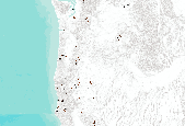
Oregon Fish Habitat Distribution These data describe areas of suitable habitat believed to be used currently by wild, natural, and/or hatchery fish populations. The term "currently" is defined as within the past five reproductive cycles. This information is based on sampling, the best professional opinion of Oregon Dept. of Fish and Wildlife or other natural resources agency staff biologists or modeling (see the fhdBasis field). Due to natural variations in run size, water conditions, or other environmental factors, some habitats identified may not be used annually. These data now comply with the Oregon Fish Habitat Distribution Data Standard that was adopted by the Oregon Geographic Information Council in...

The Nature Conservancy (TNC) has derived climate suitability forecasts for most species of trees and shrubs considered to be ecological dominants of terrestrial Californian habitat types. Our plant projections are compiled as decision support tools to help Conservancy project staff, as well as our external partners, develop the necessary plans, priorities and strategies to successfully adapt to uncertain changes in future climate. In the recently completed Southern Sierra Partnership's 2010 Climate-Adapted Conservation Plan for the Southern Sierra Nevada and Tehachapi Mountains, species and habitat forecasts shown here informed the development of a regional conservation design that explicitly incorporates long-term...
The Nature Conservancy (TNC) has derived climate suitability forecasts for most species of trees and shrubs considered to be ecological dominants of terrestrial Californian habitat types. Our plant projections are compiled as decision support tools to help Conservancy project staff, as well as our external partners, develop the necessary plans, priorities and strategies to successfully adapt to uncertain changes in future climate. In the recently completed Southern Sierra Partnership's 2010 Climate-Adapted Conservation Plan for the Southern Sierra Nevada and Tehachapi Mountains, species and habitat forecasts shown here informed the development of a regional conservation design that explicitly incorporates long-term...

The Nature Conservancy (TNC) has derived climate suitability forecasts for most species of trees and shrubs considered to be ecological dominants of terrestrial Californian habitat types. Our plant projections are compiled as decision support tools to help Conservancy project staff, as well as our external partners, develop the necessary plans, priorities and strategies to successfully adapt to uncertain changes in future climate. In the recently completed Southern Sierra Partnership's 2010 Climate-Adapted Conservation Plan for the Southern Sierra Nevada and Tehachapi Mountains, species and habitat forecasts shown here informed the development of a regional conservation design that explicitly incorporates long-term...

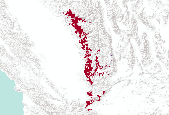
This dataset contains Canada's national forest inventory (CanFI) 2001 data for plots within the boreal region of the province of Quebec, Canada. The attribute displayed is percent forested. Refer to the "attributes" tab to view other attributes contained in this dataset. For more information, refer to the CanFI 2001 document at: http://dsp-psd.pwgsc.gc.ca/collection_2007/nrcan-rncan/Fo143-2-408E.pdf From CanFI: Canada's existing national forest inventory (CanFI) is compiled about every five years by aggregating provincial and territorial forest management inventories and reconnaissance level information. Stand-level data provided by the provincial and territorial management agencies are converted to a national...

This dataset contains Canada's national forest inventory (CanFI) 2001 data for plots within the boreal region of the province of Ontario, Canada. The attribute displayed is percent forested. Refer to the "attributes" tab to view other attributes contained in this dataset. For more information, refer to the CanFI 2001 document at: http://dsp-psd.pwgsc.gc.ca/collection_2007/nrcan-rncan/Fo143-2-408E.pdf From CanFI: Canada's existing national forest inventory (CanFI) is compiled about every five years by aggregating provincial and territorial forest management inventories and reconnaissance level information. Stand-level data provided by the provincial and territorial management agencies are converted to a national...
|

|
