Filters: Tags: {"type":"Publication"} (X) > Types: OGC WMS Service (X)
17 results (19ms)|
Filters
Date Range
Extensions Types Contacts
Categories Tag Schemes Tags (with Type=Publication ) |

Categories: Publication;
Types: Citation,
Map Service,
OGC WFS Layer,
OGC WMS Layer,
OGC WMS Service;
Tags: Data Series

Categories: Publication;
Types: Citation,
Map Service,
OGC WFS Layer,
OGC WMS Layer,
OGC WMS Service;
Tags: Scientific Investigations Report
Categories: Publication;
Types: Citation,
Map Service,
OGC WFS Layer,
OGC WMS Layer,
OGC WMS Service;
Tags: Fact Sheet
Categories: Publication;
Types: Citation,
Map Service,
OGC WFS Layer,
OGC WMS Layer,
OGC WMS Service;
Tags: Scientific Investigations Report
Categories: Publication;
Types: Citation,
Map Service,
OGC WFS Layer,
OGC WMS Layer,
OGC WMS Service;
Tags: Data Series
Categories: Publication;
Types: Citation,
Map Service,
OGC WFS Layer,
OGC WMS Layer,
OGC WMS Service;
Tags: Data Series
Categories: Publication;
Types: Citation,
Map Service,
OGC WFS Layer,
OGC WMS Layer,
OGC WMS Service;
Tags: Scientific Investigations Report
Categories: Publication;
Types: Citation,
Map Service,
OGC WFS Layer,
OGC WMS Layer,
OGC WMS Service;
Tags: Scientific Investigations Report
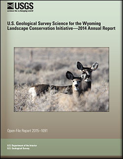
U.S. Geological Survey Science for the Wyoming Landscape Conservation Initiative: 2014 annual report
This is the seventh report produced by the U.S. Geological Survey (USGS) for the Wyoming Landscape Conservation Initiative (WLCI) to detail annual activities conducted by the USGS for addressing specific management needs identified by WLCI partners. In FY2014, there were 26 projects, including a new one that was completed, two others that were also completed, and several that entered new phases or directions. The 26 projects fall into several categories: (1) synthesizing and analyzing existing data to identify current conditions on the landscape and using the data to develop models for projecting past and future landscape conditions; (2) monitoring indicators of ecosystem conditions and the effectiveness of on-the-ground...
Categories: Publication;
Types: Citation,
Map Service,
OGC WFS Layer,
OGC WMS Layer,
OGC WMS Service;
Tags: Open-File Report
Categories: Publication;
Types: Citation,
Map Service,
OGC WFS Layer,
OGC WMS Layer,
OGC WMS Service;
Tags: Open-File Report
Water quality in the Barnegat Bay estuary along the New Jersey coast is the focus of a multidisciplinary research project begun in 2011 by the U.S. Geological Survey (USGS) in cooperation with the New Jersey Department of Environmental Protection. This narrow estuary is the drainage for the Barnegat Bay watershed and flushed by just three inlets connecting it to the Atlantic Ocean, is experiencing degraded water quality, algal blooms, loss of seagrass, and increases in oxygen-depletion events. The scale of the estuary and the scope of the problems within it required a regional approach to understand and model water circulation within the bay and adjacent ocean. A continuous elevation surface (terrain model) integrating...
Types: Map Service,
OGC WFS Layer,
OGC WMS Layer,
OGC WMS Service;
Tags: Barnegat Bay,
Barnegat Inlet,
Bathymetry,
Beach Haven,
EAARL-B,
Categories: Publication;
Types: Citation,
Map Service,
OGC WFS Layer,
OGC WMS Layer,
OGC WMS Service;
Tags: Scientific Investigations Report
Categories: Publication;
Types: Citation,
Map Service,
OGC WFS Layer,
OGC WMS Layer,
OGC WMS Service;
Tags: Fact Sheet
Categories: Publication;
Types: Citation,
Map Service,
OGC WFS Layer,
OGC WMS Layer,
OGC WMS Service;
Tags: Fact Sheet
Categories: Publication;
Types: Citation,
Map Service,
OGC WFS Layer,
OGC WMS Layer,
OGC WMS Service;
Tags: Scientific Investigations Report
The impacts from climate change are increasing the possibility of vulnerable coastal species and habitats crossing critical thresholds that could spur rapid and possibly irreversible changes. For species of high conservation concern, improved knowledge of quantitative thresholds could greatly improve management. To meet this need, we synthesized information pertaining to biological responses as tipping points to sea level rise (SLR) and coastal storms for 45 fish, wildlife, and plant species along the U.S. Atlantic and Gulf Coasts and Caribbean through a literature review and expert elicitation. Although these species were selected based on their ecological, economic, and cultural importance, just over half (56%,...
Categories: Publication;
Types: Citation,
Map Service,
OGC WFS Layer,
OGC WMS Layer,
OGC WMS Service;
Tags: Scientific Investigations Report
|

|
