Filters: Tags: 15 x 15 minute (X)
44,549 results (90ms)|
Filters
Date Range
Types Contacts Tag Types Tag Schemes
|

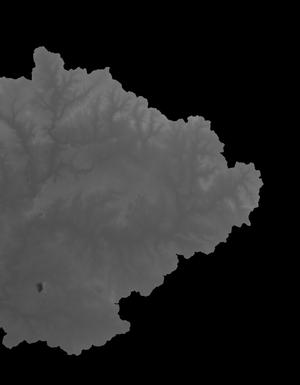
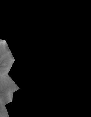
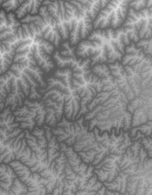
This tile of the National Elevation Dataset (NED) is 1/9 arc-second resolution. The National Elevation Dataset (NED) serves the elevation layer of The National Map, and provides basic elevation information for earth science studies and mapping applications in the United States. Scientists and resource managers use NED data for global change research, hydrologic modeling, resource monitoring, mapping and visualization, and many other applications. The NED is an elevation dataset that consists of seamless layers and a high resolution layer. Each of these layers are composed of the best available raster elevation data of the conterminous United States, Alaska, Hawaii, territorial islands, Mexico and Canada. The NED...
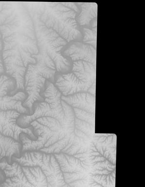
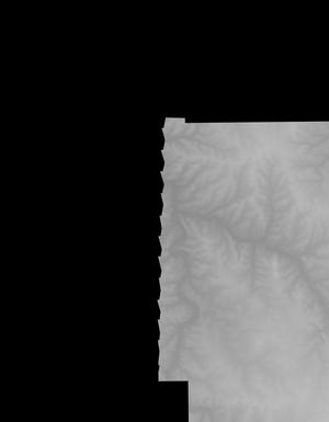
This tile of the National Elevation Dataset (NED) is 1/9 arc-second resolution. The National Elevation Dataset (NED) serves the elevation layer of The National Map, and provides basic elevation information for earth science studies and mapping applications in the United States. Scientists and resource managers use NED data for global change research, hydrologic modeling, resource monitoring, mapping and visualization, and many other applications. The NED is an elevation dataset that consists of seamless layers and a high resolution layer. Each of these layers are composed of the best available raster elevation data of the conterminous United States, Alaska, Hawaii, territorial islands, Mexico and Canada. The NED...
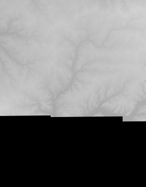
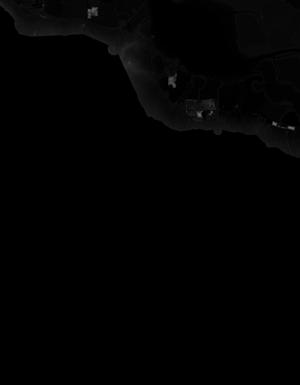
This tile of the National Elevation Dataset (NED) is 1/9 arc-second resolution. The National Elevation Dataset (NED) serves the elevation layer of The National Map, and provides basic elevation information for earth science studies and mapping applications in the United States. Scientists and resource managers use NED data for global change research, hydrologic modeling, resource monitoring, mapping and visualization, and many other applications. The NED is an elevation dataset that consists of seamless layers and a high resolution layer. Each of these layers are composed of the best available raster elevation data of the conterminous United States, Alaska, Hawaii, territorial islands, Mexico and Canada. The NED...

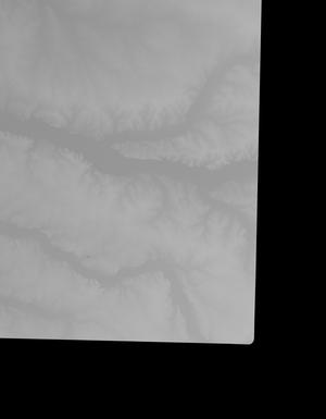
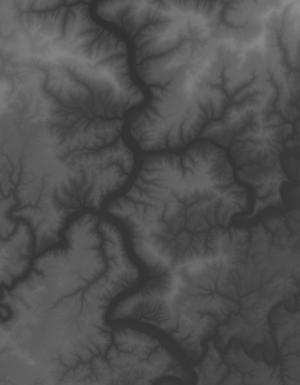
This tile of the National Elevation Dataset (NED) is 1/9 arc-second resolution. The National Elevation Dataset (NED) serves the elevation layer of The National Map, and provides basic elevation information for earth science studies and mapping applications in the United States. Scientists and resource managers use NED data for global change research, hydrologic modeling, resource monitoring, mapping and visualization, and many other applications. The NED is an elevation dataset that consists of seamless layers and a high resolution layer. Each of these layers are composed of the best available raster elevation data of the conterminous United States, Alaska, Hawaii, territorial islands, Mexico and Canada. The NED...

This tile of the National Elevation Dataset (NED) is 1/9 arc-second resolution. The National Elevation Dataset (NED) serves the elevation layer of The National Map, and provides basic elevation information for earth science studies and mapping applications in the United States. Scientists and resource managers use NED data for global change research, hydrologic modeling, resource monitoring, mapping and visualization, and many other applications. The NED is an elevation dataset that consists of seamless layers and a high resolution layer. Each of these layers are composed of the best available raster elevation data of the conterminous United States, Alaska, Hawaii, territorial islands, Mexico and Canada. The NED...

This tile of the National Elevation Dataset (NED) is 1/9 arc-second resolution. The National Elevation Dataset (NED) serves the elevation layer of The National Map, and provides basic elevation information for earth science studies and mapping applications in the United States. Scientists and resource managers use NED data for global change research, hydrologic modeling, resource monitoring, mapping and visualization, and many other applications. The NED is an elevation dataset that consists of seamless layers and a high resolution layer. Each of these layers are composed of the best available raster elevation data of the conterminous United States, Alaska, Hawaii, territorial islands, Mexico and Canada. The NED...

This tile of the National Elevation Dataset (NED) is 1/9 arc-second resolution. The National Elevation Dataset (NED) serves the elevation layer of The National Map, and provides basic elevation information for earth science studies and mapping applications in the United States. Scientists and resource managers use NED data for global change research, hydrologic modeling, resource monitoring, mapping and visualization, and many other applications. The NED is an elevation dataset that consists of seamless layers and a high resolution layer. Each of these layers are composed of the best available raster elevation data of the conterminous United States, Alaska, Hawaii, territorial islands, Mexico and Canada. The NED...
This tile of the National Elevation Dataset (NED) is 1/9 arc-second resolution. The National Elevation Dataset (NED) serves the elevation layer of The National Map, and provides basic elevation information for earth science studies and mapping applications in the United States. Scientists and resource managers use NED data for global change research, hydrologic modeling, resource monitoring, mapping and visualization, and many other applications. The NED is an elevation dataset that consists of seamless layers and a high resolution layer. Each of these layers are composed of the best available raster elevation data of the conterminous United States, Alaska, Hawaii, territorial islands, Mexico and Canada. The NED...
This tile of the National Elevation Dataset (NED) is 1/9 arc-second resolution. The National Elevation Dataset (NED) serves the elevation layer of The National Map, and provides basic elevation information for earth science studies and mapping applications in the United States. Scientists and resource managers use NED data for global change research, hydrologic modeling, resource monitoring, mapping and visualization, and many other applications. The NED is an elevation dataset that consists of seamless layers and a high resolution layer. Each of these layers are composed of the best available raster elevation data of the conterminous United States, Alaska, Hawaii, territorial islands, Mexico and Canada. The NED...

This tile of the National Elevation Dataset (NED) is 1/9 arc-second resolution. The National Elevation Dataset (NED) serves the elevation layer of The National Map, and provides basic elevation information for earth science studies and mapping applications in the United States. Scientists and resource managers use NED data for global change research, hydrologic modeling, resource monitoring, mapping and visualization, and many other applications. The NED is an elevation dataset that consists of seamless layers and a high resolution layer. Each of these layers are composed of the best available raster elevation data of the conterminous United States, Alaska, Hawaii, territorial islands, Mexico and Canada. The NED...

This tile of the National Elevation Dataset (NED) is 1/9 arc-second resolution. The National Elevation Dataset (NED) serves the elevation layer of The National Map, and provides basic elevation information for earth science studies and mapping applications in the United States. Scientists and resource managers use NED data for global change research, hydrologic modeling, resource monitoring, mapping and visualization, and many other applications. The NED is an elevation dataset that consists of seamless layers and a high resolution layer. Each of these layers are composed of the best available raster elevation data of the conterminous United States, Alaska, Hawaii, territorial islands, Mexico and Canada. The NED...
This tile of the National Elevation Dataset (NED) is 1/9 arc-second resolution. The National Elevation Dataset (NED) serves the elevation layer of The National Map, and provides basic elevation information for earth science studies and mapping applications in the United States. Scientists and resource managers use NED data for global change research, hydrologic modeling, resource monitoring, mapping and visualization, and many other applications. The NED is an elevation dataset that consists of seamless layers and a high resolution layer. Each of these layers are composed of the best available raster elevation data of the conterminous United States, Alaska, Hawaii, territorial islands, Mexico and Canada. The NED...
This tile of the National Elevation Dataset (NED) is 1/9 arc-second resolution. The National Elevation Dataset (NED) serves the elevation layer of The National Map, and provides basic elevation information for earth science studies and mapping applications in the United States. Scientists and resource managers use NED data for global change research, hydrologic modeling, resource monitoring, mapping and visualization, and many other applications. The NED is an elevation dataset that consists of seamless layers and a high resolution layer. Each of these layers are composed of the best available raster elevation data of the conterminous United States, Alaska, Hawaii, territorial islands, Mexico and Canada. The NED...

This tile of the National Elevation Dataset (NED) is 1/9 arc-second resolution. The National Elevation Dataset (NED) serves the elevation layer of The National Map, and provides basic elevation information for earth science studies and mapping applications in the United States. Scientists and resource managers use NED data for global change research, hydrologic modeling, resource monitoring, mapping and visualization, and many other applications. The NED is an elevation dataset that consists of seamless layers and a high resolution layer. Each of these layers are composed of the best available raster elevation data of the conterminous United States, Alaska, Hawaii, territorial islands, Mexico and Canada. The NED...

This tile of the National Elevation Dataset (NED) is 1/9 arc-second resolution. The National Elevation Dataset (NED) serves the elevation layer of The National Map, and provides basic elevation information for earth science studies and mapping applications in the United States. Scientists and resource managers use NED data for global change research, hydrologic modeling, resource monitoring, mapping and visualization, and many other applications. The NED is an elevation dataset that consists of seamless layers and a high resolution layer. Each of these layers are composed of the best available raster elevation data of the conterminous United States, Alaska, Hawaii, territorial islands, Mexico and Canada. The NED...
This tile of the National Elevation Dataset (NED) is 1/9 arc-second resolution. The National Elevation Dataset (NED) serves the elevation layer of The National Map, and provides basic elevation information for earth science studies and mapping applications in the United States. Scientists and resource managers use NED data for global change research, hydrologic modeling, resource monitoring, mapping and visualization, and many other applications. The NED is an elevation dataset that consists of seamless layers and a high resolution layer. Each of these layers are composed of the best available raster elevation data of the conterminous United States, Alaska, Hawaii, territorial islands, Mexico and Canada. The NED...
This tile of the National Elevation Dataset (NED) is 1/9 arc-second resolution. The National Elevation Dataset (NED) serves the elevation layer of The National Map, and provides basic elevation information for earth science studies and mapping applications in the United States. Scientists and resource managers use NED data for global change research, hydrologic modeling, resource monitoring, mapping and visualization, and many other applications. The NED is an elevation dataset that consists of seamless layers and a high resolution layer. Each of these layers are composed of the best available raster elevation data of the conterminous United States, Alaska, Hawaii, territorial islands, Mexico and Canada. The NED...
This tile of the National Elevation Dataset (NED) is 1/9 arc-second resolution. The National Elevation Dataset (NED) serves the elevation layer of The National Map, and provides basic elevation information for earth science studies and mapping applications in the United States. Scientists and resource managers use NED data for global change research, hydrologic modeling, resource monitoring, mapping and visualization, and many other applications. The NED is an elevation dataset that consists of seamless layers and a high resolution layer. Each of these layers are composed of the best available raster elevation data of the conterminous United States, Alaska, Hawaii, territorial islands, Mexico and Canada. The NED...

This tile of the National Elevation Dataset (NED) is 1/9 arc-second resolution. The National Elevation Dataset (NED) serves the elevation layer of The National Map, and provides basic elevation information for earth science studies and mapping applications in the United States. Scientists and resource managers use NED data for global change research, hydrologic modeling, resource monitoring, mapping and visualization, and many other applications. The NED is an elevation dataset that consists of seamless layers and a high resolution layer. Each of these layers are composed of the best available raster elevation data of the conterminous United States, Alaska, Hawaii, territorial islands, Mexico and Canada. The NED...

This tile of the National Elevation Dataset (NED) is 1/9 arc-second resolution. The National Elevation Dataset (NED) serves the elevation layer of The National Map, and provides basic elevation information for earth science studies and mapping applications in the United States. Scientists and resource managers use NED data for global change research, hydrologic modeling, resource monitoring, mapping and visualization, and many other applications. The NED is an elevation dataset that consists of seamless layers and a high resolution layer. Each of these layers are composed of the best available raster elevation data of the conterminous United States, Alaska, Hawaii, territorial islands, Mexico and Canada. The NED...
|

|
