Filters: Tags: 2 arc-second DEM (X) > Date Range: {"choice":"year"} (X)
29 results (23ms)|
Filters
Date Types (for Date Range)
Contacts Tag Types Tag Schemes |

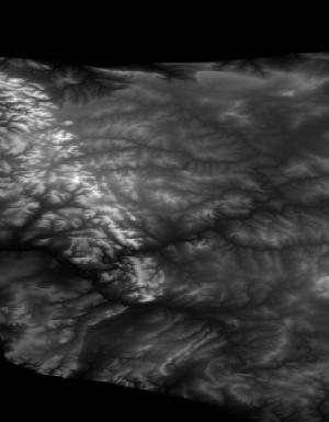
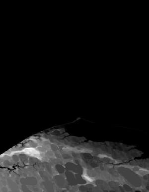
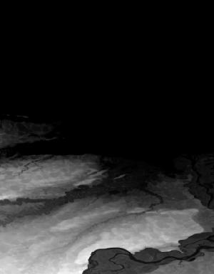
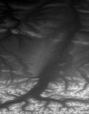
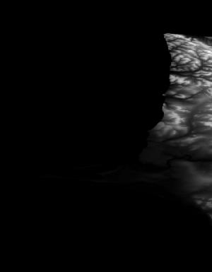
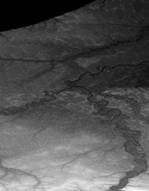
This tile of the 3D Elevation Program (3DEP) seamless products is 2 arc-second resolution. 3DEP data serve as the elevation layer of The National Map, and provide basic elevation information for Earth science studies and mapping applications in the United States. Scientists and resource managers use 3DEP data for global change research, hydrologic modeling, resource monitoring, mapping and visualization, and many other applications. 3DEP data compose an elevation dataset that consists of seamless layers and a high resolution layer. Each of these layers consists of the best available raster elevation data of the conterminous United States, Alaska, Hawaii, territorial islands, Mexico and Canada. 3DEP data are updated...
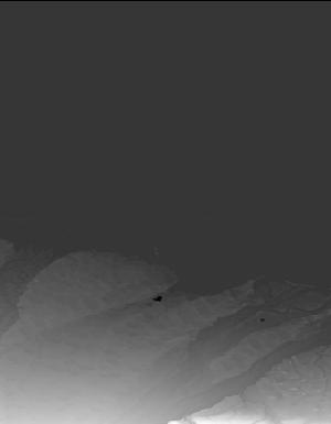
This tile of the 3D Elevation Program (3DEP) seamless products is 2 arc-second resolution. 3DEP data serve as the elevation layer of The National Map, and provide basic elevation information for Earth science studies and mapping applications in the United States. Scientists and resource managers use 3DEP data for global change research, hydrologic modeling, resource monitoring, mapping and visualization, and many other applications. 3DEP data compose an elevation dataset that consists of seamless layers and a high resolution layer. Each of these layers consists of the best available raster elevation data of the conterminous United States, Alaska, Hawaii, territorial islands, Mexico and Canada. 3DEP data are updated...
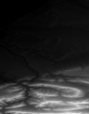
This tile of the 3D Elevation Program (3DEP) seamless products is 2 Arc Second resolution. 3DEP data serve as the elevation layer of The National Map, and provide basic elevation information for Earth science studies and mapping applications in the United States. Scientists and resource managers use 3DEP data for global change research, hydrologic modeling, resource monitoring, mapping and visualization, and many other applications. 3DEP data compose an elevation dataset that consists of seamless layers and a high resolution layer. Each of these layers consists of the best available raster elevation data of the conterminous United States, Alaska, Hawaii, territorial islands, Mexico and Canada. 3DEP data are updated...
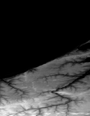
This tile of the 3D Elevation Program (3DEP) seamless products is 2 Arc Second resolution. 3DEP data serve as the elevation layer of The National Map, and provide basic elevation information for Earth science studies and mapping applications in the United States. Scientists and resource managers use 3DEP data for global change research, hydrologic modeling, resource monitoring, mapping and visualization, and many other applications. 3DEP data compose an elevation dataset that consists of seamless layers and a high resolution layer. Each of these layers consists of the best available raster elevation data of the conterminous United States, Alaska, Hawaii, territorial islands, Mexico and Canada. 3DEP data are updated...

This tile of the 3D Elevation Program (3DEP) seamless products is 2 arc-second resolution. 3DEP data serve as the elevation layer of The National Map, and provide basic elevation information for Earth science studies and mapping applications in the United States. Scientists and resource managers use 3DEP data for global change research, hydrologic modeling, resource monitoring, mapping and visualization, and many other applications. 3DEP data compose an elevation dataset that consists of seamless layers and a high resolution layer. Each of these layers consists of the best available raster elevation data of the conterminous United States, Alaska, Hawaii, territorial islands, Mexico and Canada. 3DEP data are updated...

This tile of the 3D Elevation Program (3DEP) seamless products is 2 Arc Second resolution. 3DEP data serve as the elevation layer of The National Map, and provide basic elevation information for Earth science studies and mapping applications in the United States. Scientists and resource managers use 3DEP data for global change research, hydrologic modeling, resource monitoring, mapping and visualization, and many other applications. 3DEP data compose an elevation dataset that consists of seamless layers and a high resolution layer. Each of these layers consists of the best available raster elevation data of the conterminous United States, Alaska, Hawaii, territorial islands, Mexico and Canada. 3DEP data are updated...

This is a tiled collection of the 3D Elevation Program (3DEP) and is 2 arc-second (approximately 60 m) resolution covering Alaska. The elevations in this Digital Elevation Model (DEM) represent the topographic bare-earth surface. The 3DEP data holdings serve as the elevation layer of The National Map, and provide foundational elevation information for earth science studies and mapping applications in the United States. Scientists and resource managers use 3DEP data for hydrologic modeling, resource monitoring, mapping and visualization, and many other applications. The seamless 2 arc-second DEM layers are derived from diverse source data that are processed to a common coordinate system and unit of vertical measure....
Types: Citation,
Map Service,
OGC WFS Layer,
OGC WMS Layer,
OGC WMS Service;
Tags: 1-degree DEM,
2 arc-second DEM,
3DEP,
Bare Earth,
Cartography,

This tile of the 3D Elevation Program (3DEP) seamless products is 2 Arc Second resolution. 3DEP data serve as the elevation layer of The National Map, and provide basic elevation information for Earth science studies and mapping applications in the United States. Scientists and resource managers use 3DEP data for global change research, hydrologic modeling, resource monitoring, mapping and visualization, and many other applications. 3DEP data compose an elevation dataset that consists of seamless layers and a high resolution layer. Each of these layers consists of the best available raster elevation data of the conterminous United States, Alaska, Hawaii, territorial islands, Mexico and Canada. 3DEP data are updated...

This tile of the 3D Elevation Program (3DEP) seamless products is 2 Arc Second resolution. 3DEP data serve as the elevation layer of The National Map, and provide basic elevation information for Earth science studies and mapping applications in the United States. Scientists and resource managers use 3DEP data for global change research, hydrologic modeling, resource monitoring, mapping and visualization, and many other applications. 3DEP data compose an elevation dataset that consists of seamless layers and a high resolution layer. Each of these layers consists of the best available raster elevation data of the conterminous United States, Alaska, Hawaii, territorial islands, Mexico and Canada. 3DEP data are updated...

This tile of the 3D Elevation Program (3DEP) seamless products is 2 Arc Second resolution. 3DEP data serve as the elevation layer of The National Map, and provide basic elevation information for Earth science studies and mapping applications in the United States. Scientists and resource managers use 3DEP data for global change research, hydrologic modeling, resource monitoring, mapping and visualization, and many other applications. 3DEP data compose an elevation dataset that consists of seamless layers and a high resolution layer. Each of these layers consists of the best available raster elevation data of the conterminous United States, Alaska, Hawaii, territorial islands, Mexico and Canada. 3DEP data are updated...
This tile of the 3D Elevation Program (3DEP) seamless products is 2 arc-second resolution. 3DEP data serve as the elevation layer of The National Map, and provide basic elevation information for Earth science studies and mapping applications in the United States. Scientists and resource managers use 3DEP data for global change research, hydrologic modeling, resource monitoring, mapping and visualization, and many other applications. 3DEP data compose an elevation dataset that consists of seamless layers and a high resolution layer. Each of these layers consists of the best available raster elevation data of the conterminous United States, Alaska, Hawaii, territorial islands, Mexico and Canada. 3DEP data are updated...

This tile of the 3D Elevation Program (3DEP) seamless products is 2 arc-second resolution. 3DEP data serve as the elevation layer of The National Map, and provide basic elevation information for Earth science studies and mapping applications in the United States. Scientists and resource managers use 3DEP data for global change research, hydrologic modeling, resource monitoring, mapping and visualization, and many other applications. 3DEP data compose an elevation dataset that consists of seamless layers and a high resolution layer. Each of these layers consists of the best available raster elevation data of the conterminous United States, Alaska, Hawaii, territorial islands, Mexico and Canada. 3DEP data are updated...
This tile of the 3D Elevation Program (3DEP) seamless products is 2 arc-second resolution. 3DEP data serve as the elevation layer of The National Map, and provide basic elevation information for Earth science studies and mapping applications in the United States. Scientists and resource managers use 3DEP data for global change research, hydrologic modeling, resource monitoring, mapping and visualization, and many other applications. 3DEP data compose an elevation dataset that consists of seamless layers and a high resolution layer. Each of these layers consists of the best available raster elevation data of the conterminous United States, Alaska, Hawaii, territorial islands, Mexico and Canada. 3DEP data are updated...

This tile of the 3D Elevation Program (3DEP) seamless products is 2 arc-second resolution. 3DEP data serve as the elevation layer of The National Map, and provide basic elevation information for Earth science studies and mapping applications in the United States. Scientists and resource managers use 3DEP data for global change research, hydrologic modeling, resource monitoring, mapping and visualization, and many other applications. 3DEP data compose an elevation dataset that consists of seamless layers and a high resolution layer. Each of these layers consists of the best available raster elevation data of the conterminous United States, Alaska, Hawaii, territorial islands, Mexico and Canada. 3DEP data are updated...
This tile of the 3D Elevation Program (3DEP) seamless products is 2 arc-second resolution. 3DEP data serve as the elevation layer of The National Map, and provide basic elevation information for Earth science studies and mapping applications in the United States. Scientists and resource managers use 3DEP data for global change research, hydrologic modeling, resource monitoring, mapping and visualization, and many other applications. 3DEP data compose an elevation dataset that consists of seamless layers and a high resolution layer. Each of these layers consists of the best available raster elevation data of the conterminous United States, Alaska, Hawaii, territorial islands, Mexico and Canada. 3DEP data are updated...
This tile of the 3D Elevation Program (3DEP) seamless products is 2 Arc Second resolution. 3DEP data serve as the elevation layer of The National Map, and provide basic elevation information for Earth science studies and mapping applications in the United States. Scientists and resource managers use 3DEP data for global change research, hydrologic modeling, resource monitoring, mapping and visualization, and many other applications. 3DEP data compose an elevation dataset that consists of seamless layers and a high resolution layer. Each of these layers consists of the best available raster elevation data of the conterminous United States, Alaska, Hawaii, territorial islands, Mexico and Canada. 3DEP data are updated...
|

|
