Filters: Tags: Alberta (X)
288 results (53ms)|
Filters
Date Range
Extensions
Types Contacts
Categories Tag Types
|
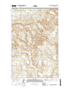
Layered geospatial PDF Map. Layers of geospatial data include orthoimagery, roads, grids, geographic names, elevation contours, hydrography, and other selected map features.
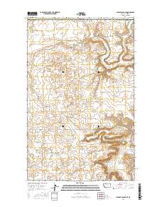
Layered geospatial PDF Map. Layers of geospatial data include orthoimagery, roads, grids, geographic names, elevation contours, hydrography, and other selected map features.
This map was developed to examine multi-scale spatial relationships between percentage of sagebrush and other response variables of interest. A map of sagebrush in the western United States was used as a base layer for a moving window analysis to calculate the percentage of the area classified as sagebrush within a 54-km search radius.
Boundary of the conservation assessment of Greater Sage-grouse and sagebrush habitat conducted by the Western Association of Fish and Wildlife Agencies. The boundary is derived from the pre-settlement distribution of the Sage-grouse.
Greater sage-grouse genetic connectivity is essential to the species persistence across the Great Northern landscape; without such connectivity the greater sage-grouse may suffer the same fate as many other related species of grouse, which disappeared from the middle and eastern portion of the United States due to loss of habitat coupled with inbreeding depression. To prevent isolation in the face of energy development and other landscape changes it is essential that we evaluate both fine-scale connectivity and assign relative importance to different leks (breeding populations) on the landscape. This massive task cannot be accomplished with existing tools and maps; fortunately, advanced molecular genomic analyses...
Categories: Data,
Project;
Types: Map Service,
OGC WFS Layer,
OGC WMS Layer,
OGC WMS Service;
Tags: 2012,
AZ-1,
Academics & scientific researchers,
Alberta,
Arizona,
Landscape simulation modeling will be used to develop detailed management guidelines for restoring and sustaining whitebark pine under future climates, accounting for the principal stressors that threaten its persistence (exotic disease infections, mountain pine beetles, and fire exclusion policies). We will build on existing work, including the 2012 publication A Range-Wide Restoration Strategy for Whitebark Pine Forests and existing simulation areas within critical whitebark pine habitat. This project will create a robust and trans-boundary set of management tools for creating resistant and resilient whitebark pine forests within the Rocky Mountains, USA and Canada.FY2013Objectives:We propose to use FireBGCv2...
Categories: Data,
Project;
Types: Map Service,
OGC WFS Layer,
OGC WMS Layer,
OGC WMS Service;
Tags: Alberta,
British Columbia,
Climate Change,
Conservation Plan/Design/Framework,
Conservation Planning,
The project will establish contact with interested parties in each tribe or first nation within the Crown of the Continent to collect information on all relevant activities and research regarding climate and adaptive management within each tribal nation. We will coordinate a meeting of all interested tribal contacts and coordinate tribal activities with other efforts in the Crown including the Crown Managers Partnership, the Crown of the Continent Conservation Initiative, and the Crown Roundtable Adaptive Management Initiative.Objectives:Establish a contact on climate adaptation management in each interested first nation/tribe or related organization in the Crown of the Continent.Develop a white paper that summarizes...
Categories: Data,
Project;
Types: Map Service,
OGC WFS Layer,
OGC WMS Layer,
OGC WMS Service;
Tags: Adaptive Management,
Alberta,
British Columbia,
Climate Change,
Conservation Planning,
The RCMAP (Rangeland Condition Monitoring Assessment and Projection) dataset quantifies the percent cover of rangeland components across western North America using Landsat imagery from 1985-2023. The RCMAP product suite consists of ten fractional components: annual herbaceous, bare ground, herbaceous, litter, non-sagebrush shrub, perennial herbaceous, sagebrush, shrub, tree, and shrub height in addition to the temporal trends of each component. Several enhancements were made to the RCMAP process relative to prior generations. First, high-resolution training was revised using an improved neural-net classifier and modelling approach. These data serve as foundation to the RCMAP approach. The training database was...
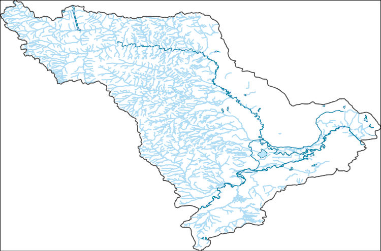
The National Hydrography Dataset (NHD) is a feature-based database that interconnects and uniquely identifies the stream segments or reaches that make up the nation's surface water drainage system. NHD data was originally developed at 1:100,000-scale and exists at that scale for the whole country. This high-resolution NHD, generally developed at 1:24,000/1:12,000 scale, adds detail to the original 1:100,000-scale NHD. (Data for Alaska, Puerto Rico and the Virgin Islands was developed at high-resolution, not 1:100,000 scale.) Local resolution NHD is being developed where partners and data exist. The NHD contains reach codes for networked features, flow direction, names, and centerline representations for areal water...
The Stoney Nakoda Nation believe that it is important to provide cultural awareness to the Great North Landscape Conservation group so that the group can understand the First Nation history of the study area. This is particularly interesting given the early policy development of national parks within the United States of America, and Canada, and the impacts on the Stoney Nakoda. The cultural awareness and First Nation history of the Stoney Nakoda will provide background on traditional uses and knowledge of the study area, and provide insight to science based practitioners on the need for integrating western science with traditional environmental knowledge. To provide First Nation cultural awareness of the Rocky...
Categories: Data,
Project;
Types: Map Service,
OGC WFS Layer,
OGC WMS Layer,
OGC WMS Service;
Tags: Alberta,
Goal 5: Sustain local, place-based land use values,
None Identified,
Project,
Report,
This layer represents the lakes in the Crown of the Continent with a 50km buffer. This layer has been produced by merging the "WATERBODY_2" shapefiles from relevant NHN folders obtained from GeoBase - National Hydro Network (NHN) for Canada within the CCE and the "NHDWaterbody" shapefile for Montana, US. This dataset was developed by the Crown Managers Partnership, as part of a transboundary collaborative management initiative for the Crown of the Continent Ecosystem, based on commonly identified management priorities that are relevant at the landscape scale. The CMP is collaborative group of land managers, scientists, and stakeholder in the CCE. For more information on the CMP and its collaborators, programs,...
Categories: Data;
Types: Citation,
Downloadable,
Map Service,
OGC WFS Layer,
OGC WMS Layer,
Shapefile;
Tags: 2016,
Alberta,
B.C.,
CCE,
Crown Manager's Partnership,
Our primary goal for this dataset was to obtain the population and number of dwellings at the finest common scale possible. Because the Canadian government first began to collect the pertinent census information at our desired scale in 2006, we used 2006 as the baseline for this product on the Canadian CCE. However, because (1) U.S. Census takes place every 10 years, and (2) our desired baseline date for the protocol was 2000, the census 2000 blocks were used on the U.S. CCE. This dataset was developed by the Crown Managers Partnership, as part of a transboundary collaborative management initiative for the Crown of the Continent Ecosystem, based on commonly identified management priorities that are relevant at the...
Categories: Data;
Types: Citation,
Downloadable,
Map Service,
OGC WFS Layer,
OGC WMS Layer,
Shapefile;
Tags: Alberta,
Alberta,
British Columbia,
British Columbia,
CCE,
Conclusions:distance from edge and the habitat heterogeneity were the most important variables affecting bryophyte and lichen species richnessThresholds/Learnings:Temperature and light intensity decreased, and humidity increased up to 15m from the edge of fragments in the study.
Categories: Publication;
Types: Citation;
Tags: Alberta,
Land use configuration,
Landscape fragmentation,
Manitoba,
Natural cover heterogeneity,
Synopsis: This report evaluates habitat requirements of the American badger according to parameters of soil texture, graminoid cover, slope, and proximity to roads. Badgers tend to prefer sandy loam and silty loam, medium and moderately coarse textured soils. In terms of graminoid coverage, badgers generally prefer open grassland habitat, but can also be found in agriculturally dominated landscapes containing isolated pockets of Richardson 's ground squirrel colonies. Graminoid coverage of 23% was chosen as the minimum requirement for suitable badger habitat. As slope increases, habitat suitability decreases to a point at which the likelihood of badgers existing there (i.e. cliffs and badlands) is extremely low...
Categories: Publication;
Types: Citation,
Map Service,
OGC WFS Layer,
OGC WMS Layer,
OGC WMS Service;
Tags: Alberta,
American badger,
HSI models,
Land use configuration,
Landscape fragmentation,
This data set contains imagery from the National Agriculture Imagery Program (NAIP). The NAIP program is administered by USDA FSA and has been established to support two main FSA strategic goals centered on agricultural production. These are, increase stewardship of America's natural resources while enhancing the environment, and to ensure commodities are procured and distributed effectively and efficiently to increase food security. The NAIP program supports these goals by acquiring and providing ortho imagery that has been collected during the agricultural growing season in the U.S. The NAIP ortho imagery is tailored to meet FSA requirements and is a fundamental tool used to support FSA farm and conservation programs....
These data represent simulated ecological drought conditions for current climate, and for future climate represented by all available climate models at two time periods during the 21st century. These data were used to: 1) describe geographic patterns in ecological drought under historical climate conditions, 2) quantify the direction and magnitude of change in ecological drought, 3) identify areas and ecological drought metrics with projected changes that are robust across climate models, defined as drought metrics and locations where >90% of climate models agree in the direction of change.
This map depicts the proportion of non-Sage-grouse habitat with 18km of each pixel. The map was produced using a moving window analysis on the Distribution of Non-Sage Grouse Habitat in the Conservation Assessment Area with a search radius of 18km. The product of the moving window was the mean pixel value within the window. This map has a 540m resolution.
Categories: Data;
Types: Downloadable,
GeoTIFF,
Map Service,
Raster;
Tags: Alberta,
Arizona,
British Columbia,
California,
Canada,
This metadata references the polygonal ARC/INFO GIS cover showing the current and historic distribution of potential habitat, or range, of the Greater Sage-grouse (Centrocercus urophasianus) and Gunnison Sage-grouse (Centrocercus minimus) in Western North America. This data was initially researched and compiled by Dr. Michael A. Schroeder, research biologist for the Washington State Department of Fish and Wildlife. The initial draft of current and historic range data was mapped and submitted to state, federal, or provincial natural resource agencies and other experts for review, comment, and editing. The final product represents the best available science and expert review available at the time of compilation.Definition...
Categories: Data;
Types: Downloadable,
Map Service,
OGC WFS Layer,
OGC WMS Layer,
Shapefile;
Tags: Alberta,
Biology and Ecology,
Bird Conservation,
California,
Canada,
This data set contains imagery from the National Agriculture Imagery Program (NAIP). The NAIP program is administered by USDA FSA and has been established to support two main FSA strategic goals centered on agricultural production. These are, increase stewardship of America's natural resources while enhancing the environment, and to ensure commodities are procured and distributed effectively and efficiently to increase food security. The NAIP program supports these goals by acquiring and providing ortho imagery that has been collected during the agricultural growing season in the U.S. The NAIP ortho imagery is tailored to meet FSA requirements and is a fundamental tool used to support FSA farm and conservation programs....
This data set contains imagery from the National Agriculture Imagery Program (NAIP). The NAIP program is administered by USDA FSA and has been established to support two main FSA strategic goals centered on agricultural production. These are, increase stewardship of America's natural resources while enhancing the environment, and to ensure commodities are procured and distributed effectively and efficiently to increase food security. The NAIP program supports these goals by acquiring and providing ortho imagery that has been collected during the agricultural growing season in the U.S. The NAIP ortho imagery is tailored to meet FSA requirements and is a fundamental tool used to support FSA farm and conservation programs....
|

|
