Filters: Tags: Anvil Lake (X)
8 results (25ms)|
Filters
Date Range
Types (Less) Contacts (Less)
Tag Types Tag Schemes
|
Interannual differences in the water quality of Anvil Lake, WI, were examined to determine how water level and climate affect the hydrodynamics and trophic state of shallow lakes, and their importance compared to anthropogenic changes in the watershed. To determine how changes in water level may affect these processes, the General Lake Model (GLM) was used to simulate how the lake’s thermal structure should change in response to changes in water level using R. This dataset includes the data inputs to the GLM model and the direct outputs from the model. Model Calibration (GLM_CalibrationZ); Simulation of with Deep Lake and Cold Weather (GLM_Deep_Cold_SimulationZ); Simulation of with Deep Lake and Hot Weather (GLM_Deep_Hot_SimulationZ);...
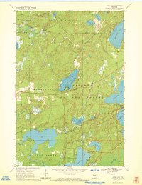
USGS Historical Quadrangle in GeoPDF.

A MODFLOW-NWT groundwater flow model was developed to simulate groundwater movement in the area around Anvil Lake, and groundwater inputs and outputs from the lake from 1980 to 2014. Surface-water hydrology was simulated using the lake package. The MODFLOW model was first calibrated for steady-state conditions, or "average" conditions corresponding to January 1, 1980, to December 31, 2014 to estimate spatial hydrogeologic properties. Following the steady-state calibration, the model was applied in transient mode to estimate average monthly hydrologic conditions (groundwater inputs and outputs) for each year from 1980 to 2014.
This data set contains imagery from the National Agriculture Imagery Program (NAIP). The NAIP program is administered by USDA FSA and has been established to support two main FSA strategic goals centered on agricultural production. These are, increase stewardship of America's natural resources while enhancing the environment, and to ensure commodities are procured and distributed effectively and efficiently to increase food security. The NAIP program supports these goals by acquiring and providing ortho imagery that has been collected during the agricultural growing season in the U.S. The NAIP ortho imagery is tailored to meet FSA requirements and is a fundamental tool used to support FSA farm and conservation programs....
This data set contains imagery from the National Agriculture Imagery Program (NAIP). The NAIP program is administered by USDA FSA and has been established to support two main FSA strategic goals centered on agricultural production. These are, increase stewardship of America's natural resources while enhancing the environment, and to ensure commodities are procured and distributed effectively and efficiently to increase food security. The NAIP program supports these goals by acquiring and providing ortho imagery that has been collected during the agricultural growing season in the U.S. The NAIP ortho imagery is tailored to meet FSA requirements and is a fundamental tool used to support FSA farm and conservation programs....
This data set contains imagery from the National Agriculture Imagery Program (NAIP). The NAIP program is administered by USDA FSA and has been established to support two main FSA strategic goals centered on agricultural production. These are, increase stewardship of America's natural resources while enhancing the environment, and to ensure commodities are procured and distributed effectively and efficiently to increase food security. The NAIP program supports these goals by acquiring and providing ortho imagery that has been collected during the agricultural growing season in the U.S. The NAIP ortho imagery is tailored to meet FSA requirements and is a fundamental tool used to support FSA farm and conservation programs....
This data set contains imagery from the National Agriculture Imagery Program (NAIP). The NAIP program is administered by USDA FSA and has been established to support two main FSA strategic goals centered on agricultural production. These are, increase stewardship of America's natural resources while enhancing the environment, and to ensure commodities are procured and distributed effectively and efficiently to increase food security. The NAIP program supports these goals by acquiring and providing ortho imagery that has been collected during the agricultural growing season in the U.S. The NAIP ortho imagery is tailored to meet FSA requirements and is a fundamental tool used to support FSA farm and conservation programs....

USGS Historical Quadrangle in GeoPDF.
|

|
