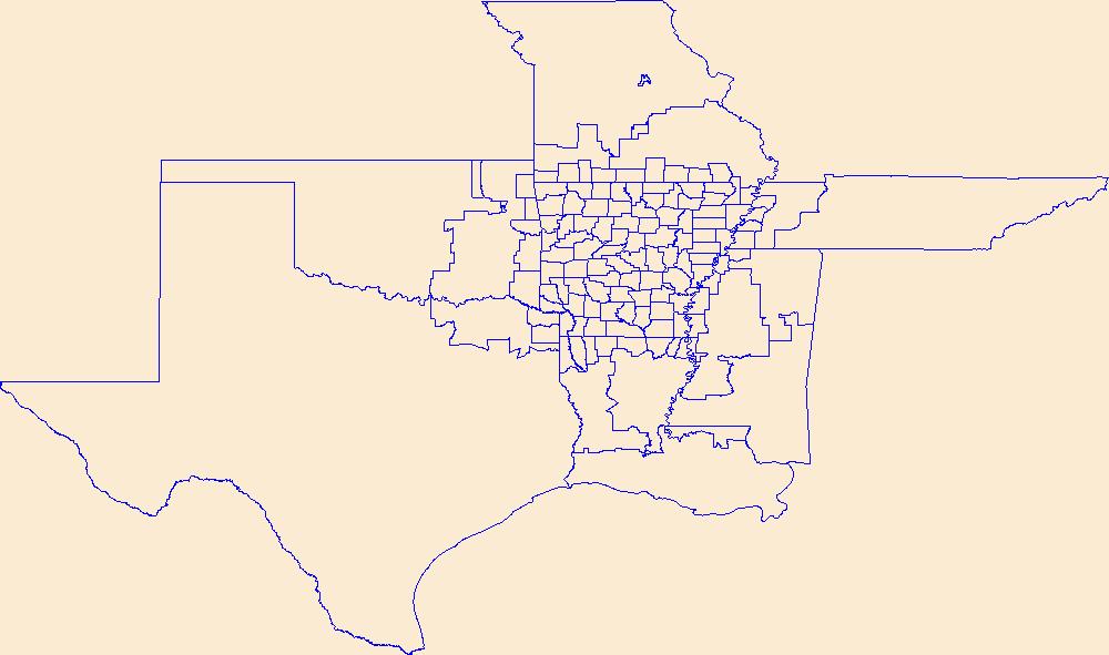
Filters: Tags: Arkansas (X) > Date Range: {"choice":"year"} (X)
386 results (26ms)|
Filters
Date Types (for Date Range)
Types
Contacts
Categories
Tag Types
|
Forest Retention Index classes for the southeastern United States at 2040 were processed using the Forest Retention Decision Tree and rendered on a 30-meter by 30-meter grid. The Forest Retention Index is used only for current forestland, identified using National Land Cover Database 2011. Many datasets were used as inputs for the Forest Retention Decision Tree, and they can be grouped into five broad categories: Protected, Tier 1 Priority, Tier 2 Priority, Threats to Forest Retention, and Socio-Economic Value of Forests. Protected datasets include Protected Areas Database-United States, National Conservation Easement Database, state-maintained databases, and private datasets volunteered by conservation partners....
Categories: Data;
Types: ArcGIS REST Map Service,
ArcGIS Service Definition,
Downloadable,
Map Service;
Tags: Alabama,
Arkansas,
Florida,
Georgia,
Illinois,
The balance between economic needs and natural resource conservation will become more tenuous in the future as a result of a myriad of environmental stressors. We propose a methodology that can help guide forest management practices whenever adequate species locational data and quality forest or land use data exist. More specifically, the results of this study can be used to evaluate alternative land and silviculture management scenarios in terms of creating or maintaining high-quality forest habitat for a specific species. We used data collected on radiotelemetered black bears from 1988 to 2015 to develop a regional habitat model throughout Louisiana and Arkansas using Mahalanobis distance (D2) statistic. We created...
Categories: Data;
Tags: Arkansas,
Consevation design,
LCC Network Science Catalog,
Louisiana,
Mahalanobis distance,
Geospatial data is comprised of government boundaries.
Layers of geospatial data include roads, airports, trails, and railroads.

The Geographic Names Information System (GNIS) is the Federal standard for geographic nomenclature. The U.S. Geological Survey developed the GNIS for the U.S. Board on Geographic Names, a Federal inter-agency body chartered by public law to maintain uniform feature name usage throughout the Government and to promulgate standard names to the public. The GNIS is the official repository of domestic geographic names data; the official vehicle for geographic names use by all departments of the Federal Government; and the source for applying geographic names to Federal electronic and printed products of all types.

The Geographic Names Information System (GNIS) is the Federal standard for geographic nomenclature. The U.S. Geological Survey developed the GNIS for the U.S. Board on Geographic Names, a Federal inter-agency body chartered by public law to maintain uniform feature name usage throughout the Government and to promulgate standard names to the public. The GNIS is the official repository of domestic geographic names data; the official vehicle for geographic names use by all departments of the Federal Government; and the source for applying geographic names to Federal electronic and printed products of all types.
The Geographic Names Information System (GNIS) is the Federal standard for geographic nomenclature. The U.S. Geological Survey developed the GNIS for the U.S. Board on Geographic Names, a Federal inter-agency body chartered by public law to maintain uniform feature name usage throughout the Government and to promulgate standard names to the public. The GNIS is the official repository of domestic geographic names data; the official vehicle for geographic names use by all departments of the Federal Government; and the source for applying geographic names to Federal electronic and printed products of all types.

These data were released prior to the October 1, 2016 effective date for the USGS’s policy dictating the review, approval, and release of scientific data as referenced in USGS Survey Manual Chapter 502.8 Fundamental Science Practices: Review and Approval of Scientific Data for Release. This geodatabase contains the spatial datasets that represent the Edwards-Trinity aquifer system in the States of Arkansas, Oklahoma, and Texas. Included are: (1) polygon extents; datasets that represent the aquifer system extent, the entire extent subdivided into subareas or subunits, and any polygon extents of special interest (no data available, areas underlying other aquifers, anomalies, for example), (2) raster datasets for...
We provide genetic and distribution data for the Louisiana Pigtoe, Pleurobema riddellii, to guide decisions related to federal protection for the species under the U.S. Endangered Species Act. Our final dataset includes 125 COI sequences generated as part of our study representing P. riddellii from eight North American river basins. This includes the COI sequence we generated from a museum specimen collected from the Trinity River in the late 1900s, which is the first genetic confirmation of P. riddellii in the Trinity River basin. Also included are sequences from specimens initially identified as Fusconaia cerina (n=3) Fusconaia flava (n=1), Fusconaia sp. (n=5), Pleurobema sintoxia (n=10), and Pustulosa pustulosa...
This child item describes Python code used to estimate average yearly and monthly tourism per 1000 residents within public-supply water service areas. Increases in population due to tourism may impact amounts of water used by public-supply water systems. This data release contains model input datasets, Python code used to develop the tourism information, and output estimates of tourism. This dataset is part of a larger data release using machine learning to predict public supply water use for 12-digit hydrologic units from 2000-2020. Output from this code was used as an input feature in the public supply delivery and water use machine learning models. This page includes the following files: tourism_input_data.zip...
This child item describes a public supply delivery machine learning model that was developed to estimate public-supply deliveries. Publicly supplied water may be delivered to domestic users or to commercial, industrial, institutional, and irrigation (CII) users. This model predicts total, domestic, and CII per capita rates for public-supply water service areas within the conterminous United States for 2009-2020. This child item contains model input datasets, code used to build the delivery machine learning model, and national predictions. This dataset is part of a larger data release using machine learning to predict public-supply water use for 12-digit hydrologic units from 2000-2020. This page includes the following...
This child item describes Python code used to query census data from the TigerWeb Representational State Transfer (REST) services and the U.S. Census Bureau Application Programming Interface (API). These data were needed as input feature variables for a machine learning model to predict public supply water use for the conterminous United States. Census data were retrieved for public-supply water service areas, but the census data collector could be used to retrieve data for other areas of interest. This dataset is part of a larger data release using machine learning to predict public supply water use for 12-digit hydrologic units from 2000-2020. Data retrieved by the census data collector code were used as input...
This map layer shows major ports in the United States, Puerto Rico, and the U.S. Virgin Islands. A port is a city, town, or urban area with a harbor where ships load or unload. This is a revised version of the July 2012 map layer.
Categories: Data;
Types: Downloadable,
Map Service,
OGC WFS Layer,
OGC WMS Layer,
Shapefile;
Tags: Academics & scientific researchers,
Alabama,
Arizona,
Arkansas,
California,
This data set represents the extent, approximate location and type of wetlands and deepwater habitats in the United States and its Territories. These data delineate the areal extent of wetlands and surface waters as defined by Cowardin et al. (1979). Certain wetland habitats are excluded from the National mapping program because of the limitations of aerial imagery as the primary data source used to detect wetlands. These habitats include seagrasses or submerged aquatic vegetation that are found in the intertidal and subtidal zones of estuaries and near shore coastal waters. Some deepwater reef communities (coral or tuberficid worm reefs) have also been excluded from the inventory. These habitats, because of their...
Categories: Data;
Types: Map Service,
OGC WFS Layer,
OGC WMS Layer,
OGC WMS Service;
Tags: Academics & scientific researchers,
Alabama,
Alabama,
Alaska,
Arizona,
This dataset is a point shapefile of wells measured for the potentiometric surface maps of the Mississippi River Valley alluvial aquifer (MRVA) in Spring 2016, 2018, and 2020. The data provided for each well considered in the applicable potentiometric surface map are the water-level date, altitude [relative to the North American vertical datum of 1988 (NAVD88)], a useYYYY code (which is positive if the water level was used in the potentiometric surface map for that year), a use comment (which is populated for water levels not used), and the water-level change values, for 2016-18, 2018-20, and 2016-20 for water levels with positive useYYYY codes for the applicable years. The data provided for each streamgage considered...
This dataset is a raster surface, in feet, of the depth to water, spring 2020, Mississippi River Valley alluvial aquifer (MRVA). The raster cell size is 1,000 meters (3,280.8 ft). The raster was interpolated using (1) depth-to-water (GW_D2W) data from wells and (2) an assumed value of zero for depth to water at streamgages (SW_D2W) because the precise depth to groundwater at the streamgage is not known..The streamgage data is used only when it appears the regional aquifer and surface water are hydrologically connected.
Policy-relevant flood risk modeling must capture interactions between physical and social processes to accurately project impacts from scenarios of sea level rise and inland flooding due to climate change. Here we simultaneously model urban growth, flood hazard change, and adaptive response using the FUTure Urban-Regional Environment Simulation (FUTURES) version 3 framework (Sanchez et al., 2023). FUTURES is an open source urban growth model designed to address the regional-scale ecological and environmental impacts of urbanization; it is one of the few land change models that explicitly captures the spatial structure of development in response to user-specified scenarios. We present probabilistic land change projections...
Dataset contains the groundwater well locations and water-level measurements for 273 wells measured during a water-level survey of the Sparta-Memphis aquifer in Arkansas, January through June 2015. Well-location and water-level data is publicly available from the U.S. Geological Survey's National Water Information System.
Categories: Data;
Types: Downloadable,
Map Service,
OGC WFS Layer,
OGC WMS Layer,
Shapefile;
Tags: Arkansas,
Mississippi Embayment aquifer system,
Sparta-Memphis Sand,
aquifer,
effects of groundwater extraction,
Airborne radiometric data are provided here as part of the data release "Airborne magnetic and radiometric survey, western Arkansas, 2022." This website includes the processed radiometric data, with and without spectra, provided in ASCII .csv files and geoTIFF images showing the total count (K, U, Th), percent potassium (%K), equivalent uranium (eU), and equivalent thorium (eTh).
Categories: Data;
Types: Downloadable,
GeoTIFF,
Map Service,
Raster;
Tags: AASG,
Arkansas,
Association of State Geologists,
Dardanelle,
Dardanelle Lake,
This dataset represents results from this study attributed to the NHDPlus V2 catchments. Changes in climate occurring throughout the Mississippi River Basin are expected to lead to additional impacts in stream habitats and fish assemblages in multiple ways, including changing changing thermal properties and flow regimes. To manage streams for current impacts and future changes, managers need region-wide information for decision-making and developing proactive management strategies. Our project provides a suite of climate metrics that have been found to be relevant to the distribution and population structure of aquatic organisms in freshwater stream networks. These results provide natural resource managers, decision-makers,...
Categories: Data;
Types: Map Service,
OGC WFS Layer,
OGC WMS Layer,
OGC WMS Service;
Tags: Academics & scientific researchers,
Alabama,
Arkansas,
Colorado,
Complete,
|

|
