Filters: Tags: Asbestos (X)
83 results (73ms)|
Filters
Date Range
Extensions Types
Contacts
Categories Tag Types
|

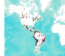
This data set consists of records for over 900 mineral facilities in Latin America and Canada. The mineral facilities include mines, plants, smelters, or refineries of aluminum, cement, coal, copper, diamond, gold, iron and steel, nickel, platinum-group metals, salt, and silver, among others. Records include attributes such as commodity, country, location, company name, facility type and capacity if applicable, and generalized coordinates. The data were compiled from multiple sources, including the 2003 and 2004 USGS Minerals Yearbooks (Latin America and Candada volume), data to be published in the 2005 Minerals Yearbook Latin America and Canada Volume, minerals statistics and information from the USGS minerals...
ADMMR map collection: Reynolds Falls Asbestos Inc., Proposed Explorations; 1 in. to 100 feet; 16 x 11 in.
Types: Map Service,
OGC WFS Layer,
OGC WMS Layer,
OGC WMS Service;
Tags: Asbestos,
Kobuk River Region, Alaska
Types: Map Service,
OGC WFS Layer,
OGC WMS Layer,
OGC WMS Service;
Tags: Asbestos,
Gila County, Arizona
ADMMR map collection: Gila and Salt River Meridian, Arizona, Township 6 North, Range 14 East; 1 in. to 2640 feet; 24 x 18 in.
ADMMR map collection: Claims of American Fiber Corporation's Rock House Property; 1 in. to 500 feet; 25 x 34 in.
ADMMR map collection: Victory Mine, Plan and Sections, Western Chemical Company, Asbestos Division; 1 in. to 100 feet; 18 x 22 in.
This location is part of the Arizona Mineral Industry Location System (AzMILS), an inventory of mineral occurences, prospects and mine locations in Arizona. Gila379 is located in T6N R15.5E Sec 4 -- in the Mcfadden Peak - 15 Min quad. This collection consists of various reports, maps, records and related materials acquired by the Arizona Department of Mines and Mineral Resources regarding mining properties in Arizona. Information was obtained by various means, including the property owners, exploration companies, consultants, verbal interviews, field visits, newspapers and publications. Some sections may be redacted for copyright. Please see the access statement.
ADMMR map collection: Underground Workings, K & M Whitemountain Apache Tribe Property; 1 in. to 100 feet; 24 x 28 in.
Categories: Data;
Tags: 1960s,
Arizona,
Asbestos,
Carrizo Embayment physiographic area,
Carrizo Se - 7.5 Min,

This dataset consists of records for over 1,500 mineral facilities in Africa and the Middle East. The mineral facilities include mines, plants, mills , or refineries of aluminum, cement, coal, copper, diamond, gold, iron and steel, nickel, platinum-group metals, salt, and silver, among others. Records include attributes such as commodity, country, site, company name, plant capacity if applicable, and generalized coordinates. The data were compiled from multiple sources, including the 2004 USGS Minerals Yearbook (Africa and Middle East volume), minerals statistics and information from the USGS minerals information Web site (http://minerals.usgs.gov/minerals/), and data collected by USGS minerals information country...
This location is part of the Arizona Mineral Industry Location System (AzMILS), an inventory of mineral occurences, prospects and mine locations in Arizona. Pinal149D is located in T3S R13E Sec 24 N2 in the Hot Tamale Peak - 7.5 Min quad. This collection consists of various reports, maps, records and related materials acquired by the Arizona Department of Mines and Mineral Resources regarding mining properties in Arizona. Information was obtained by various means, including the property owners, exploration companies, consultants, verbal interviews, field visits, newspapers and publications. Some sections may be redacted for copyright. Please see the access statement.
Types: Map Service,
OGC WFS Layer,
OGC WMS Layer,
OGC WMS Service;
Tags: Asbestos,
Gila County, Arizona
|

|