Filters: Tags: Audubon County (X) > Date Range: {"choice":"year"} (X)
6 results (50ms)|
Filters
Date Types (for Date Range)
Categories Tag Types Tag Schemes |
These data were released prior to the October 1, 2016 effective date for the USGS’s policy dictating the review, approval, and release of scientific data as referenced in USGS Survey Manual Chapter 502.8 Fundamental Science Practices: Review and Approval of Scientific Data for Release. Point coverage of bathymetry target points for Littlefield Lake in Audubon Co., Iowa. The U.S. Geological Survey conducted a bathymetric survey of Littlefield Lake in 2004.
These data were released prior to the October 1, 2016 effective date for the USGS’s policy dictating the review, approval, and release of scientific data as referenced in USGS Survey Manual Chapter 502.8 Fundamental Science Practices: Review and Approval of Scientific Data for Release. This data set consists of digital polygon coverage that defines the shoreline of Littlefield Lake in Audubon Co., Iowa. The U.S. Geological Survey conducted a bathymetric survey of Littlefield Lake in 2004.
These data were released prior to the October 1, 2016 effective date for the USGS’s policy dictating the review, approval, and release of scientific data as referenced in USGS Survey Manual Chapter 502.8 Fundamental Science Practices: Review and Approval of Scientific Data for Release. Point coverage of bathymetry data for Littlefield Lake in Audubon Co., Iowa. The U.S. Geological Survey conducted a bathymetric survey of Littlefield Lake in 2004.
These data were released prior to the October 1, 2016 effective date for the USGS’s policy dictating the review, approval, and release of scientific data as referenced in USGS Survey Manual Chapter 502.8 Fundamental Science Practices: Review and Approval of Scientific Data for Release. This data set consists of digital bathymetry contours for Littlefield Lake in Audubon Co., Iowa. The U.S. Geological Survey conducted a bathymetric survey of Littlefield Lake in 2004.

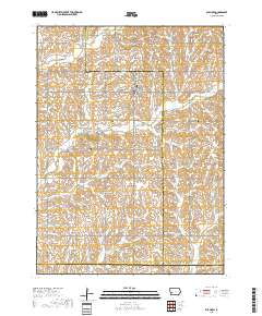
Layered geospatial PDF 7.5 Minute Quadrangle Map. Layers of geospatial data include orthoimagery, roads, grids, geographic names, elevation contours, hydrography, and other selected map features. This map is derived from GIS (geospatial information system) data. It represents a repackaging of GIS data in traditional map form, not creation of new information. The geospatial data in this map are from selected National Map data holdings and other government sources.
Layered geospatial PDF 7.5 Minute Quadrangle Map. Layers of geospatial data include orthoimagery, roads, grids, geographic names, elevation contours, hydrography, and other selected map features. This map is derived from GIS (geospatial information system) data. It represents a repackaging of GIS data in traditional map form, not creation of new information. The geospatial data in this map are from selected National Map data holdings and other government sources.
|

|
