Filters: Tags: Barite (X)
22 results (31ms)|
Filters
Date Range
Extensions (Less) Types (Less)
Contacts (Less)
Categories (Less) Tag Types
|
This data release provides descriptions of more than 60 mineral regions, mines, and mineral deposits within the United States and its territories that are reported to contain enrichments of cobalt (Co). To focus the scope of this data release, we report only mined deposits and exploration prospects with past production, or resource and reserve estimates of 1,000 metric tons or more of cobalt. Cobalt has diverse uses because of its properties, which include ferromagnetism, hardness, wear-resistance, low conductivity, and high melting point. The primary uses for cobalt are in rechargeable battery electrodes, and in superalloys used to make gas turbine engines. In 2017, the United States had a net import reliance...
Categories: Data;
Types: ArcGIS REST Map Service,
ArcGIS Service Definition,
Downloadable,
Map Service;
Tags: Alaska,
BLM,
Bureau of Land Management,
California,
GGGSC,
Types: Map Service,
OGC WFS Layer,
OGC WMS Layer,
OGC WMS Service;
Tags: Barite,
Stevens County, Washington
This report provides detailed mapping (1:63,360-scale) in the Dalton Highway area, from Atigun Gorge to Slope Mountain, in the west-central Philip Smith Mountains quadrangle. The map area extends from the northern flank of the Endicott Mountains into the Arctic Foothills province.
In response to Executive Order 13817 of December 20, 2017, the U.S. Geological Survey (USGS) coordinated with the Bureau of Land Management (BLM) to identify 36 nonfuel minerals or mineral materials considered critical to the economic and national security of the United States (U.S.) (https://pubs.usgs.gov/of/2018/1021/ofr20181021.pdf). Acquiring information on possible domestic sources of these critical minerals is the rationale for the USGS Earth Mapping Resources Initiative (Earth MRI). The program, which partners the USGS with State Geological Surveys, Federal agencies, and the private sector, aims to collect new geological, geophysical, and topographic (lidar) data in key areas of the U.S. to stimulate mineral...
The U.S. Geological Survey (USGS) has compiled a geodatabase containing mineral-related geospatial data for the People's Republic of China. The data can be used in analyses of the extractive fuel and nonfuel mineral industries and related economic and physical infrastructure integral for the successful operation of the mineral industries within the area of study as well as the movement of mineral products across domestic and global markets. This geodatabase reflects the USGS ongoing commitment to its mission of understanding the nature and distribution of global mineral commodity supply chains by updating and publishing the georeferenced locations of mineral commodity production and processing facilities, mineral...
The U.S. Geological Survey (USGS) has compiled a geodatabase containing mineral-related geospatial data for 10 countries of interest in Southwest Asia (area of study): Afghanistan, Cambodia, Laos, India, Indonesia, Iran, Nepal, North Korea, Pakistan, and Thailand. The data can be used in analyses of the extractive fuel and nonfuel mineral industries and related economic and physical infrastructure integral for the successful operation of the mineral industries within the area of study as well as the movement of mineral products across domestic and global markets. This geodatabase reflects the USGS ongoing commitment to its mission of understanding the nature and distribution of global mineral commodity supply chains...
This data release contains the U.S. salient statistics and world production data extracted from the BARITE data sheet of the USGS Mineral Commodity Summaries 2023.
Types: Map Service,
OGC WFS Layer,
OGC WMS Layer,
OGC WMS Service;
Tags: Barite,
Hot Spring County, Arkansas
This report summarizes work done while profiling fifty-two (52) antimony and barite companies, mines, and /or deposits in twenty (20) market economy countries, exclusive of the United States. The profiles include current geological, engineering and economic data on deposits that represent eighty -five (85) percent of the production potential for these two commodities. In addition to summarizing the information collected, the report describes the methods used to gather and evaluate the data. Several suggestions are made for improving the data collection efforts on future work of this type.
This data release contains the U.S. salient statistics and world production data extracted from the BARITE data sheet of the USGS Mineral Commodity Summaries 2024.

This data set includes mineral and metal operations in the United States. The data represent commodities monitored by the National Minerals Information Center of the USGS, and the operations included are those considered active in 2003 and surveyed by the MIT. Additional mineral and metal operations information can be obtained from the U.S. Geological Survey National Minerals Information Center web page at: <http://minerals.usgs.gov/minerals/>
Sediment hosted gold deposits in Nevada were first mined in the 1960s from open pit mines with large tonnage and low grade resources. Since that time, continuing exploration and discovery have identified extraordinary resources, and together these deposits now form the second-largest gold endowment on Earth, surpassed only by the Witwatersrand Gold Fields of South Africa. The data herein are part of a larger U.S. Geological Survey (USGS) project to develop an updated geospatial database of mines, mineral deposits and mineral regions in the United States. The point and polygon layers within this database represent locations of mines, mineral occurrences (which includes deposits and prospects), and mining...
Categories: Data;
Types: ArcGIS REST Map Service,
ArcGIS Service Definition,
Downloadable,
Map Service;
Tags: Ag,
Au,
BLM,
Bureau of Land Management,
Carlin,
This data release contains the U.S. salient statistics and world production data extracted from the BARITE data sheet of the USGS Mineral Commodity Summaries 2022.
Lenticular body of barite in dolomite of the Rome formation, exposed by barite mining 900 feet northwest of Paga No. 2 mine. Bartow County, Georgia. Circa 1944. Plate 14- C, in U.S.Geological Survey Professional paper 224. 1950.
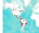
This data set consists of records for over 900 mineral facilities in Latin America and Canada. The mineral facilities include mines, plants, smelters, or refineries of aluminum, cement, coal, copper, diamond, gold, iron and steel, nickel, platinum-group metals, salt, and silver, among others. Records include attributes such as commodity, country, location, company name, facility type and capacity if applicable, and generalized coordinates. The data were compiled from multiple sources, including the 2003 and 2004 USGS Minerals Yearbooks (Latin America and Candada volume), data to be published in the 2005 Minerals Yearbook Latin America and Canada Volume, minerals statistics and information from the USGS minerals...

This dataset consists of records for over 1,500 mineral facilities in Africa and the Middle East. The mineral facilities include mines, plants, mills , or refineries of aluminum, cement, coal, copper, diamond, gold, iron and steel, nickel, platinum-group metals, salt, and silver, among others. Records include attributes such as commodity, country, site, company name, plant capacity if applicable, and generalized coordinates. The data were compiled from multiple sources, including the 2004 USGS Minerals Yearbook (Africa and Middle East volume), minerals statistics and information from the USGS minerals information Web site (http://minerals.usgs.gov/minerals/), and data collected by USGS minerals information country...
In response to Executive Order 13817 of December 20, 2017, the U.S. Geological Survey (USGS) coordinated with the Bureau of Land Management (BLM) to identify 35 nonfuel minerals or mineral materials considered critical to the economic and national security of the United States (U.S.) (https://pubs.usgs.gov/of/2018/1021/ofr20181021.pdf). Acquiring information on possible domestic sources of these critical minerals is the rationale for the USGS Earth Mapping Resources Initiative (Earth MRI). The program, which partners the USGS with State Geological Surveys, Federal agencies, and the private sector, aims to collect new geological, geophysical, and topographic (lidar) data in key areas of the U.S. to stimulate mineral...
This collection consists of materials that were collected during the Atomic Energy Commission drilling program in the Slick Rock district in southwestern Colorado. There are six core boxes that contain tins holding heavy mineral separates originally prepared from core samples collected by Dan Shawe. The heavy mineral separate samples include materials recovered from cores drilled in three areas of the Slick Rock district: Legin (abbreviated to LE in sample IDs), Spud Patch (abbreviated to SP in sample IDs), and Disappointment Valley (abbreviated to DV or DVR in sample IDs). The analysis of the separates is described in USGS Bulletin 1107-B and Professional Paper 576-D. The mineral separates were later processed...
This U.S. Geological Survey (USGS) Data Release contains locations and concentrations of metals in various size fractions in floodplain-core, streambed-sediment samples, and sediment deposited on the flood plain from the December 2015 flood and underlying soils collected from along the Middle Big River and tributaries in the Southeast Missouri Barite District from 2012 to 2015. All samples were analyzed either by inductively-coupled plasma-mass spectrometry (ICP-MS) or x-ray fluorescence (XRF). Concentrations of metals in quality-assurance samples are also presented to evaluate the effect of sample splitting and compare the U.S. Environmental Protection Agency (EPA) and USGS Missouri Water Science Center XRF units....
Types: Map Service,
OGC WFS Layer,
OGC WMS Layer,
OGC WMS Service;
Tags: Big River,
Environmental Health,
Geochemistry,
Sediment,
Soil Sciences,
Note: this data release has been superseded by version 2.0, available here: https://doi.org/10.5066/P97NJLI4.
Categories: Data;
Types: ArcGIS REST Map Service,
ArcGIS Service Definition,
Downloadable,
Map Service;
Tags: Alaska,
Arizona,
BLM,
Bureau of Land Management,
California,
|

|
