Filters
Date Range
Extensions
Types
Contacts
Tag Types
Tag Schemes
|

Geospatial data that is a derivative land cover product depicting woodland on topographic maps.
Tags: Agricultural land,
Barren land,
Downloadable Data,
FileGDB 10.1,
FileGDB 10.1, All tags...
Forest land,
Land Cover,
Land Cover - Woodland,
Land Cover - Woodland,
Not Classified,
Orthoimage,
Range land,
State,
State,
US,
US,
United States,
United States,
Urban and built-up land,
VA,
Virginia,
Water,
Wetland,
Woodland,
annotations,
biota,
ecology,
environment,
farming,
flora,
habitat,
imagery,
imageryBaseMapsEarthCover,
land cover, Fewer tags
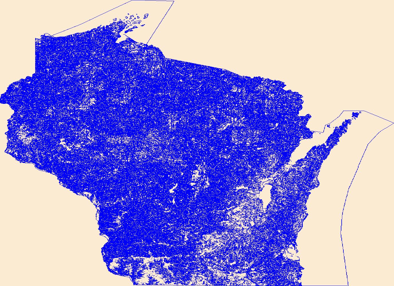
Geospatial data that is a derivative land cover product depicting woodland on topographic maps.
Tags: Agricultural land,
Barren land,
Downloadable Data,
FileGDB 10.1,
FileGDB 10.1, All tags...
Forest land,
Land Cover,
Land Cover - Woodland,
Land Cover - Woodland,
Not Classified,
Orthoimage,
Range land,
State,
State,
US,
US,
United States,
Urban and built-up land,
WI,
Water,
Wetland,
Wisconsin,
Woodland,
annotations,
biota,
ecology,
environment,
farming,
flora,
habitat,
imagery,
imageryBaseMapsEarthCover,
land cover, Fewer tags

Geospatial data that is a derivative land cover product depicting woodland on topographic maps.
Tags: Agricultural land,
Barren land,
Downloadable Data,
FileGDB 10.1,
FileGDB 10.1, All tags...
Forest land,
Land Cover,
Land Cover - Woodland,
Land Cover - Woodland,
Not Classified,
Orthoimage,
Range land,
SD,
South Dakota,
State,
State,
US,
US,
United States,
United States,
Urban and built-up land,
Water,
Wetland,
Woodland,
annotations,
biota,
ecology,
environment,
farming,
flora,
habitat,
imagery,
imageryBaseMapsEarthCover,
land cover, Fewer tags

Geospatial data that is a derivative land cover product depicting woodland on topographic maps.
Types: Citation;
Tags: AL,
Agricultural land,
Alabama,
Barren land,
Downloadable Data, All tags...
Forest land,
Land Cover,
Land Cover - Woodland,
Not Classified,
Orthoimage,
Range land,
Shapefile,
State,
US,
US,
United States,
Urban and built-up land,
Water,
Wetland,
Woodland,
annotations,
biota,
ecology,
environment,
farming,
flora,
habitat,
imagery,
imageryBaseMapsEarthCover,
land cover, Fewer tags
As one of the cornerstones of the U.S. Geological Survey's (USGS) National Geospatial Program, The National Map is a collaborative effort among the USGS and other Federal, State, and local partners to improve and deliver topographic information for the Nation. It has many uses ranging from recreation to scientific analysis to emergency response. The National Map is easily accessible for display on the Web, as products and services, and as downloadable data. The geographic information available from The National Map includes orthoimagery (aerial photographs), elevation, geographic names, hydrography, boundaries, transportation, structures, and land cover.
Tags: 1 arc-second DEM,
1 meter DEM,
1-degree DEM,
1/3 arc-second DEM,
1/9 arc-second DEM, All tags...
10,000 meter DEM,
15-minute DEM,
2 arc-second DEM,
3DEP,
Administrative watershed units,
Aerial Compliance,
Aerial Photography,
Agricultural land,
Airport Complex,
Airport Point,
Airport Runway,
Airports,
Airstrips,
Area of Complex Channels,
Area to be submerged,
Bare Earth,
Barren land,
Basin,
Bay/Inlet,
Boundaries,
Boundary,
Bridge,
Canal/Ditch,
Cartography,
Coastline,
College / University,
Compliance,
Connector,
County or Equivalent,
DEM,
Dam/Weir,
Digital Elevation Model,
Digital Mapping,
Digital Ortho rectified Image,
Digital Terrain Model,
Drainage areas for surface water,
Elevation,
Elevation Theme,
Estuary,
Feature class,
Feature coordinates,
Feature county,
Feature description,
Feature designation,
Feature history,
Feature identification,
Feature name,
Feature state,
Fire Station/ EMS Station,
Flow direction network,
Flume,
ForeShore,
Forest land,
GIS,
Gaging Station,
Gate,
Geodata,
Geographic feature,
Geographic name,
Geographic names,
Geographical feature,
Geographical name,
Georeferenced,
Governmental Units, and Administrative and Statistical Boundaries Theme,
Grid,
HU10,
HU12,
HU14,
HU16,
HU2,
HU4,
HU6,
HU8,
HUC,
Hazard Zone,
High Resolution,
High Resolution Orthoimagery,
Hospital/Medical Center,
Hydro-Flattened,
Hydrographic,
Hydrography,
Hydrologic Unit Code,
Hydrologic Units,
IFSAR,
Ice mass,
Image processing,
Impervious,
Imperviousness,
Incorporated Place,
Interferometric Synthetic Aperture Radar,
Inundation Area,
JPEG 2000,
Juction,
Jurisdictional,
LAS,
LIDAR,
LIght Detection And Ranging,
Land Use-Land Cover Theme,
Land cover,
Law Enforcement,
Levee,
Light Detection and Ranging,
Line,
Lock Chamber,
Mapping,
Marsh,
Minor Civil Division,
NAIP,
NED,
NGDA,
National Elevation Dataset,
National Geospatial Data Asset,
Native American Area,
NavAid,
Nonearthen Shore,
Not Classified,
Official feature name,
Ortho Rectification,
Orthoimage,
PLSS First Division,
PLSS Special Survey,
PLSS Township,
Percent Developed Imperviousness,
Place name,
Playa,
Point,
Point Cloud,
PointEvent,
Pond,
Prison/ Correctional Facility,
Public Land Survey System,
Quarter Quadrangle,
Railways,
Range land,
Rapids,
Raster,
Reach,
Reach code,
Real Property Theme,
Reef,
Region,
Reserve,
Reservoir,
Roads,
Rock,
School,
School:Elementary,
School:High School,
School:Middle School,
Sea/Ocean,
Sink/Rise,
Sounding Datum Line,
Special Use Zone,
Special Use Zone Limit,
Spillway,
State Capitol,
State or Territory,
Stream/River,
Sub-basin,
Sub-region,
Subbasin,
Submerged Stream,
Subregion,
Subwatershed,
Survey,
Swamp,
Technical School,
Terrain Elevation,
Topographic,
Topographic Surface,
Topography,
Trade School,
TrailFeature,
Trails,
Transportation,
Transportation Theme,
Tunnel,
U.S. Geological Survey,
U.S. Geological Survey (USGS),
U.S. National Grid,
USGS,
Underground Conduit,
Unincorporated Place,
Urban and built-up land,
Variant name,
Vector,
WBD,
Wall,
Wash,
Water,
Water Intake Outflow,
Water – Inland Theme,
Waterfall,
Watershed,
Watershed Boundaries,
Watershed Boundary Dataset,
Waterway,
Well,
Wetland,
Woodland,
a-16,
altitude,
annotations,
artificial path,
biota,
boundaries,
boundaries,
boundary,
cadastral surveys,
contour,
dams,
dems,
digital spatial data,
drainage systems and characteristics,
ecology,
economy,
elevation,
elevation,
environment,
flora,
geographic names,
grid,
habitat,
hydrography,
image map,
imagery,
imageryBaseMapsEarthCover,
inlandWaters,
lakes,
land cover,
land ownership,
land use maps,
legal land descriptions,
location,
natural color orthophoto,
orthoimage,
orthophoto,
political and administrative boundaries,
polygon grid,
rectified image,
rivers,
slope,
society,
stream,
structure,
transportation, Fewer tags

Geospatial data that is a derivative land cover product depicting woodland on topographic maps.
Tags: Agricultural land,
Barren land,
Downloadable Data,
FileGDB 10.1,
FileGDB 10.1, All tags...
Forest land,
Land Cover,
Land Cover - Woodland,
Land Cover - Woodland,
NV,
Nevada,
Not Classified,
Orthoimage,
Range land,
State,
State,
US,
US,
United States,
United States,
Urban and built-up land,
Water,
Wetland,
Woodland,
annotations,
biota,
ecology,
environment,
farming,
flora,
habitat,
imagery,
imageryBaseMapsEarthCover,
land cover, Fewer tags
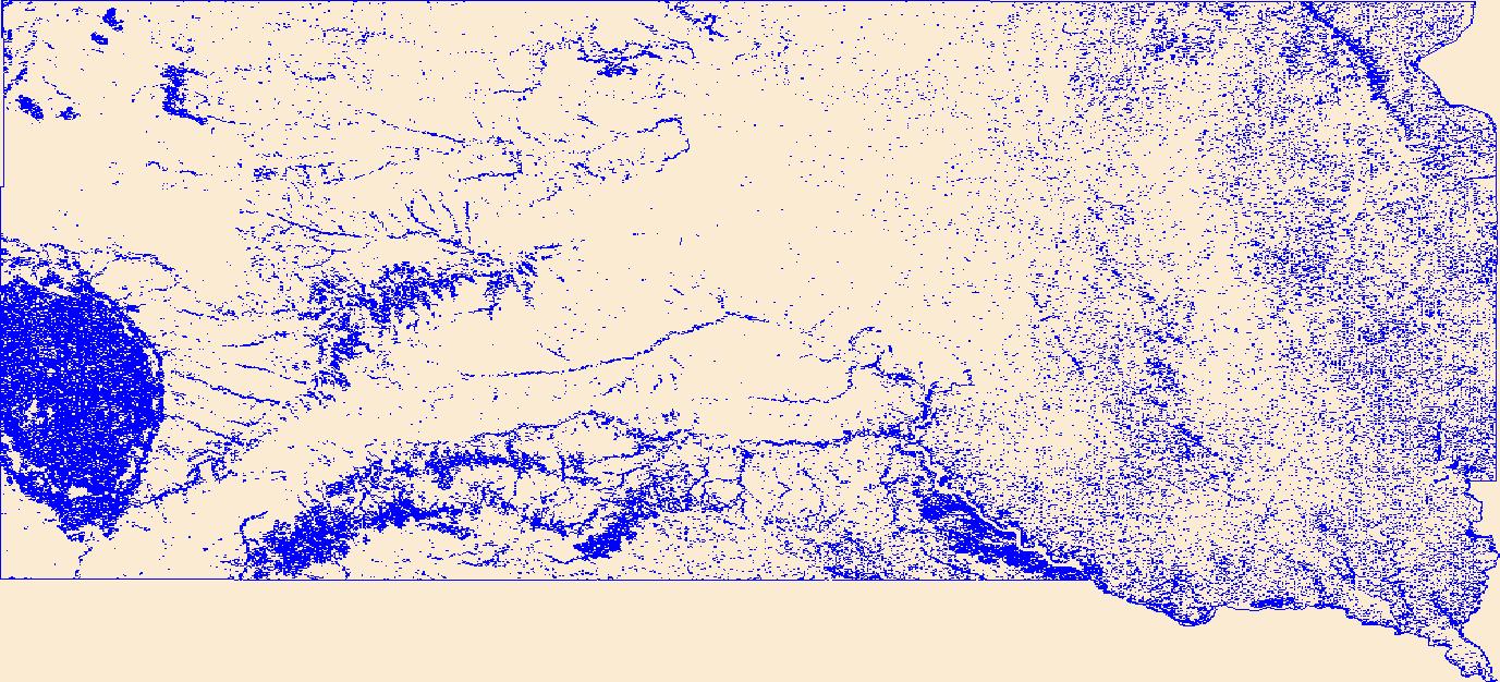
Geospatial data that is a derivative land cover product depicting woodland on topographic maps.
Tags: Agricultural land,
Barren land,
Downloadable Data,
Forest land,
Land Cover, All tags...
Land Cover - Woodland,
Land Cover - Woodland,
Not Classified,
Orthoimage,
Range land,
SD,
Shapefile,
Shapefile,
South Dakota,
State,
State,
US,
US,
United States,
United States,
Urban and built-up land,
Water,
Wetland,
Woodland,
annotations,
biota,
ecology,
environment,
farming,
flora,
habitat,
imagery,
imageryBaseMapsEarthCover,
land cover, Fewer tags
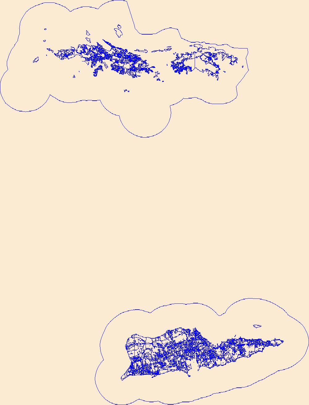
Geospatial data that is a derivative land cover product depicting woodland on topographic maps.
Tags: Agricultural land,
Barren land,
Downloadable Data,
Forest land,
Land Cover, All tags...
Land Cover - Woodland,
Land Cover - Woodland,
Not Classified,
Orthoimage,
Range land,
Shapefile,
Shapefile,
State,
State,
US,
US,
United States,
United States,
United States Virgin Islands,
Urban and built-up land,
VI,
Water,
Wetland,
Woodland,
annotations,
biota,
ecology,
environment,
farming,
flora,
habitat,
imagery,
imageryBaseMapsEarthCover,
land cover, Fewer tags
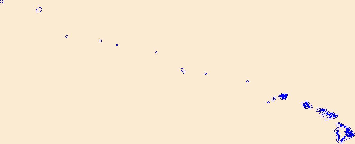
Geospatial data that is a derivative land cover product depicting woodland on topographic maps.
Tags: Agricultural land,
Barren land,
Downloadable Data,
FileGDB 10.1,
FileGDB 10.1, All tags...
Forest land,
HI,
Hawaii,
Land Cover,
Land Cover - Woodland,
Land Cover - Woodland,
Not Classified,
Orthoimage,
Range land,
State,
State,
US,
US,
United States,
Urban and built-up land,
Water,
Wetland,
Woodland,
annotations,
biota,
ecology,
environment,
farming,
flora,
habitat,
imagery,
imageryBaseMapsEarthCover,
land cover, Fewer tags
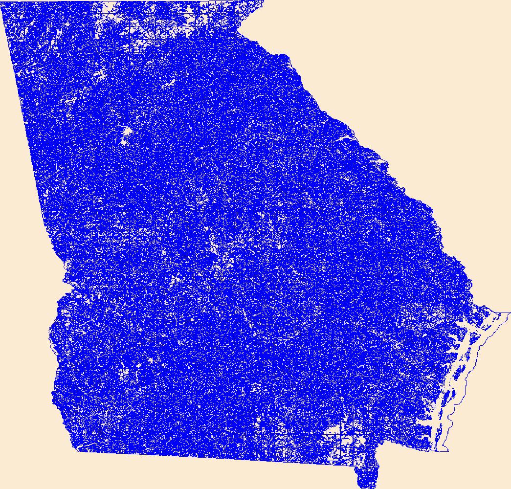
Geospatial data that is a derivative land cover product depicting woodland on topographic maps.
Tags: Agricultural land,
Barren land,
Downloadable Data,
FileGDB 10.1,
FileGDB 10.1, All tags...
Forest land,
GA,
Georgia,
Land Cover,
Land Cover - Woodland,
Land Cover - Woodland,
Not Classified,
Orthoimage,
Range land,
State,
State,
US,
US,
United States,
United States,
Urban and built-up land,
Water,
Wetland,
Woodland,
annotations,
biota,
ecology,
environment,
farming,
flora,
habitat,
imagery,
imageryBaseMapsEarthCover,
land cover, Fewer tags
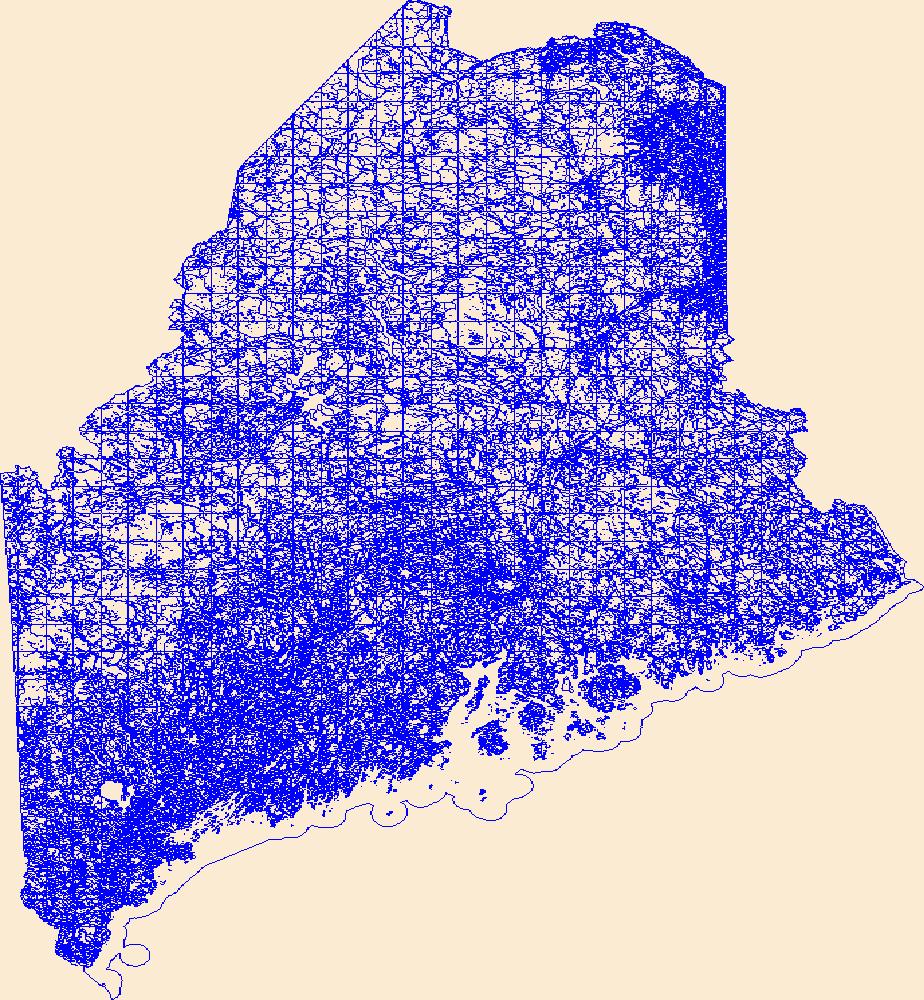
Geospatial data that is a derivative land cover product depicting woodland on topographic maps.
Tags: Agricultural land,
Barren land,
Downloadable Data,
Forest land,
Land Cover, All tags...
Land Cover - Woodland,
Land Cover - Woodland,
ME,
Maine,
Not Classified,
Orthoimage,
Range land,
Shapefile,
Shapefile,
State,
State,
US,
US,
United States,
Urban and built-up land,
Water,
Wetland,
Woodland,
annotations,
biota,
ecology,
environment,
farming,
flora,
habitat,
imagery,
imageryBaseMapsEarthCover,
land cover, Fewer tags
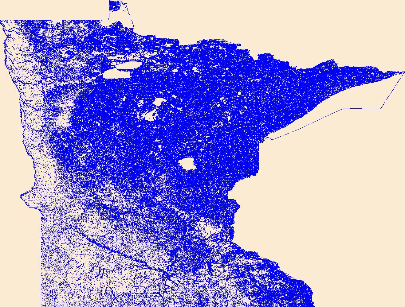
Geospatial data that is a derivative land cover product depicting woodland on topographic maps.
Tags: Agricultural land,
Barren land,
Downloadable Data,
Forest land,
Land Cover, All tags...
Land Cover - Woodland,
Land Cover - Woodland,
MN,
Minnesota,
Not Classified,
Orthoimage,
Range land,
Shapefile,
Shapefile,
State,
State,
US,
US,
United States,
United States,
Urban and built-up land,
Water,
Wetland,
Woodland,
annotations,
biota,
ecology,
environment,
farming,
flora,
habitat,
imagery,
imageryBaseMapsEarthCover,
land cover, Fewer tags
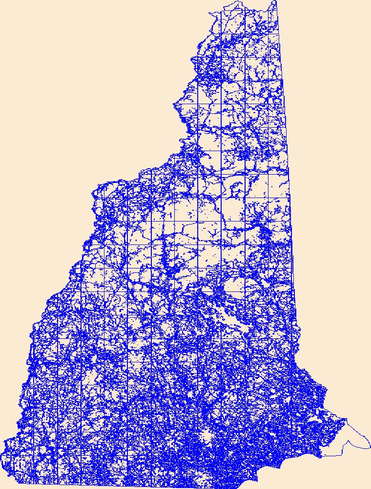
Geospatial data that is a derivative land cover product depicting woodland on topographic maps.
Tags: Agricultural land,
Barren land,
Downloadable Data,
Forest land,
Land Cover, All tags...
Land Cover - Woodland,
Land Cover - Woodland,
NH,
New Hampshire,
Not Classified,
Orthoimage,
Range land,
Shapefile,
Shapefile,
State,
State,
US,
US,
United States,
Urban and built-up land,
Water,
Wetland,
Woodland,
annotations,
biota,
ecology,
environment,
farming,
flora,
habitat,
imagery,
imageryBaseMapsEarthCover,
land cover, Fewer tags
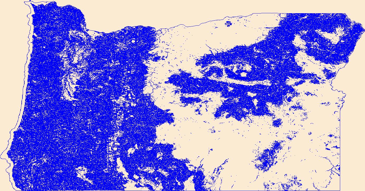
Geospatial data that is a derivative land cover product depicting woodland on topographic maps.
Tags: Agricultural land,
Barren land,
Downloadable Data,
FileGDB 10.1,
FileGDB 10.1, All tags...
Forest land,
Land Cover,
Land Cover - Woodland,
Land Cover - Woodland,
Not Classified,
OR,
Oregon,
Orthoimage,
Range land,
State,
State,
US,
US,
United States,
United States,
Urban and built-up land,
Water,
Wetland,
Woodland,
annotations,
biota,
ecology,
environment,
farming,
flora,
habitat,
imagery,
imageryBaseMapsEarthCover,
land cover, Fewer tags
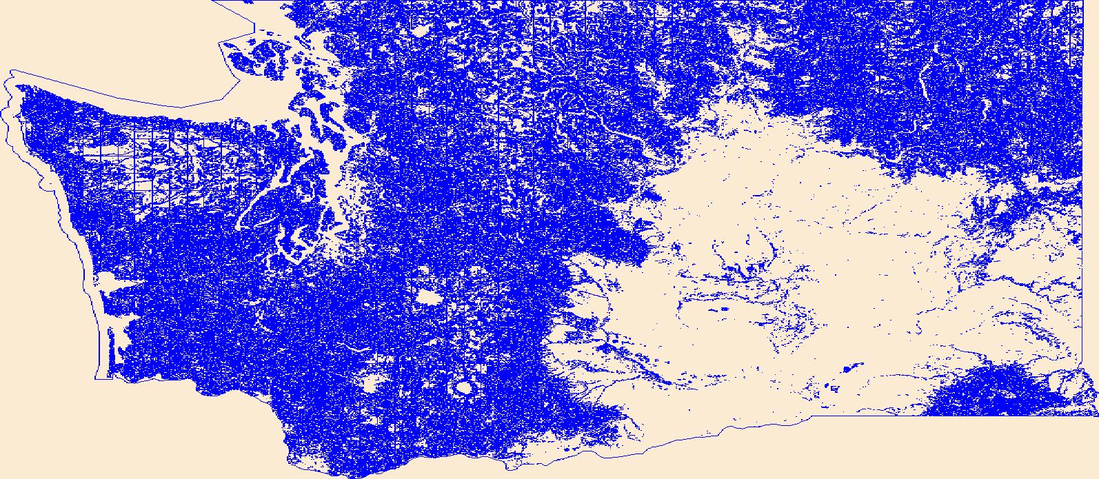
Geospatial data that is a derivative land cover product depicting woodland on topographic maps.
Tags: Agricultural land,
Barren land,
Downloadable Data,
Forest land,
Land Cover, All tags...
Land Cover - Woodland,
Land Cover - Woodland,
Not Classified,
Orthoimage,
Range land,
Shapefile,
Shapefile,
State,
State,
US,
US,
United States,
United States,
Urban and built-up land,
WA,
Washington,
Water,
Wetland,
Woodland,
annotations,
biota,
ecology,
environment,
farming,
flora,
habitat,
imagery,
imageryBaseMapsEarthCover,
land cover, Fewer tags
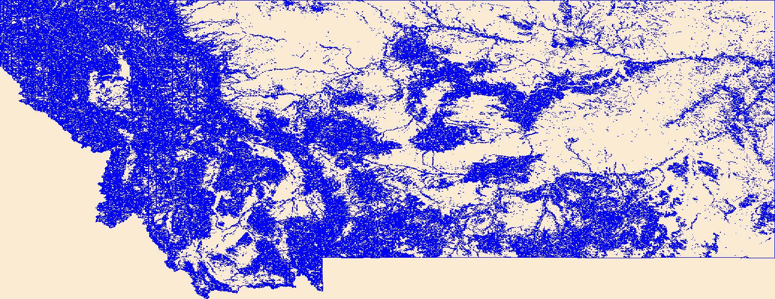
Geospatial data that is a derivative land cover product depicting woodland on topographic maps.
Tags: Agricultural land,
Barren land,
Downloadable Data,
FileGDB 10.1,
FileGDB 10.1, All tags...
Forest land,
Land Cover,
Land Cover - Woodland,
Land Cover - Woodland,
MT,
Montana,
Not Classified,
Orthoimage,
Range land,
State,
State,
US,
US,
United States,
United States,
Urban and built-up land,
Water,
Wetland,
Woodland,
annotations,
biota,
ecology,
environment,
farming,
flora,
habitat,
imagery,
imageryBaseMapsEarthCover,
land cover, Fewer tags
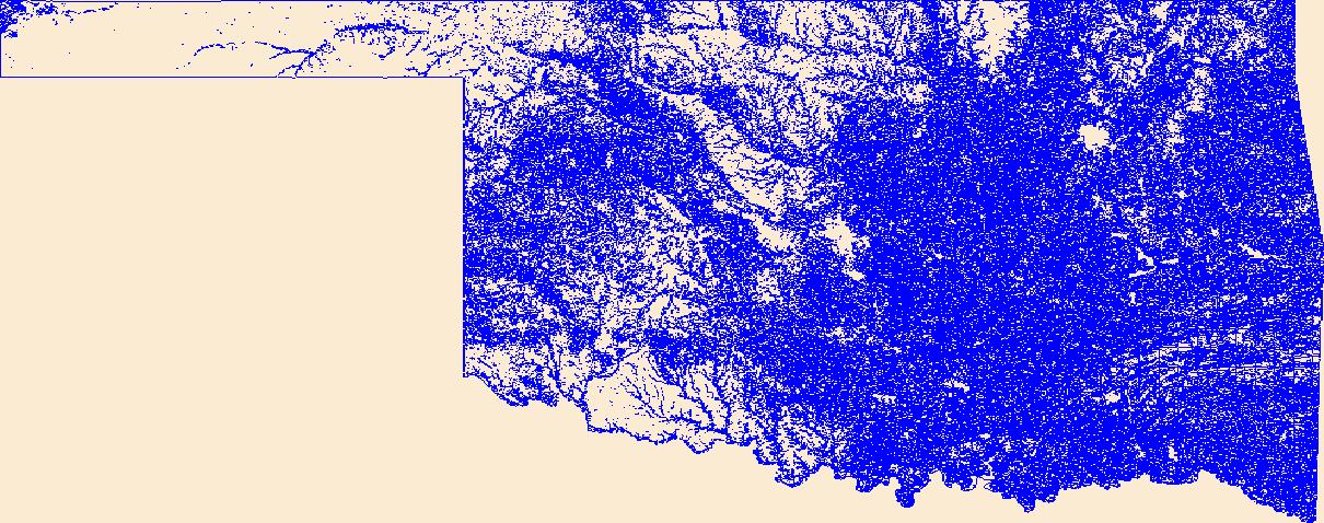
Geospatial data that is a derivative land cover product depicting woodland on topographic maps.
Tags: Agricultural land,
Barren land,
Downloadable Data,
Forest land,
Land Cover, All tags...
Land Cover - Woodland,
Land Cover - Woodland,
Not Classified,
OK,
Oklahoma,
Orthoimage,
Range land,
Shapefile,
Shapefile,
State,
State,
US,
US,
United States,
United States,
Urban and built-up land,
Water,
Wetland,
Woodland,
annotations,
biota,
ecology,
environment,
farming,
flora,
habitat,
imagery,
imageryBaseMapsEarthCover,
land cover, Fewer tags
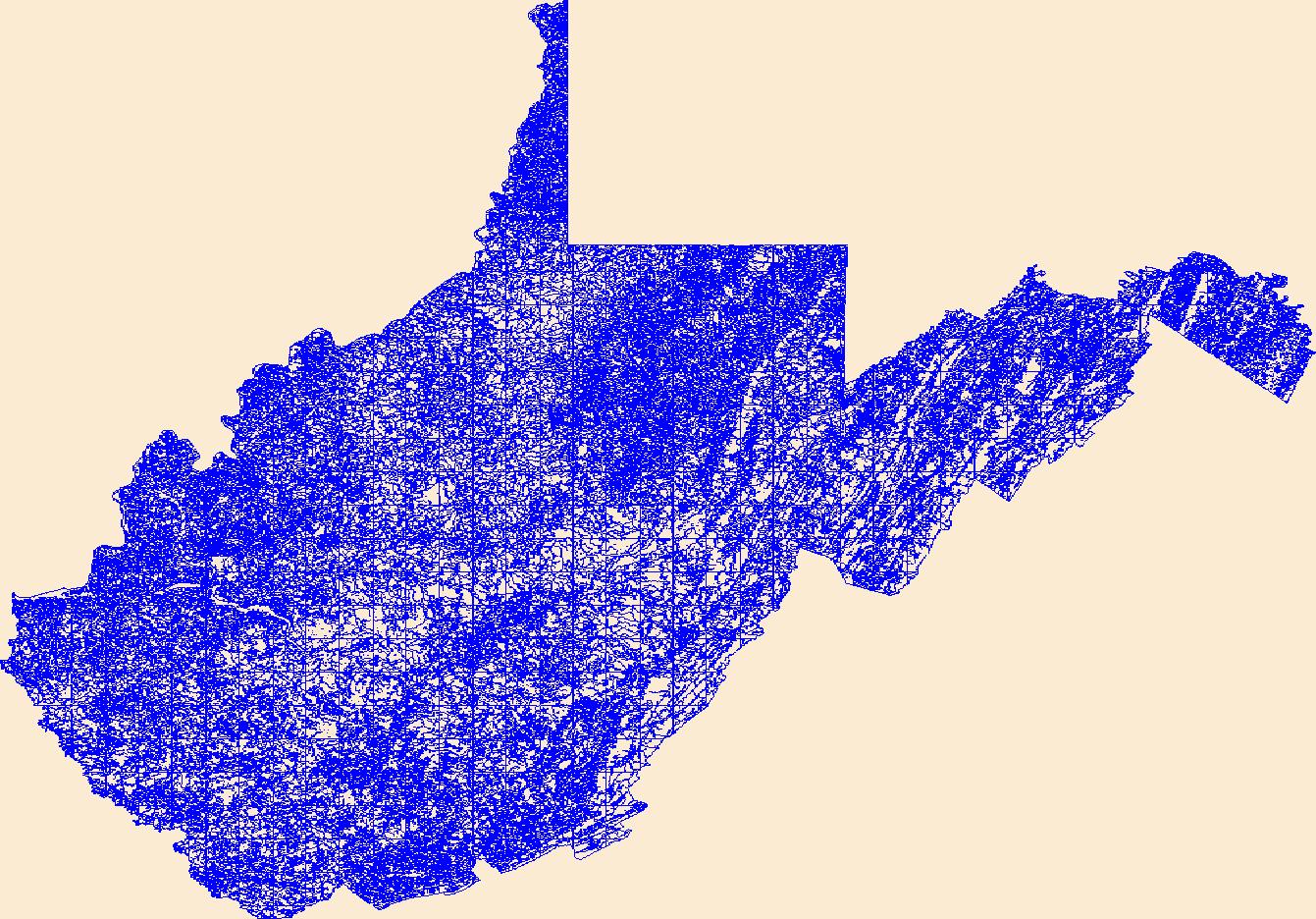
Geospatial data that is a derivative land cover product depicting woodland on topographic maps.
Tags: Agricultural land,
Barren land,
Downloadable Data,
Forest land,
Land Cover, All tags...
Land Cover - Woodland,
Land Cover - Woodland,
Not Classified,
Orthoimage,
Range land,
Shapefile,
Shapefile,
State,
State,
US,
US,
United States,
United States,
Urban and built-up land,
WV,
Water,
West Virginia,
Wetland,
Woodland,
annotations,
biota,
ecology,
environment,
farming,
flora,
habitat,
imagery,
imageryBaseMapsEarthCover,
land cover, Fewer tags
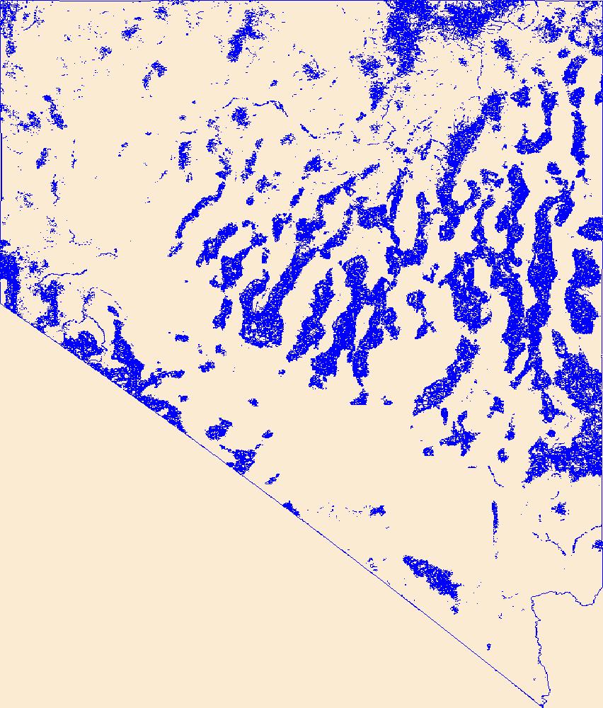
Geospatial data that is a derivative land cover product depicting woodland on topographic maps.
Tags: Agricultural land,
Barren land,
Downloadable Data,
Forest land,
Land Cover, All tags...
Land Cover - Woodland,
Land Cover - Woodland,
NV,
Nevada,
Not Classified,
Orthoimage,
Range land,
Shapefile,
Shapefile,
State,
State,
US,
US,
United States,
United States,
Urban and built-up land,
Water,
Wetland,
Woodland,
annotations,
biota,
ecology,
environment,
farming,
flora,
habitat,
imagery,
imageryBaseMapsEarthCover,
land cover, Fewer tags
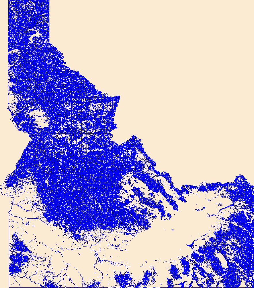
Geospatial data that is a derivative land cover product depicting woodland on topographic maps.
Tags: Agricultural land,
Barren land,
Downloadable Data,
FileGDB 10.1,
FileGDB 10.1, All tags...
Forest land,
ID,
Idaho,
Land Cover,
Land Cover - Woodland,
Land Cover - Woodland,
Not Classified,
Orthoimage,
Range land,
State,
State,
US,
US,
United States,
United States,
Urban and built-up land,
Water,
Wetland,
Woodland,
annotations,
biota,
ecology,
environment,
farming,
flora,
habitat,
imagery,
imageryBaseMapsEarthCover,
land cover, Fewer tags
|
|

