Filters: Tags: Beach Haven (X)
18 results (8ms)|
Filters
Contacts
(Less)
|
Water quality in the Barnegat Bay estuary along the New Jersey coast is the focus of a multidisciplinary research project begun in 2011 by the U.S. Geological Survey (USGS) in cooperation with the New Jersey Department of Environmental Protection. This narrow estuary is the drainage for the Barnegat Bay watershed and flushed by just three inlets connecting it to the Atlantic Ocean, is experiencing degraded water quality, algal blooms, loss of seagrass, and increases in oxygen-depletion events. The scale of the estuary and the scope of the problems within it required a regional approach to understand and model water circulation within the bay and adjacent ocean. A continuous elevation surface (terrain model) integrating...
The natural resiliency of the New Jersey barrier island system, and the efficacy of management efforts to reduce vulnerability, depends on the ability of the system to recover and maintain equilibrium in response to storms and persistent coastal change. This resiliency is largely dependent on the availability of sand in the beach system. In an effort to better understand the system's sand budget and processes in which this system evolves, high-resolution geophysical mapping of the sea floor in Little Egg Inlet and along the southern end of Long Beach Island near Beach Haven, New Jersey was conducted from May 31 to June 10, 2018, followed by a sea floor sampling survey conducted from October 22 to 23, 2018, as part...
Categories: Data;
Types: Downloadable,
Map Service,
OGC WFS Layer,
OGC WMS Layer,
Shapefile;
Tags: Beach Haven,
CMHRP,
Coastal and Marine Hazards and Resources Program,
EdgeTech,
Forsythe Wildlife Refuge,
The natural resiliency of the New Jersey barrier island system, and the efficacy of management efforts to reduce vulnerability, depends on the ability of the system to recover and maintain equilibrium in response to storms and persistent coastal change. This resiliency is largely dependent on the availability of sand in the beach system. In an effort to better understand the system's sand budget and processes in which this system evolves, high-resolution geophysical mapping of the sea floor in Little Egg Inlet and along the southern end of Long Beach Island near Beach Haven, New Jersey was conducted from May 31 to June 10, 2018, followed by a sea floor sampling survey conducted from October 22 to 23, 2018, as part...
Categories: Data;
Types: Downloadable,
Map Service,
OGC WFS Layer,
OGC WMS Layer,
Shapefile;
Tags: Beach Haven,
CMHRP,
Coastal and Marine Hazards and Resources Program,
DOI,
Department of the Interior,
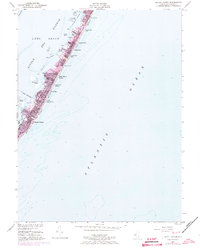
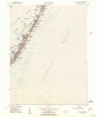
USGS Historical Quadrangle in GeoPDF.
The natural resiliency of the New Jersey barrier island system, and the efficacy of management efforts to reduce vulnerability, depends on the ability of the system to recover and maintain equilibrium in response to storms and persistent coastal change. This resiliency is largely dependent on the availability of sand in the beach system. In an effort to better understand the system's sand budget and processes in which this system evolves, high-resolution geophysical mapping of the sea floor in Little Egg Inlet and along the southern end of Long Beach Island near Beach Haven, New Jersey was conducted from May 31 to June 10, 2018, followed by a sea floor sampling survey conducted from October 22 to 23, 2018, as part...
Categories: Data;
Types: Downloadable,
GeoTIFF,
Map Service,
Raster;
Tags: Beach Haven,
CMHRP,
Coastal and Marine Hazards and Resources Program,
DOI,
Department of the Interior,
The natural resiliency of the New Jersey barrier island system, and the efficacy of management efforts to reduce vulnerability, depends on the ability of the system to recover and maintain equilibrium in response to storms and persistent coastal change. This resiliency is largely dependent on the availability of sand in the beach system. In an effort to better understand the system's sand budget and processes in which this system evolves, high-resolution geophysical mapping of the sea floor in Little Egg Inlet and along the southern end of Long Beach Island near Beach Haven, New Jersey was conducted from May 31 to June 10, 2018, followed by a sea floor sampling survey conducted from October 22 to 23, 2018, as part...
Categories: Data;
Types: Downloadable,
Map Service,
OGC WFS Layer,
OGC WMS Layer,
Shapefile;
Tags: Beach Haven,
CMHRP,
Coastal and Marine Hazards and Resources Program,
DOI,
Department of the Interior,
USGS Historical Quadrangle in GeoPDF.
The natural resiliency of the New Jersey barrier island system, and the efficacy of management efforts to reduce vulnerability, depends on the ability of the system to recover and maintain equilibrium in response to storms and persistent coastal change. This resiliency is largely dependent on the availability of sand in the beach system. In an effort to better understand the system's sand budget and processes in which this system evolves, high-resolution geophysical mapping of the sea floor in Little Egg Inlet and along the southern end of Long Beach Island near Beach Haven, New Jersey was conducted from May 31 to June 10, 2018, followed by a sea floor sampling survey conducted from October 22 to 23, 2018, as part...
Categories: Data;
Types: Downloadable,
Map Service,
OGC WFS Layer,
OGC WMS Layer,
Shapefile;
Tags: Beach Haven,
CMHRP,
CSV,
Coastal and Marine Hazards and Resources Program,
DOI,
This data set contains imagery from the National Agriculture Imagery Program (NAIP). The NAIP program is administered by USDA FSA and has been established to support two main FSA strategic goals centered on agricultural production. These are, increase stewardship of America's natural resources while enhancing the environment, and to ensure commodities are procured and distributed effectively and efficiently to increase food security. The NAIP program supports these goals by acquiring and providing ortho imagery that has been collected during the agricultural growing season in the U.S. The NAIP ortho imagery is tailored to meet FSA requirements and is a fundamental tool used to support FSA farm and conservation programs....
The natural resiliency of the New Jersey barrier island system, and the efficacy of management efforts to reduce vulnerability, depends on the ability of the system to recover and maintain equilibrium in response to storms and persistent coastal change. This resiliency is largely dependent on the availability of sand in the beach system. In an effort to better understand the system's sand budget and processes in which this system evolves, high-resolution geophysical mapping of the sea floor in Little Egg Inlet and along the southern end of Long Beach Island near Beach Haven, New Jersey was conducted from May 31 to June 10, 2018, followed by a sea floor sampling survey conducted from October 22 to 23, 2018, as part...
The natural resiliency of the New Jersey barrier island system, and the efficacy of management efforts to reduce vulnerability, depends on the ability of the system to recover and maintain equilibrium in response to storms and persistent coastal change. This resiliency is largely dependent on the availability of sand in the beach system. In an effort to better understand the system's sand budget and processes in which this system evolves, high-resolution geophysical mapping of the sea floor in Little Egg Inlet and along the southern end of Long Beach Island near Beach Haven, New Jersey was conducted from May 31 to June 10, 2018, followed by a sea floor sampling survey conducted from October 22 to 23, 2018, as part...
Categories: Data;
Types: Downloadable,
GeoTIFF,
Map Service,
Raster;
Tags: Beach Haven,
CMHRP,
Coastal and Marine Hazards and Resources Program,
DOI,
Department of the Interior,
The natural resiliency of the New Jersey barrier island system, and the efficacy of management efforts to reduce vulnerability, depends on the ability of the system to recover and maintain equilibrium in response to storms and persistent coastal change. This resiliency is largely dependent on the availability of sand in the beach system. In an effort to better understand the system's sand budget and processes in which this system evolves, high-resolution geophysical mapping of the sea floor in Little Egg Inlet and along the southern end of Long Beach Island near Beach Haven, New Jersey was conducted from May 31 to June 10, 2018, followed by a sea floor sampling survey conducted from October 22 to 23, 2018, as part...
Water quality in the Barnegat Bay estuary along the New Jersey coast is the focus of a multidisciplinary research project begun in 2011 by the U.S. Geological Survey (USGS) in cooperation with the New Jersey Department of Environmental Protection. This narrow estuary is the drainage for the Barnegat Bay watershed and flushed by just three inlets connecting it to the Atlantic Ocean, is experiencing degraded water quality, algal blooms, loss of seagrass, and increases in oxygen-depletion events. The scale of the estuary and the scope of the problems within it required a regional approach to understand and model water circulation within the bay and adjacent ocean. A continuous elevation surface (terrain model) integrating...
Types: Map Service,
OGC WFS Layer,
OGC WMS Layer,
OGC WMS Service;
Tags: Barnegat Bay,
Barnegat Inlet,
Bathymetry,
Beach Haven,
EAARL-B,
This data set contains imagery from the National Agriculture Imagery Program (NAIP). The NAIP program is administered by USDA FSA and has been established to support two main FSA strategic goals centered on agricultural production. These are, increase stewardship of America's natural resources while enhancing the environment, and to ensure commodities are procured and distributed effectively and efficiently to increase food security. The NAIP program supports these goals by acquiring and providing ortho imagery that has been collected during the agricultural growing season in the U.S. The NAIP ortho imagery is tailored to meet FSA requirements and is a fundamental tool used to support FSA farm and conservation programs....
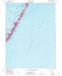
USGS Historical Quadrangle in GeoPDF.
Water quality in the Barnegat Bay estuary along the New Jersey coast is the focus of a multidisciplinary research project begun in 2011 by the U.S. Geological Survey (USGS) in cooperation with the New Jersey Department of Environmental Protection. This narrow estuary is the drainage for the Barnegat Bay watershed and flushed by just three inlets connecting it to the Atlantic Ocean, is experiencing degraded water quality, algal blooms, loss of seagrass, and increases in oxygen-depletion events. The scale of the estuary and the scope of the problems within it required a regional approach to understand and model water circulation within the bay and adjacent ocean. A continuous elevation surface (terrain model) integrating...
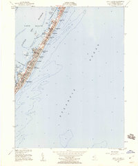
USGS Historical Quadrangle in GeoPDF.
The natural resiliency of the New Jersey barrier island system, and the efficacy of management efforts to reduce vulnerability, depends on the ability of the system to recover and maintain equilibrium in response to storms and persistent coastal change. This resiliency is largely dependent on the availability of sand in the beach system. In an effort to better understand the system's sand budget and processes in which this system evolves, high-resolution geophysical mapping of the sea floor in Little Egg Inlet and along the southern end of Long Beach Island near Beach Haven, New Jersey was conducted from May 31 to June 10, 2018, followed by a sea floor sampling survey conducted from October 22 to 23, 2018, as part...
Categories: Data;
Types: Downloadable,
Map Service,
OGC WFS Layer,
OGC WMS Layer,
Shapefile;
Tags: Beach Haven,
CMHRP,
Coastal and Marine Hazards and Resources Program,
DOI,
Department of the Interior,
|

|
