Filters
Date Range
Types
Contacts
Tag Types
Tag Schemes
|

The shapefile associated with this metadata file represents the spatial distribution of mean annual water-budget components, in inches, for Hawaii Island, Hawaii. The water-budget components in the shapefile were computed by a water-budget model for a scenario representative of predevelopment conditions (1916-83 rainfall and 1870 land cover), as described in USGS Scientific Investigations Report (SIR) 2015-5164. The model was developed for estimating groundwater recharge and other water-budget components for each subarea of the model. The model-subarea data set, consisting of 467,805 subareas (polygons), was generated using Esri ArcGIS software by intersecting (merging) multiple spatial data sets. Spatial datasets...
Tags: Big Island,
Groundwater Resources Program,
Hawaii,
Hawaii Volcanic Rock Aquifer Study,
NSDI, All tags...
Pacific islands,
USGS Science Data Catalog (SDC),
canopy evaporation,
evapotranspiration,
groundwater recharge,
inlandWaters,
inlandWaters,
irrigation,
rainfall,
runoff,
soil-water balance,
water-budget model, Fewer tags
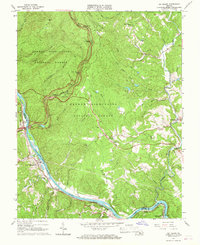
USGS Historical Quadrangle in GeoPDF.
Tags: 7.5 x 7.5 minute,
Big Island,
Downloadable Data,
GeoPDF,
GeoTIFF, All tags...
Historical Topographic Maps,
Historical Topographic Maps 7.5 x 7.5 Minute Map Series,
Map,
VA,
imageryBaseMapsEarthCover, Fewer tags

The US Geological Survey, in cooperation with the National Park Service, mapped 35 7.5-minute quadrangles, within a 2-mile-wide+ corridor centered on the Parkway, from BLRI (Blue Ridge Parkway) Mile Post (MP) 0 near Afton, Virginia southward to MP 218 at Cumberland Knob, approximately 1.3 km south of the Virginia – North Carolina State Line. Detailed bedrock geologic mapping for this project was conducted at 1:24,000-scale by systematically traversing roads, trails, creeks, and ridges within and adjacent to the 2-mile-wide+ corridor along the 216.9-mile length of the BLRI in Virginia. Geologic data at more than 23,000 station points were collected during this project (September 2009 – February 2014), with approximately...
Types: Citation,
Map Service,
OGC WFS Layer,
OGC WMS Layer,
OGC WMS Service;
Tags: Adney Gap,
Air Bellows Gap,
Alligator Back Formation,
Antietam Formation,
Ashe Formation, All tags...
Ashville,
Bald Mountain,
Balsam Gap,
Beacon Heights,
Bear Den,
Bear Mountain Gap,
Bearwallow Gap,
Bedrock,
Beech Gap,
Beetree Gap,
Benge Gap,
Big Island,
Big Witch Gap,
Biltmore Estate,
Blackhorse Gap,
Blowing Rock,
Blue Ridge Music Center Visitor Center,
Blue Ridge Park Visitor Center and Park Headquarters,
Blue Ridge Parkway,
Bluff Mountain,
Bottom Creek Metagranitoid Suite,
Buck Creek Gap,
Buena Vista,
Bull Gap,
Carbonate,
Cherokee,
Cherokee Indian Reservation,
Chestoa View,
Chilhowee Group,
Cold Mountain,
Conococheague Formation,
Crabtree Falls,
Crabtree Faults,
Craggy Gardens Visitor Center,
Craven Gap,
Crossnore,
Crossnore Plutonic Suite,
Cumberland Knob,
Daniel Boone's Trace,
Deep Gap,
Devils Backbone Overlook,
Devils Courthouse,
Diabase,
Doughton Park,
E.B. Jeffress Park,
Elbrook Formation,
Elk Pasture Gap,
Ervin,
Ervin,
Fallingwater Cascades,
Fancy Gap,
Flat Rock,
Folds,
Formation,
Fox Hunters Paradise,
Geology,
George Washington National Forest,
Gillespie Gap,
Glendale Springs,
Gneiss,
Graggy Dome,
Grandfather Mountain,
Grandfather Mountain State Park,
Granite,
Graveyard Fields,
Great Valley Overlook,
Green Knob,
Greenstone Trail,
Groundhog Mountain,
Hampton Formation,
Harpers Formation,
Hawksbill Mountain,
Hominy Creek,
Humpback Mountain,
Humpback Rocks Visitor Center,
Indian Gap,
Irish Gap,
James River,
James River Visitor Center and Canal,
Jefferson National Forest,
Julian Price Memorial Park,
Jumpinoff Rock,
Lake Powhaten,
Laurel Springs,
Lineville River,
Linville,
Linville Falls,
Linville Falls Visitor Center,
Little Switzerland,
Looking Glass Rock Overlook,
Lynchburg Group,
Mabry Hill,
Martinsburg Formation,
McKinney Gap,
Meadows of Dan,
Mesoproterozoic gneisses of the Fries Thrust Sheet,
Metabasalt,
Metagranitoid,
Moses H. Cone Memorial Park and Visitor Center,
Mount Jefferson State Park,
Mount Mitchell,
Mount Mitchell State Park,
Mount Pisgah,
Museum of North Carolina Minerals Visitor Center,
N&W Railroad Overlook,
Nantahala National Forest,
Normal Fault,
North Carolina,
North Carolina Arboretum,
Northwest Trading Post,
Oconalufte Visitor Center,
Onion Mountain Overlook,
Orchard Gap,
Oteen,
Otter Creek,
Overmountain Victory Nation Historic Trail,
Peach Bottom Mountain,
Peaks of Otter Metagranitoid,
Peaks of Otter Visitor Center,
Petites Gap,
Pilot Gneiss,
Pineola,
Pipers Gap,
Pisgah National Forest,
Poor Mountain,
Powell Gap,
Price Lake,
Puckett Cabin,
Purgatory Overlook,
Rakes Millpond,
Ravens Roost,
Reverse Fault,
Richland Balsam,
Roanoke Mountain,
Roanoke River,
Roanoke River Gorge,
Roanoke Valley Overlook,
Rocky Knob,
Rocky Knob Visitor Center,
Sandy Creek Gneiss,
Shady Dolomite,
Sharp Top,
Sherando Lake,
Skyland,
Southern End,
Staunton River,
Stone Mountain State Park,
Structure,
Sugarloaf Mountain,
Swannanoa River,
Swift Run Formation,
Table Rock Mountain,
Terrapin Mountain,
The Lump,
The Saddle,
Thrust Fault,
Tunnel Gap,
Twenty Minute Cliff,
Tye River,
Tye River Gap,
USGS Science Data Catalog (SDC),
Unicoi Formation,
Virginia,
Virginia Explore Park and Visitor Center,
Volunteer Gap,
Wagon Road Gap,
Watauga River,
Waterrock Knob Visitor Center,
Wayneboro Formation,
Waynesboro,
Wayneville,
Weverton Formation,
Whites Gap Overlook,
Wigwarm Falls,
Woodlaw,
Wrights Creek,
Yankee Horse Ridge,
Z.B. Vance Birthplace, Fewer tags
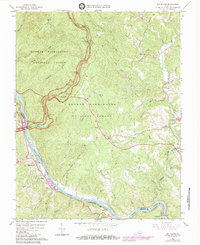
USGS Historical Quadrangle in GeoPDF.
Tags: 7.5 x 7.5 minute,
Big Island,
Downloadable Data,
GeoPDF,
GeoTIFF, All tags...
Historical Topographic Maps,
Historical Topographic Maps 7.5 x 7.5 Minute Map Series,
Map,
VA,
imageryBaseMapsEarthCover, Fewer tags

The US Geological Survey, in cooperation with the National Park Service, mapped 35 7.5-minute quadrangles, within a 2-mile-wide+ corridor centered on the Parkway, from BLRI (Blue Ridge Parkway) Mile Post (MP) 0 near Afton, Virginia southward to MP 218 at Cumberland Knob, approximately 1.3 km south of the Virginia – North Carolina State Line. Detailed bedrock geologic mapping for this project was conducted at 1:24,000-scale by systematically traversing roads, trails, creeks, and ridges within and adjacent to the 2-mile-wide+ corridor along the 216.9-mile length of the BLRI in Virginia. Geologic data at more than 23,000 station points were collected during this project (September 2009 – February 2014), with approximately...
Types: Citation;
Tags: Adney Gap,
Air Bellows Gap,
Alligator Back Formation,
Antietam Formation,
Ashe Formation, All tags...
Ashville,
Bald Mountain,
Balsam Gap,
Beacon Heights,
Bear Den,
Bear Mountain Gap,
Bearwallow Gap,
Bedrock,
Beech Gap,
Beetree Gap,
Benge Gap,
Big Island,
Big Witch Gap,
Biltmore Estate,
Blackhorse Gap,
Blowing Rock,
Blue Ridge Music Center Visitor Center,
Blue Ridge Park Visitor Center and Park Headquarters,
Blue Ridge Parkway,
Bluff Mountain,
Bottom Creek Metagranitoid Suite,
Buck Creek Gap,
Buena Vista,
Bull Gap,
Carbonate,
Cherokee,
Cherokee Indian Reservation,
Chestoa View,
Chilhowee Group,
Cold Mountain,
Conococheague Formation,
Crabtree Falls,
Crabtree Faults,
Craggy Gardens Visitor Center,
Craven Gap,
Crossnore,
Crossnore Plutonic Suite,
Cumberland Knob,
Daniel Boone's Trace,
Deep Gap,
Devils Backbone Overlook,
Devils Courthouse,
Diabase,
Doughton Park,
E.B. Jeffress Park,
Elbrook Formation,
Elk Pasture Gap,
Ervin,
Ervin,
Fallingwater Cascades,
Fancy Gap,
Flat Rock,
Folds,
Formation,
Fox Hunters Paradise,
Geology,
George Washington National Forest,
Gillespie Gap,
Glendale Springs,
Gneiss,
Graggy Dome,
Grandfather Mountain,
Grandfather Mountain State Park,
Granite,
Graveyard Fields,
Great Valley Overlook,
Green Knob,
Greenstone Trail,
Groundhog Mountain,
Hampton Formation,
Harpers Formation,
Hawksbill Mountain,
Hominy Creek,
Humpback Mountain,
Humpback Rocks Visitor Center,
Indian Gap,
Irish Gap,
James River,
James River Visitor Center and Canal,
Jefferson National Forest,
Julian Price Memorial Park,
Jumpinoff Rock,
Lake Powhaten,
Laurel Springs,
Lineville River,
Linville,
Linville Falls,
Linville Falls Visitor Center,
Little Switzerland,
Looking Glass Rock Overlook,
Lynchburg Group,
Mabry Hill,
Martinsburg Formation,
McKinney Gap,
Meadows of Dan,
Mesoproterozoic gneisses of the Fries Thrust Sheet,
Metabasalt,
Metagranitoid,
Moses H. Cone Memorial Park and Visitor Center,
Mount Jefferson State Park,
Mount Mitchell,
Mount Mitchell State Park,
Mount Pisgah,
Museum of North Carolina Minerals Visitor Center,
N&W Railroad Overlook,
Nantahala National Forest,
Normal Fault,
North Carolina,
North Carolina Arboretum,
Northwest Trading Post,
Oconalufte Visitor Center,
Onion Mountain Overlook,
Orchard Gap,
Oteen,
Otter Creek,
Overmountain Victory Nation Historic Trail,
Peach Bottom Mountain,
Peaks of Otter Metagranitoid,
Peaks of Otter Visitor Center,
Petites Gap,
Pilot Gneiss,
Pineola,
Pipers Gap,
Pisgah National Forest,
Poor Mountain,
Powell Gap,
Price Lake,
Puckett Cabin,
Purgatory Overlook,
Rakes Millpond,
Ravens Roost,
Reverse Fault,
Richland Balsam,
Roanoke Mountain,
Roanoke River,
Roanoke River Gorge,
Roanoke Valley Overlook,
Rocky Knob,
Rocky Knob Visitor Center,
Sandy Creek Gneiss,
Shady Dolomite,
Sharp Top,
Sherando Lake,
Skyland,
Southern End,
Staunton River,
Stone Mountain State Park,
Structure,
Sugarloaf Mountain,
Swannanoa River,
Swift Run Formation,
Table Rock Mountain,
Terrapin Mountain,
The Lump,
The Saddle,
Thrust Fault,
Tunnel Gap,
Twenty Minute Cliff,
Tye River,
Tye River Gap,
Unicoi Formation,
Virginia,
Virginia Explore Park and Visitor Center,
Volunteer Gap,
Wagon Road Gap,
Watauga River,
Waterrock Knob Visitor Center,
Wayneboro Formation,
Waynesboro,
Wayneville,
Weverton Formation,
Whites Gap Overlook,
Wigwarm Falls,
Woodlaw,
Wrights Creek,
Yankee Horse Ridge,
Z.B. Vance Birthplace, Fewer tags
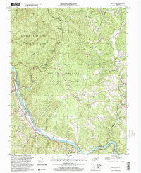
USGS Historical Quadrangle in GeoPDF.
Tags: 7.5 x 7.5 minute,
Big Island,
Downloadable Data,
GeoPDF,
GeoTIFF, All tags...
Historical Topographic Maps,
Historical Topographic Maps 7.5 x 7.5 Minute Map Series,
Map,
VA,
imageryBaseMapsEarthCover, Fewer tags
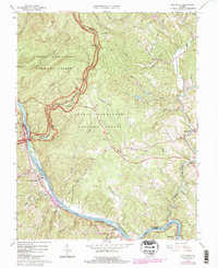
USGS Historical Quadrangle in GeoPDF.
Tags: 7.5 x 7.5 minute,
Big Island,
Downloadable Data,
GeoPDF,
GeoTIFF, All tags...
Historical Topographic Maps,
Historical Topographic Maps 7.5 x 7.5 Minute Map Series,
Map,
VA,
imageryBaseMapsEarthCover, Fewer tags
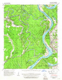
USGS Historical Quadrangle in GeoPDF.
Tags: 15 x 15 minute,
AR,
Big Island,
Downloadable Data,
GeoPDF, All tags...
GeoTIFF,
Historical Topographic Maps,
Historical Topographic Maps 15 x 15 Minute Map Series,
Map,
imageryBaseMapsEarthCover, Fewer tags
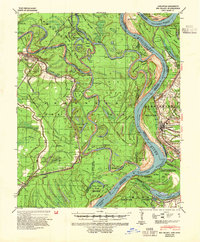
USGS Historical Quadrangle in GeoPDF.
Tags: 15 x 15 minute,
AR,
Big Island,
Downloadable Data,
GeoPDF, All tags...
GeoTIFF,
Historical Topographic Maps,
Historical Topographic Maps 15 x 15 Minute Map Series,
Map,
imageryBaseMapsEarthCover, Fewer tags

The shapefile associated with this metadata file represents the spatial distribution of mean annual water-budget components, in inches, for Hawaii Island, Hawaii. The water-budget components in the shapefile were computed by a water-budget model for a scenario representative of recent conditions (1916-83 rainfall and 2008 land cover), as described in USGS Scientific Investigations Report (SIR) 2011-5078 and summarized in USGS SIR 2015-5164. The model was developed for estimating groundwater recharge and other water-budget components for each subarea of the model. The model-subarea dataset, consisting of 467,805 subareas (polygons), was generated using Esri ArcGIS software by intersecting (merging) multiple spatial...
Tags: Big Island,
Groundwater Resources Program,
Hawaii,
Hawaii Volcanic Rock Aquifer Study,
NSDI, All tags...
Pacific islands,
USGS Science Data Catalog (SDC),
canopy evaporation,
evapotranspiration,
groundwater recharge,
inlandWaters,
inlandWaters,
irrigation,
rainfall,
runoff,
soil-water balance,
water-budget model, Fewer tags
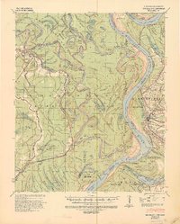
USGS Historical Quadrangle in GeoPDF.
Tags: 15 x 15 minute,
AR,
Big Island,
Downloadable Data,
GeoPDF, All tags...
GeoTIFF,
Historical Topographic Maps,
Historical Topographic Maps 15 x 15 Minute Map Series,
Map,
imageryBaseMapsEarthCover, Fewer tags
|
|

