Filters: Tags: Bonanza (X)
214 results (67ms)|
Filters
Date Range
Extensions (Less) Types (Less)
Contacts (Less)
Categories (Less) Tag Types
|
An adit at the Octave mine with a wooden and stone entrance and two sets of rail tracks.
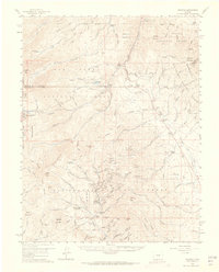
ADMMR map collection: Bonanza Section N 497; 1 in. to 40 feet; 13 x 15 in.
ADMMR map collection: Bonanza Mine 325 Level; 1 in. to 40 feet; 11 x 18 in.
This location is part of the Arizona Mineral Industry Location System (AzMILS), an inventory of mineral occurences, prospects and mine locations in Arizona. Yavapai81 is located in T13N R8W Sec 9 N2 in the Malpais Mesa Ne - 7.5 Min quad. This collection consists of various reports, maps, records and related materials acquired by the Arizona Department of Mines and Mineral Resources regarding mining properties in Arizona. Information was obtained by various means, including the property owners, exploration companies, consultants, verbal interviews, field visits, newspapers and publications. Some sections may be redacted for copyright. Please see the access statement.
This data set contains imagery from the National Agriculture Imagery Program (NAIP). The NAIP program is administered by USDA FSA and has been established to support two main FSA strategic goals centered on agricultural production. These are, increase stewardship of America's natural resources while enhancing the environment, and to ensure commodities are procured and distributed effectively and efficiently to increase food security. The NAIP program supports these goals by acquiring and providing ortho imagery that has been collected during the agricultural growing season in the U.S. The NAIP ortho imagery is tailored to meet FSA requirements and is a fundamental tool used to support FSA farm and conservation programs....
ADMMR map collection: Bonanza Mine 535 Level; 1 in. to 40 feet; 29 x 15 in.
ADMMR map collection: SKML 100 INT.; 1 in. to 40 feet; 8 x 11 in.
ADMMR map collection: Bonanza 215 Int.; 1 in. to 40 feet; 8 x 11 in.
ADMMR map collection: Bonanza Section N585; 1 in. to 40 feet; 15 x 22 in.
ADMMR map collection: Topographic Map of Coyote Mountains for Consolidated Red Poplar Minerals, Ltd, Sheet 8; 1 in. to 100 feet; 32 x 33 in.
Heinrichs Geoexploration Co. Maps: Harquahala, I.P. Traverse Line No. Open Pit Special; 1 in. to 100 feet; 25 x 21 in.
Heinrichs Geoexploration Co. Maps: Harquahala, I.P. Traverse Line No. A Sheet 1 and 2; 1 in. to 400 feet; 32 x 21 in.
ADMMR map collection: Bonanza Mine Section N12E Section Map; 1 in. to 40 feet; 32 x 22 in.
ADMMR map collection: Bonanza Mine 235 Level; 1 in. to 40 feet; 13 x 14 in.
ADMMR map collection: Octave Mine Plan of Workings; 1 in. to 100 feet; 42 x 28 in.
ADMMR map collection: Bonanza Section Thru Diamond Drill Hole 280; 8 x 11 in.
Heinrichs Geoexploration Co. Maps: Harquahala, I.P. Traverse Line No. E Sheet 1 and 2; 1 in. to 400 feet; 32 x 21 in.
This part of the Data Release contains the raster representation of the water-level altitude and water-level change maps developed every 5 years from 1980-2015 for the upper Rio Grande Focus Area Study. The input point data used to generate the water-level altitude maps can be found in the "Groundwater level measurement data used to develop water-level altitude maps in the upper Rio Grande Alluvial Basins" child item of this data release. These digital data accompany Houston, N.A., Thomas, J.V., Foster, L.K., Pedraza, D.E., and Welborn, T.L., 2020, Hydrogeologic framework, groundwater-level altitudes, groundwater-level changes, and groundwater-storage changes in selected alluvial basins of the upper Rio Grande...
Types: Map Service,
OGC WFS Layer,
OGC WMS Layer,
OGC WMS Service;
Tags: Abiquiu Reservoir,
Ahumada,
Alamosa,
Alamosa County,
Alamosa Creek,
USGS Historical Quadrangle in GeoPDF.
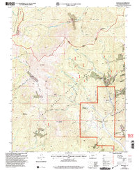
USGS Historical Quadrangle in GeoPDF.
|

|
