Filters
Date Range
Contacts
Tag Types
Tag Schemes
|

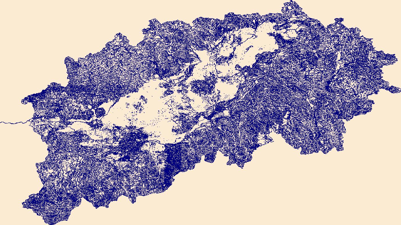
The High Resolution National Hydrography Dataset Plus (NHDPlus HR) is an integrated set of geospatial data layers, including the National Hydrography Dataset (NHD), National Watershed Boundary Dataset (WBD), and 3D Elevation Program Digital Elevation Model (3DEP DEM). The NHDPlus HR combines the NHD, 3DEP DEMs, and WBD to a data suite that includes the NHD stream network with linear referencing functionality, the WBD hydrologic units, elevation-derived catchment areas for each stream segment, "value added attributes" (VAAs), and other features that enhance hydrologic data analysis and routing.
Tags: Bannock County,
Bear Lake County,
Box Elder County,
Cache County,
Caribou County, All tags...
Downloadable Data,
Duchesne County,
Esri File GeoDatabase 10,
FileGDB,
Franklin County,
HU-4,
HU-4 Subregion,
HU4_1601,
Hydrography,
ID,
Idaho,
Lincoln County,
Morgan County,
NHDPlus HR Rasters,
NHDPlus High Resolution (NHDPlus HR),
National Hydrography Dataset (NHD),
National Hydrography Dataset Plus High Resolution (NHDPlus HR),
National Hydrography Dataset Plus High Resolution (NHDPlus HR) Current,
Oneida County,
Power County,
Rich County,
Summit County,
US,
UT,
Uinta County,
United States,
Utah,
WY,
Weber County,
Wyoming,
base maps,
cartography,
catchments,
channels,
digital elevation models,
drainage basins,
earthsciences,
environment,
geographic information systems,
geoscientificInformation,
geospatial analysis,
hydrographic datasets,
hydrographic features,
hydrology,
inlandWaters,
lakes,
land surface characteristics,
reservoirs,
river reaches,
rivers,
streamflow,
streamflow data,
streams,
surface water quality,
topography,
water resources,
waterbodies,
watersheds, Fewer tags
The High Resolution National Hydrography Dataset Plus (NHDPlus HR) is an integrated set of geospatial data layers, including the best available National Hydrography Dataset (NHD), the 10-meter 3D Elevation Program Digital Elevation Model (3DEP DEM), and the National Watershed Boundary Dataset (WBD). The NHDPlus HR combines the NHD, 3DEP DEMs, and WBD to create a stream network with linear referencing, feature naming, "value added attributes" (VAAs), elevation-derived catchments, and other features for hydrologic data analysis. The stream network with linear referencing is a system of data relationships applied to hydrographic systems so that one stream reach "flows" into another and "events" can be tied to and traced...
Tags: Bannock County,
Bear Lake County,
Beaverhead County,
Bingham County,
Blaine County, All tags...
Bonneville County,
Box Elder County,
Butte County,
Camas County,
Caribou County,
Cassia County,
Clark County,
Custer County,
Downloadable Data,
Elko County,
Elmore County,
FileGDB,
FileGDB 10.1,
Franklin County,
Fremont County,
Fremont County,
Gallatin County,
Gooding County,
HU-4 Subregion,
HU-4 Subregion,
HU4_1704,
Hydrography,
ID,
Idaho,
Jefferson County,
Jerome County,
Lemhi County,
Lincoln County,
Lincoln County,
MT,
Madison County,
Madison County,
Minidoka County,
Montana,
NHDPlus HR Rasters,
NHDPlus High Resolution (NHDPlus HR),
NV,
National Hydrography Dataset (NHD),
National Hydrography Dataset Plus High Resolution (NHDPlus HR),
National Hydrography Dataset Plus High Resolution (NHDPlus HR) Current,
Nevada,
Oneida County,
Owyhee County,
Park County,
Power County,
Sublette County,
Teton County,
Teton County,
Twin Falls County,
US,
UT,
United States,
Utah,
WY,
Wyoming,
base maps,
cartography,
catchments,
channels,
digital elevation models,
drainage basins,
earth sciences,
elevation,
environment,
geographic information systems,
geoscientific,
geospatial analysis,
hydrographic datasets,
hydrographic features,
hydrology,
imagery,
inland waters,
lakes,
land surface characteristics,
reservoirs,
river reaches,
rivers,
streamflow,
streamflow data,
streams,
topography,
water bodies,
water quality,
water resources,
watersheds, Fewer tags

The High Resolution National Hydrography Dataset Plus (NHDPlus HR) is an integrated set of geospatial data layers, including the National Hydrography Dataset (NHD), National Watershed Boundary Dataset (WBD), and 3D Elevation Program Digital Elevation Model (3DEP DEM). The NHDPlus HR combines the NHD, 3DEP DEMs, and WBD to a data suite that includes the NHD stream network with linear referencing functionality, the WBD hydrologic units, elevation-derived catchment areas for each stream segment, "value added attributes" (VAAs), and other features that enhance hydrologic data analysis and routing.
Tags: Beaver County,
Box Elder County,
Cache County,
Carbon County,
Cassia County, All tags...
Davis County,
Downloadable Data,
Duchesne County,
Elko County,
Esri File GeoDatabase 10,
FileGDB,
HU-4,
HU-4 Subregion,
HU4_1602,
Hydrography,
ID,
Idaho,
Iron County,
Juab County,
Lincoln County,
Millard County,
Morgan County,
NHDPlus HR Rasters,
NHDPlus High Resolution (NHDPlus HR),
NV,
National Hydrography Dataset (NHD),
National Hydrography Dataset Plus High Resolution (NHDPlus HR),
National Hydrography Dataset Plus High Resolution (NHDPlus HR) Current,
Nevada,
Oneida County,
Power County,
Rich County,
Salt Lake County,
Sanpete County,
Summit County,
Tooele County,
US,
UT,
Uinta County,
United States,
Utah,
Utah County,
WY,
Wasatch County,
Weber County,
White Pine County,
Wyoming,
base maps,
cartography,
catchments,
channels,
digital elevation models,
drainage basins,
earthsciences,
environment,
geographic information systems,
geoscientificInformation,
geospatial analysis,
hydrographic datasets,
hydrographic features,
hydrology,
inlandWaters,
lakes,
land surface characteristics,
reservoirs,
river reaches,
rivers,
streamflow,
streamflow data,
streams,
surface water quality,
topography,
water resources,
waterbodies,
watersheds, Fewer tags
|
|

