Filters
Date Range
Types
Contacts
Tag Types
Tag Schemes
|
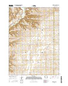
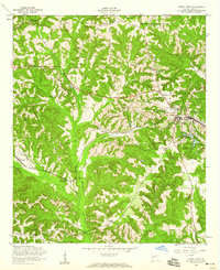
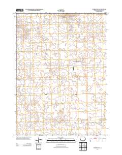
Layered GeoPDF 7.5 Minute Quadrangle Map. Layers of geospatial data include orthoimagery, roads, grids, geographic names, elevation contours, hydrography, and other selected map features.
Tags: 7.5 x 7.5 minute,
Buena Vista,
Cherokee,
Downloadable Data,
EarthCover, All tags...
GeoPDF,
Imagery and Base Maps,
Iowa,
Map,
Peterson SW, IA,
Public Land Survey System,
U.S. National Grid,
US,
US Topo,
US Topo Historical,
United States,
boundary,
contour,
geographic names,
hydrography,
imageryBaseMapsEarthCover,
orthoimage,
structures,
topographic,
transportation,
woodland, Fewer tags
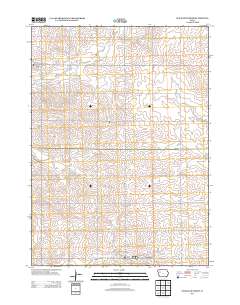
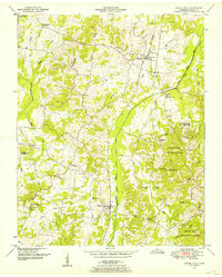
Layered GeoPDF 7.5 Minute Quadrangle Map. Layers of geospatial data include orthoimagery, roads, grids, geographic names, elevation contours, hydrography, and other selected map features.
Tags: 7.5 x 7.5 minute,
Buena Vista,
Downloadable Data,
EarthCover,
GeoPDF, All tags...
Imagery and Base Maps,
Iowa,
Map,
Public Land Survey System,
Sac,
Schaller North, IA,
U.S. National Grid,
US,
US Topo,
US Topo Historical,
United States,
boundary,
contour,
geographic names,
hydrography,
imageryBaseMapsEarthCover,
orthoimage,
structures,
topographic,
transportation,
woodland, Fewer tags
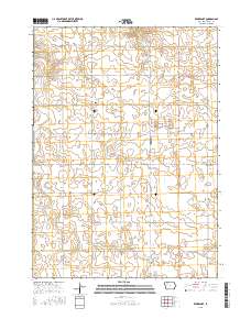
Layered GeoPDF 7.5 Minute Quadrangle Map. Layers of geospatial data include orthoimagery, roads, grids, geographic names, elevation contours, hydrography, and other selected map features.
Tags: 7.5 x 7.5 minute,
Buena Vista,
Downloadable Data,
EarthCover,
GeoPDF, All tags...
Imagery and Base Maps,
Iowa,
Map,
Public Land Survey System,
Rembrandt, IA,
U.S. National Grid,
US,
US Topo,
US Topo Historical,
United States,
boundary,
contour,
geographic names,
hydrography,
imageryBaseMapsEarthCover,
orthoimage,
structures,
topographic,
transportation,
woodland, Fewer tags

Layers of geospatial data include roads, airports, trails, and railroads.
Tags: Accomack,
Airport Complex,
Airport Point,
Airport Runway,
Airports, All tags...
Airstrips,
Albemarle,
Alexandria,
Alleghany,
Amelia,
Amherst,
Appomattox,
Arlington,
Augusta,
Bath,
Bedford,
Bland,
Botetourt,
Bristol,
Brunswick,
Buchanan,
Buckingham,
Buena Vista,
Campbell,
Caroline,
Carroll,
Charles City,
Charlotte,
Charlottesville,
Chesapeake,
Chesterfield,
Clarke,
Colonial Heights,
Covington,
Craig,
Culpeper,
Cumberland,
Danville,
Dickenson,
Dinwiddie,
Downloadable Data,
Emporia,
Essex,
Fairfax,
Falls Church,
Fauquier,
Floyd,
Fluvanna,
Franklin,
Frederick,
Fredericksburg,
Galax,
GeoPackage,
Geographic names,
Giles,
Gloucester,
Goochland,
Grayson,
Greene,
Greensville,
Halifax,
Hampton,
Hanover,
Harrisonburg,
Henrico,
Henry,
Highland,
Hopewell,
Isle of Wight,
James City,
King George,
King William,
King and Queen,
Lancaster,
Lee,
Lexington,
Loudoun,
Louisa,
Lunenburg,
Lynchburg,
Madison,
Manassas,
Manassas Park,
Martinsville,
Mathews,
Mecklenburg,
Middlesex,
Montgomery,
National Transportation Dataset (NTD),
National Transportation Dataset (NTD),
Nelson,
New Kent,
Newport News,
Norfolk,
Northampton,
Northumberland,
Norton,
Nottoway,
Open Geospatial Consortium GeoPackage 1.2,
Orange,
Page,
Patrick,
Petersburg,
Pittsylvania,
Poquoson,
Portsmouth,
Powhatan,
Prince Edward,
Prince George,
Prince William,
Pulaski,
Radford,
Railways,
Rappahannock,
Richmond,
Roads,
Roanoke,
Rockbridge,
Rockingham,
Russell,
Salem,
Scott,
Shenandoah,
Smyth,
Southampton,
Spotsylvania,
Stafford,
State,
State,
Staunton,
Suffolk,
Surry,
Sussex,
Tazewell,
Trail,
Trails,
Transportation,
Transportation,
US,
United States,
VA,
Virginia,
Virginia Beach,
Warren,
Washington,
Waterway,
Waynesboro,
Westmoreland,
Williamsburg,
Winchester,
Wise,
Wythe,
York,
transportation, Fewer tags
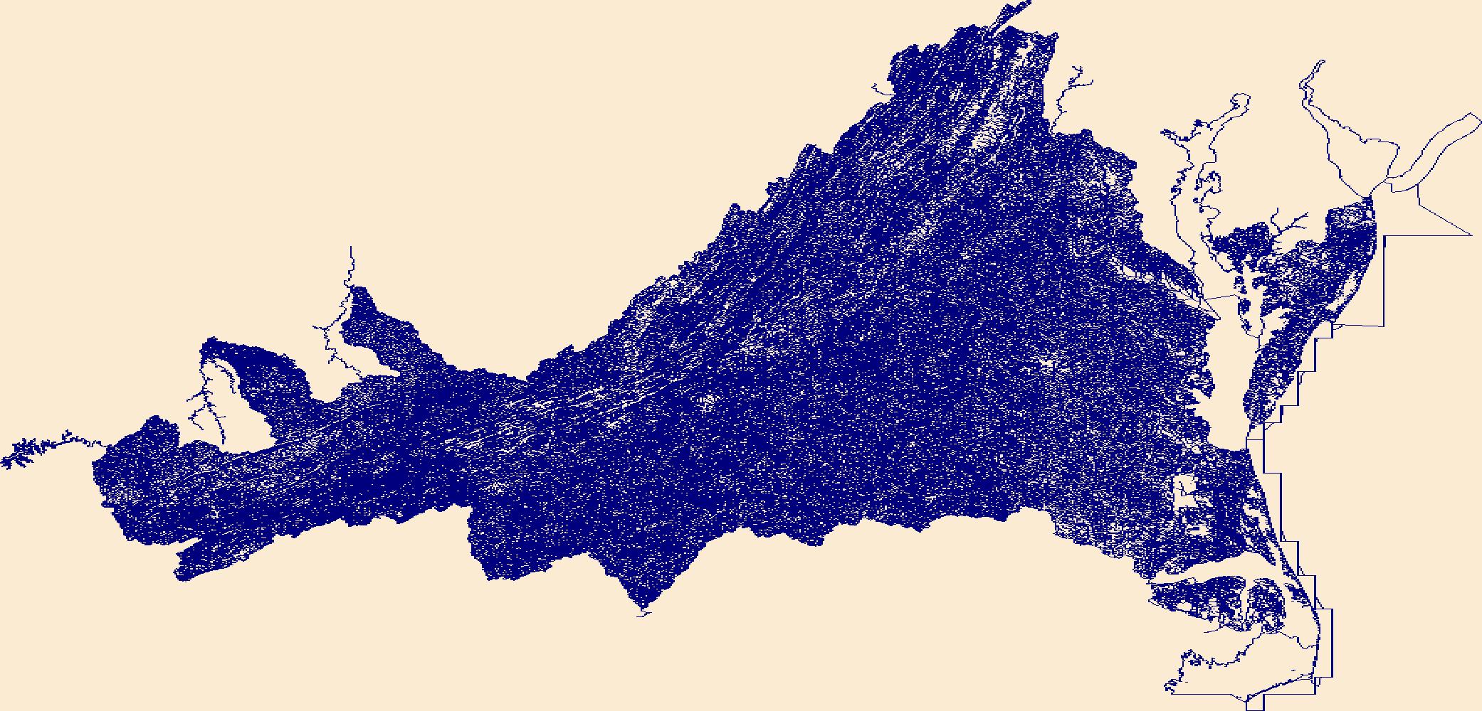
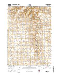
The National Hydrography Dataset (NHD) is a feature-based database that interconnects and uniquely identifies the stream segments or reaches that make up the nation's surface water drainage system. NHD data was originally developed at 1:100,000-scale and exists at that scale for the whole country. This high-resolution NHD, generally developed at 1:24,000/1:12,000 scale, adds detail to the original 1:100,000-scale NHD. (Data for Alaska, Puerto Rico and the Virgin Islands was developed at high-resolution, not 1:100,000 scale.) Local resolution NHD is being developed where partners and data exist. The NHD contains reach codes for networked features, flow direction, names, and centerline representations for areal water...
Tags: Accomack,
Administrative watershed units,
Administrative watershed units,
Albemarle,
Alexandria, All tags...
Alleghany,
Amelia,
Amherst,
Appomattox,
Area of Complex Channels,
Area to be submerged,
Arlington,
Augusta,
Basin,
Basin,
Bath,
Bay/Inlet,
Bedford,
Bland,
Botetourt,
Boundaries,
Boundary,
Bridge,
Bristol,
Brunswick,
Buchanan,
Buckingham,
Buena Vista,
Campbell,
Canal/Ditch,
Caroline,
Carroll,
Charles City,
Charlotte,
Charlottesville,
Chesapeake,
Chesterfield,
Clarke,
Coastline,
Colonial Heights,
Connector,
Covington,
Craig,
Culpeper,
Cumberland,
Dam/Weir,
Danville,
Dickenson,
Dinwiddie,
Downloadable Data,
Drainage areas for surface water,
Drainageway,
Emporia,
Esri Shapefile nan,
Essex,
Estuary,
Fairfax,
Falls Church,
Fauquier,
Flow direction network,
Floyd,
Flume,
Fluvanna,
ForeShore,
Franklin,
Frederick,
Fredericksburg,
Gaging Station,
Galax,
Gate,
Giles,
Gloucester,
Goochland,
Grayson,
Greene,
Greensville,
HU10,
HU12,
HU14,
HU16,
HU2,
HU4,
HU6,
HU8,
HUC,
Halifax,
Hampton,
Hanover,
Harrisonburg,
Hazard Zone,
Henrico,
Henry,
Highland,
Hopewell,
Hydrographic,
Hydrography,
Hydrography,
Hydrography,
Hydrologic Unit Code,
Hydrologic Units,
Ice mass,
Inundation Area,
Isle of Wight,
James City,
King George,
King William,
King and Queen,
Lancaster,
Lee,
Levee,
Lexington,
Line,
Lock Chamber,
Loudoun,
Louisa,
Lunenburg,
Lynchburg,
Madison,
Manassas,
Manassas Park,
Marsh,
Martinsville,
Mathews,
Mecklenburg,
Middlesex,
Montgomery,
National Hydrography Dataset (NHD),
National Hydrography Dataset (NHD) Best Resolution,
National Hydrography Dataset (NHD) Best Resolution,
Nelson,
New Kent,
Newport News,
Nonearthen Shore,
Norfolk,
Northampton,
Northumberland,
Norton,
Nottoway,
Orange,
Orthoimage,
Page,
Patrick,
Petersburg,
Pittsylvania,
Playa,
Point,
PointEvent,
Pond,
Poquoson,
Portsmouth,
Powhatan,
Prince Edward,
Prince George,
Prince William,
Pulaski,
Radford,
Rapids,
Rapids,
Rappahannock,
Reach,
Reach code,
Reef,
Region,
Reservoir,
Richmond,
Roanoke,
Rock,
Rockbridge,
Rockingham,
Russell,
Salem,
Scott,
Sea/Ocean,
Shapefile,
Shenandoah,
Sink/Rise,
Smyth,
Sounding Datum Line,
Southampton,
Special Use Zone,
Special Use Zone Limit,
Spillway,
Spotsylvania,
Stafford,
State,
State,
State_Virginia,
Staunton,
Stream,
Stream/River,
Sub-basin,
Sub-region,
Subbasin,
Submerged Stream,
Subregion,
Subwatershed,
Suffolk,
Surface water systems,
Surry,
Sussex,
Swamp,
Tazewell,
Topographic,
Tunnel,
US,
Underground Conduit,
United States,
VA,
Virginia,
Virginia Beach,
WBD,
WBD,
Wall,
Warren,
Wash,
Washington,
Water Intake Outflow,
Waterfall,
Watershed,
Watershed Boundaries,
Watershed Boundary Dataset,
Watershed Boundary Dataset,
Waynesboro,
Well,
Westmoreland,
Williamsburg,
Winchester,
Wise,
Wythe,
York,
artificial path,
boundaries,
dams,
drainage systems and characteristics,
inlandWaters,
lakes,
ngda,
rivers, Fewer tags
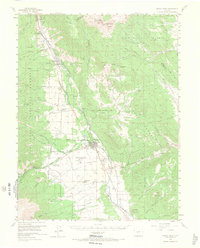
USGS Historical Quadrangle in GeoPDF.
Tags: 7.5 x 7.5 minute,
Buena Vista,
Downloadable Data,
GA,
GeoPDF, All tags...
GeoTIFF,
Historical Topographic Maps,
Historical Topographic Maps 7.5 x 7.5 Minute Map Series,
Map,
imageryBaseMapsEarthCover, Fewer tags
USGS Historical Quadrangle in GeoPDF.
Tags: 7.5 x 7.5 minute,
Buena Vista,
Downloadable Data,
GeoPDF,
GeoTIFF, All tags...
Historical Topographic Maps,
Historical Topographic Maps 7.5 x 7.5 Minute Map Series,
Map,
TN,
imageryBaseMapsEarthCover, Fewer tags
USGS Historical Quadrangle in GeoPDF.
Tags: 30 x 30 minute,
Buena Vista,
Downloadable Data,
GeoPDF,
GeoTIFF, All tags...
Historical Topographic Maps,
Historical Topographic Maps 30 x 30 Minute Map Series,
Map,
VA,
imageryBaseMapsEarthCover, Fewer tags
USGS Historical Quadrangle in GeoPDF.
Tags: 7.5 x 7.5 minute,
Buena Vista,
Downloadable Data,
GeoPDF,
GeoTIFF, All tags...
Historical Topographic Maps,
Historical Topographic Maps 7.5 x 7.5 Minute Map Series,
Map,
VA,
imageryBaseMapsEarthCover, Fewer tags
USGS Historical Quadrangle in GeoPDF.
Tags: 15 x 15 minute,
Buena Vista,
Downloadable Data,
GeoPDF,
GeoTIFF, All tags...
Historical Topographic Maps,
Historical Topographic Maps 15 x 15 Minute Map Series,
Map,
VA,
imageryBaseMapsEarthCover, Fewer tags

USGS Historical Quadrangle in GeoPDF.
Tags: 15 x 15 minute,
Buena Vista,
Downloadable Data,
GeoPDF,
GeoTIFF, All tags...
Historical Topographic Maps,
Historical Topographic Maps 15 x 15 Minute Map Series,
Map,
VA,
imageryBaseMapsEarthCover, Fewer tags
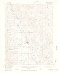
USGS Historical Quadrangle in GeoPDF.
Tags: 15 x 15 minute,
Buena Vista,
CO,
Downloadable Data,
GeoPDF, All tags...
GeoTIFF,
Historical Topographic Maps,
Historical Topographic Maps 15 x 15 Minute Map Series,
Map,
imageryBaseMapsEarthCover, Fewer tags
USGS Historical Quadrangle in GeoPDF.
Tags: 15 x 15 minute,
Buena Vista,
CO,
Downloadable Data,
GeoPDF, All tags...
GeoTIFF,
Historical Topographic Maps,
Historical Topographic Maps 15 x 15 Minute Map Series,
Map,
imageryBaseMapsEarthCover, Fewer tags
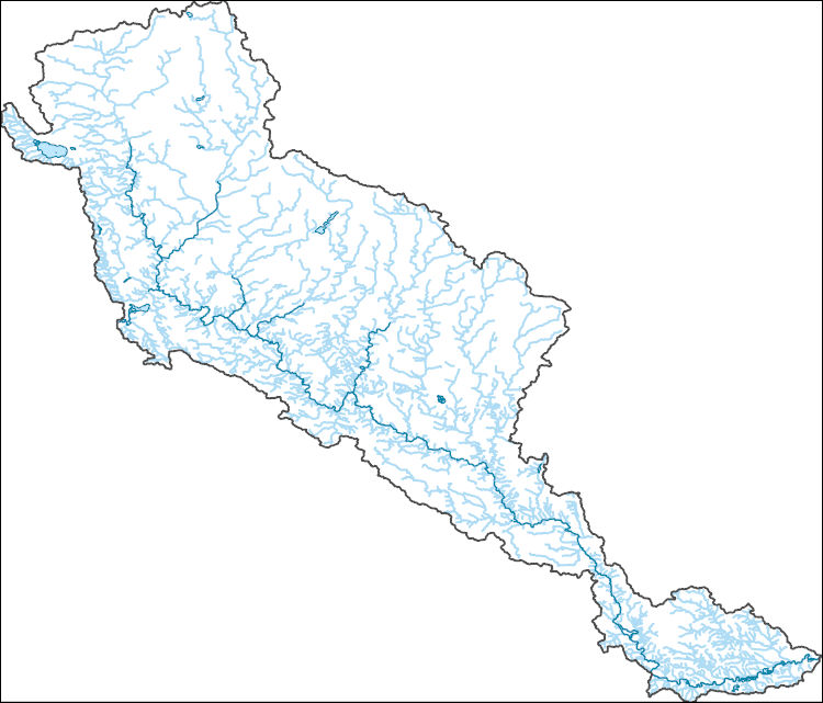
The National Hydrography Dataset (NHD) is a feature-based database that interconnects and uniquely identifies the stream segments or reaches that make up the nation's surface water drainage system. NHD data was originally developed at 1:100,000-scale and exists at that scale for the whole country. This high-resolution NHD, generally developed at 1:24,000/1:12,000 scale, adds detail to the original 1:100,000-scale NHD. (Data for Alaska, Puerto Rico and the Virgin Islands was developed at high-resolution, not 1:100,000 scale.) Local resolution NHD is being developed where partners and data exist. The NHD contains reach codes for networked features, flow direction, names, and centerline representations for areal water...
Tags: Administrative watershed units,
Administrative watershed units,
Area of Complex Channels,
Area to be submerged,
Basin, All tags...
Basin,
Bay/Inlet,
Boone,
Boundaries,
Boundary,
Bridge,
Buena Vista,
Calhoun,
Canal/Ditch,
Carroll,
Clay,
Coastline,
Connector,
Dallas,
Dam/Weir,
Downloadable Data,
Drainage areas for surface water,
Drainageway,
Esri Shapefile nan,
Estuary,
Flow direction network,
Flume,
ForeShore,
Gaging Station,
Gate,
Greene,
Guthrie,
HU-8,
HU-8 Subbasin,
HU10,
HU12,
HU14,
HU16,
HU2,
HU4,
HU6,
HU8,
HU8_07100006,
HUC,
Hazard Zone,
Hydrographic,
Hydrography,
Hydrography,
Hydrography,
Hydrologic Unit Code,
Hydrologic Units,
IA,
Ice mass,
Inundation Area,
Iowa,
Levee,
Line,
Lock Chamber,
Madison,
Marsh,
National Hydrography Dataset (NHD),
National Hydrography Dataset (NHD) Best Resolution,
National Hydrography Dataset (NHD) Best Resolution,
Nonearthen Shore,
Orthoimage,
Palo Alto,
Playa,
Pocahontas,
Point,
PointEvent,
Polk,
Pond,
Rapids,
Rapids,
Reach,
Reach code,
Reef,
Region,
Reservoir,
Rock,
Sac,
Sea/Ocean,
Shapefile,
Sink/Rise,
Sounding Datum Line,
Special Use Zone,
Special Use Zone Limit,
Spillway,
Stream,
Stream/River,
Sub-basin,
Sub-region,
Subbasin,
Submerged Stream,
Subregion,
Subwatershed,
Surface water systems,
Swamp,
Topographic,
Tunnel,
US,
Underground Conduit,
United States,
WBD,
WBD,
Wall,
Warren,
Wash,
Water Intake Outflow,
Waterfall,
Watershed,
Watershed Boundaries,
Watershed Boundary Dataset,
Watershed Boundary Dataset,
Webster,
Well,
artificial path,
boundaries,
dams,
drainage systems and characteristics,
inlandWaters,
lakes,
ngda,
rivers, Fewer tags

The National Hydrography Dataset (NHD) is a feature-based database that interconnects and uniquely identifies the stream segments or reaches that make up the nation's surface water drainage system. NHD data was originally developed at 1:100,000-scale and exists at that scale for the whole country. This high-resolution NHD, generally developed at 1:24,000/1:12,000 scale, adds detail to the original 1:100,000-scale NHD. (Data for Alaska, Puerto Rico and the Virgin Islands was developed at high-resolution, not 1:100,000 scale.) Local resolution NHD is being developed where partners and data exist. The NHD contains reach codes for networked features, flow direction, names, and centerline representations for areal water...
Tags: Administrative watershed units,
Administrative watershed units,
Area of Complex Channels,
Area to be submerged,
Basin, All tags...
Basin,
Bay/Inlet,
Boone,
Boundaries,
Boundary,
Bridge,
Buena Vista,
Calhoun,
Canal/Ditch,
Carroll,
Clay,
Coastline,
Connector,
Dallas,
Dam/Weir,
Downloadable Data,
Drainage areas for surface water,
Drainageway,
Estuary,
Flow direction network,
Flume,
ForeShore,
Gaging Station,
Gate,
GeoPackage,
Greene,
Guthrie,
HU-8,
HU-8 Subbasin,
HU10,
HU12,
HU14,
HU16,
HU2,
HU4,
HU6,
HU8,
HU8_07100006,
HUC,
Hazard Zone,
Hydrographic,
Hydrography,
Hydrography,
Hydrography,
Hydrologic Unit Code,
Hydrologic Units,
IA,
Ice mass,
Inundation Area,
Iowa,
Levee,
Line,
Lock Chamber,
Madison,
Marsh,
National Hydrography Dataset (NHD),
National Hydrography Dataset (NHD) Best Resolution,
National Hydrography Dataset (NHD) Best Resolution,
Nonearthen Shore,
Open Geospatial Consortium GeoPackage 1.2,
Orthoimage,
Palo Alto,
Playa,
Pocahontas,
Point,
PointEvent,
Polk,
Pond,
Rapids,
Rapids,
Reach,
Reach code,
Reef,
Region,
Reservoir,
Rock,
Sac,
Sea/Ocean,
Sink/Rise,
Sounding Datum Line,
Special Use Zone,
Special Use Zone Limit,
Spillway,
Stream,
Stream/River,
Sub-basin,
Sub-region,
Subbasin,
Submerged Stream,
Subregion,
Subwatershed,
Surface water systems,
Swamp,
Topographic,
Tunnel,
US,
Underground Conduit,
United States,
WBD,
WBD,
Wall,
Warren,
Wash,
Water Intake Outflow,
Waterfall,
Watershed,
Watershed Boundaries,
Watershed Boundary Dataset,
Watershed Boundary Dataset,
Webster,
Well,
artificial path,
boundaries,
dams,
drainage systems and characteristics,
inlandWaters,
lakes,
ngda,
rivers, Fewer tags

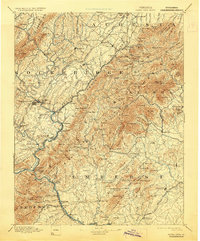
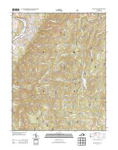
The US Geological Survey, in cooperation with the National Park Service, mapped 35 7.5-minute quadrangles, within a 2-mile-wide+ corridor centered on the Parkway, from BLRI (Blue Ridge Parkway) Mile Post (MP) 0 near Afton, Virginia southward to MP 218 at Cumberland Knob, approximately 1.3 km south of the Virginia – North Carolina State Line. Detailed bedrock geologic mapping for this project was conducted at 1:24,000-scale by systematically traversing roads, trails, creeks, and ridges within and adjacent to the 2-mile-wide+ corridor along the 216.9-mile length of the BLRI in Virginia. Geologic data at more than 23,000 station points were collected during this project (September 2009 – February 2014), with approximately...
Types: Citation,
Map Service,
OGC WFS Layer,
OGC WMS Layer,
OGC WMS Service;
Tags: Adney Gap,
Air Bellows Gap,
Alligator Back Formation,
Antietam Formation,
Ashe Formation, All tags...
Ashville,
Bald Mountain,
Balsam Gap,
Beacon Heights,
Bear Den,
Bear Mountain Gap,
Bearwallow Gap,
Bedrock,
Beech Gap,
Beetree Gap,
Benge Gap,
Big Island,
Big Witch Gap,
Biltmore Estate,
Blackhorse Gap,
Blowing Rock,
Blue Ridge Music Center Visitor Center,
Blue Ridge Park Visitor Center and Park Headquarters,
Blue Ridge Parkway,
Bluff Mountain,
Bottom Creek Metagranitoid Suite,
Buck Creek Gap,
Buena Vista,
Bull Gap,
Carbonate,
Cherokee,
Cherokee Indian Reservation,
Chestoa View,
Chilhowee Group,
Cold Mountain,
Conococheague Formation,
Crabtree Falls,
Crabtree Faults,
Craggy Gardens Visitor Center,
Craven Gap,
Crossnore,
Crossnore Plutonic Suite,
Cumberland Knob,
Daniel Boone's Trace,
Deep Gap,
Devils Backbone Overlook,
Devils Courthouse,
Diabase,
Doughton Park,
E.B. Jeffress Park,
Elbrook Formation,
Elk Pasture Gap,
Ervin,
Ervin,
Fallingwater Cascades,
Fancy Gap,
Flat Rock,
Folds,
Formation,
Fox Hunters Paradise,
Geology,
George Washington National Forest,
Gillespie Gap,
Glendale Springs,
Gneiss,
Graggy Dome,
Grandfather Mountain,
Grandfather Mountain State Park,
Granite,
Graveyard Fields,
Great Valley Overlook,
Green Knob,
Greenstone Trail,
Groundhog Mountain,
Hampton Formation,
Harpers Formation,
Hawksbill Mountain,
Hominy Creek,
Humpback Mountain,
Humpback Rocks Visitor Center,
Indian Gap,
Irish Gap,
James River,
James River Visitor Center and Canal,
Jefferson National Forest,
Julian Price Memorial Park,
Jumpinoff Rock,
Lake Powhaten,
Laurel Springs,
Lineville River,
Linville,
Linville Falls,
Linville Falls Visitor Center,
Little Switzerland,
Looking Glass Rock Overlook,
Lynchburg Group,
Mabry Hill,
Martinsburg Formation,
McKinney Gap,
Meadows of Dan,
Mesoproterozoic gneisses of the Fries Thrust Sheet,
Metabasalt,
Metagranitoid,
Moses H. Cone Memorial Park and Visitor Center,
Mount Jefferson State Park,
Mount Mitchell,
Mount Mitchell State Park,
Mount Pisgah,
Museum of North Carolina Minerals Visitor Center,
N&W Railroad Overlook,
Nantahala National Forest,
Normal Fault,
North Carolina,
North Carolina Arboretum,
Northwest Trading Post,
Oconalufte Visitor Center,
Onion Mountain Overlook,
Orchard Gap,
Oteen,
Otter Creek,
Overmountain Victory Nation Historic Trail,
Peach Bottom Mountain,
Peaks of Otter Metagranitoid,
Peaks of Otter Visitor Center,
Petites Gap,
Pilot Gneiss,
Pineola,
Pipers Gap,
Pisgah National Forest,
Poor Mountain,
Powell Gap,
Price Lake,
Puckett Cabin,
Purgatory Overlook,
Rakes Millpond,
Ravens Roost,
Reverse Fault,
Richland Balsam,
Roanoke Mountain,
Roanoke River,
Roanoke River Gorge,
Roanoke Valley Overlook,
Rocky Knob,
Rocky Knob Visitor Center,
Sandy Creek Gneiss,
Shady Dolomite,
Sharp Top,
Sherando Lake,
Skyland,
Southern End,
Staunton River,
Stone Mountain State Park,
Structure,
Sugarloaf Mountain,
Swannanoa River,
Swift Run Formation,
Table Rock Mountain,
Terrapin Mountain,
The Lump,
The Saddle,
Thrust Fault,
Tunnel Gap,
Twenty Minute Cliff,
Tye River,
Tye River Gap,
USGS Science Data Catalog (SDC),
Unicoi Formation,
Virginia,
Virginia Explore Park and Visitor Center,
Volunteer Gap,
Wagon Road Gap,
Watauga River,
Waterrock Knob Visitor Center,
Wayneboro Formation,
Waynesboro,
Wayneville,
Weverton Formation,
Whites Gap Overlook,
Wigwarm Falls,
Woodlaw,
Wrights Creek,
Yankee Horse Ridge,
Z.B. Vance Birthplace, Fewer tags
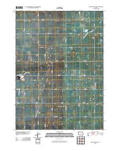
Layered GeoPDF 7.5 Minute Quadrangle Map. Layers of geospatial data include orthoimagery, roads, grids, geographic names, elevation contours, hydrography, and other selected map features.
Tags: 7.5 x 7.5 minute,
Buena Vista,
Downloadable Data,
EarthCover,
GeoPDF, All tags...
Imagery and Base Maps,
Iowa,
Map,
Public Land Survey System,
Rembrandt, IA,
U.S. National Grid,
US,
US Topo,
US Topo Historical,
United States,
boundary,
contour,
geographic names,
hydrography,
imageryBaseMapsEarthCover,
orthoimage,
structures,
topographic,
transportation,
woodland, Fewer tags
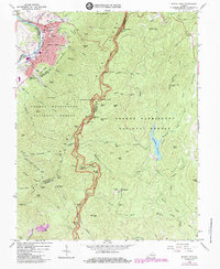
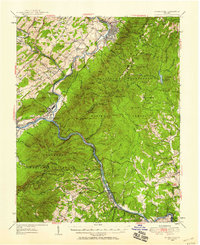
Layered GeoPDF 7.5 Minute Quadrangle Map. Layers of geospatial data include orthoimagery, roads, grids, geographic names, elevation contours, hydrography, and other selected map features.
Tags: 7.5 x 7.5 minute,
Amherst,
Buena Vista,
Buena Vista, VA,
Downloadable Data, All tags...
EarthCover,
GeoPDF,
Imagery and Base Maps,
Map,
Public Land Survey System,
Rockbridge,
U.S. National Grid,
US,
US Topo,
US Topo Historical,
United States,
Virginia,
boundary,
contour,
geographic names,
hydrography,
imageryBaseMapsEarthCover,
orthoimage,
structures,
topographic,
transportation,
woodland, Fewer tags
Layered GeoPDF 7.5 Minute Quadrangle Map. Layers of geospatial data include orthoimagery, roads, grids, geographic names, elevation contours, hydrography, and other selected map features.
Tags: 7.5 x 7.5 minute,
Buena Vista,
Downloadable Data,
EarthCover,
GeoPDF, All tags...
Imagery and Base Maps,
Iowa,
Map,
Peterson SE, IA,
Public Land Survey System,
U.S. National Grid,
US,
US Topo,
US Topo Historical,
United States,
boundary,
contour,
geographic names,
hydrography,
imageryBaseMapsEarthCover,
orthoimage,
structures,
topographic,
transportation,
woodland, Fewer tags
Layered GeoPDF 7.5 Minute Quadrangle Map. Layers of geospatial data include orthoimagery, roads, grids, geographic names, elevation contours, hydrography, and other selected map features.
Tags: 7.5 x 7.5 minute,
Buena Vista,
Downloadable Data,
EarthCover,
GeoPDF, All tags...
Imagery and Base Maps,
Iowa,
Map,
Sioux Rapids SE, IA,
U.S. National Grid,
US,
US Topo,
US Topo Historical,
United States,
contour,
geographic names,
hydrography,
orthoimage,
topographic,
transportation, Fewer tags
|
|

