Filters: Tags: California (X) > Date Range: {"choice":"year"} (X)
2,216 results (123ms)|
Filters
Date Types (for Date Range)
Types
Contacts
Categories Tag Types
|

The Geographic Names Information System (GNIS) is the Federal standard for geographic nomenclature. The U.S. Geological Survey developed the GNIS for the U.S. Board on Geographic Names, a Federal inter-agency body chartered by public law to maintain uniform feature name usage throughout the Government and to promulgate standard names to the public. The GNIS is the official repository of domestic geographic names data; the official vehicle for geographic names use by all departments of the Federal Government; and the source for applying geographic names to Federal electronic and printed products of all types.

These data were released prior to the October 1, 2016 effective date for the USGS’s policy dictating the review, approval, and release of scientific data as referenced in USGS Survey Manual Chapter 502.8 Fundamental Science Practices: Review and Approval of Scientific Data for Release. This digital dataset defines the model grid and altitudes of the top of the 10 model layers and base of the model simulated in the transient hydrologic model of the Central Valley flow system. The Central Valley encompasses an approximate 50,000 square-kilometer region of California. The complex hydrologic system of the Central Valley is simulated using the USGS numerical modeling code MODFLOW-FMP (Schmid and others, 2006), which...

These data were released prior to the October 1, 2016 effective date for the USGS’s policy dictating the review, approval, and release of scientific data as referenced in USGS Survey Manual Chapter 502.8 Fundamental Science Practices: Review and Approval of Scientific Data for Release. This data set represents the average monthly maximum temperature in Celsius multiplied by 100 for 2002 compiled for every catchment of NHDPlus for the conterminous United States. The source data were the Near-Real-Time High-Resolution Monthly Average Maximum/Minimum Temperature for the Conterminous United States for 2002 raster dataset produced by the Spatial Climate Analysis Service at Oregon State University. The NHDPlus Version...

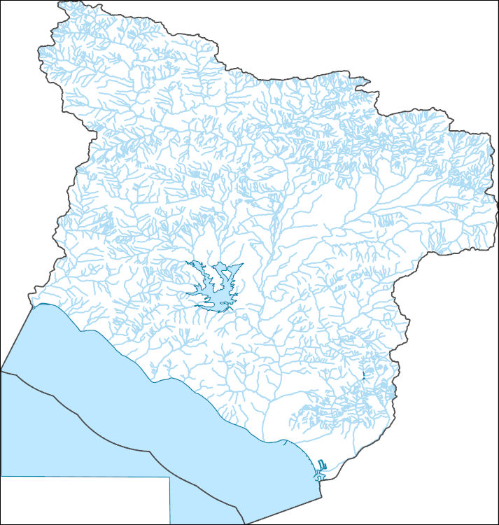
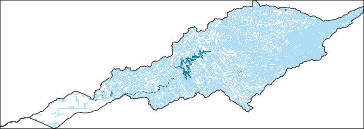
These data were released prior to the October 1, 2016 effective date for the USGS’s policy dictating the review, approval, and release of scientific data as referenced in USGS Survey Manual Chapter 502.8 Fundamental Science Practices: Review and Approval of Scientific Data for Release. This digital dataset contains the surface-water network for the Central Valley Hydrologic Model (CVHM). The Central Valley encompasses an approximate 50,000-square-kilometer region of California. The complex hydrologic system of the Central Valley is simulated using the USGS numerical modeling code MODFLOW-FMP (Schmid and others, 2006). This simulation is referred to here as the CVHM (Faunt, 2009). Utilizing MODFLOW-FMP, the CVHM...

These data were released prior to the October 1, 2016 effective date for the USGS’s policy dictating the review, approval, and release of scientific data as referenced in USGS Survey Manual Chapter 502.8 Fundamental Science Practices: Review and Approval of Scientific Data for Release. This tabular data set represents the area of each level 3 nutrient ecoregion in square meters compiled for every MRB_E2RF1 catchment of the Major River Basins (MRBs, Crawford and others, 2006). The source data are from the 2002 version of the U.S. Environmental Protection Agency's (USEPA) Aggregations of Level III Ecoregions for National Nutrient Assessment & Management Strategy (USEPA, 2002). The MRB_E2RF1 catchments are based on...

These data were released prior to the October 1, 2016 effective date for the USGS’s policy dictating the review, approval, and release of scientific data as referenced in USGS Survey Manual Chapter 502.8 Fundamental Science Practices: Review and Approval of Scientific Data for Release. This tabular data set represents the estimated area of level 3 ecological landscape regions (ecoregions), as defined by Omernik (1987), compiled for every MRB_E2RF1 catchment of the Major River Basins (MRBs, Crawford and others, 2006). The source data set is Level III Ecoregions of the Continental United States (U.S. Environmental Protection Agency, 2003). The MRB_E2RF1 catchments are based on a modified version of the U.S. Environmental...
Data presented are results of surveys in 2021 for San Diego Cactus Wren (Campylorhynchus brunneicapillus) in southern San Diego County. Surveys were conducted at 378 plots. Plots were surveyed twice in 2021 and the number, age (adult or juvenile), banding status (color banded or not), and breeding status (paired, unpaired, or unknown) of all wrens recorded. Habitat covariate data were collected including amount of dead and stressed cactus in the plot, percent cover of bare ground, and the dominant and percent cover of invasive species.
Categories: Data;
Types: Downloadable,
Map Service,
OGC WFS Layer,
OGC WMS Layer,
Shapefile;
Tags: California,
San Diego,
animal and plant census,
biota,
birds,
This dataset describes mesopredator locations (raccoons and striped skunks), dabbling duck nest locations (mallard, gadwall, and cinnamon teal), northern harrier nest locations, and random locations in relation to a set of habitat features in Suisun Marsh, California during 2016 through 2019. We designed a series of questions to link fine-scale predator movements and vulnerability of dabbling duck nests to predator encounters and egg predation. We conducted our study over a 4-year period using 41 GPS-collared raccoons and striped skunks, two of the most widespread mammalian predators of waterfowl eggs in North America, and more than 2000 monitored duck nests. Each night of movement for mesopredators contains the...
Categories: Data;
Tags: California,
Suisun Marsh,
USGS Science Data Catalog (SDC),
Wildlife Biology,
animal behavior,
These data represent trapping effort and captures of deer mice at Point Reyes National Seashore, Marin County, California. Deer mice were captured and marked with ear tags to allow identification of individuals. The location of captures can be used in a spatially explicit capture recapture model to estimate density of mice and how mouse density varies by site and habitat type.
Categories: Data;
Types: Downloadable,
Map Service,
OGC WFS Layer,
OGC WMS Layer,
OGC WMS Service,
Shapefile;
Tags: California,
Ecology,
Marin County,
Point Reyes National Seashore,
USGS Science Data Catalog (SDC),
These data were compiled for a networked field-trial restoration experiment (RestoreNet) that spans the southwestern US, including 21 distributed field sites. The objective of our study was to understand the environmental factors and restoration practices (including seed mixes and soil manipulation) that increase plant establishment and survival to ultimate improve restoration outcomes in dryland environments. These data represent point-in-time plant density and height measurements at our field sites at the time of monitoring. These data were collected at 21 arid and semi-arid sites, located throughout Arizona, Utah, New Mexico, and California. These data were collected by USGS Restoration Assessment and Monitoring...
Climate change over the past century has altered vegetation community composition and species distributions across rangelands in the western United States. The scale and magnitude of climatic influences are largely unknown. We used fractional component cover data for rangeland functional groups and weather data from the 1985 to 2023 reference period in conjunction with soils and topography data to develop empirical models describing the spatio-temporal variation in component cover. To investigate the ramifications of future change across the western US, we extended models based on historical relationships over the reference period to model landscape effects based on future weather conditions from two emissions scenarios...
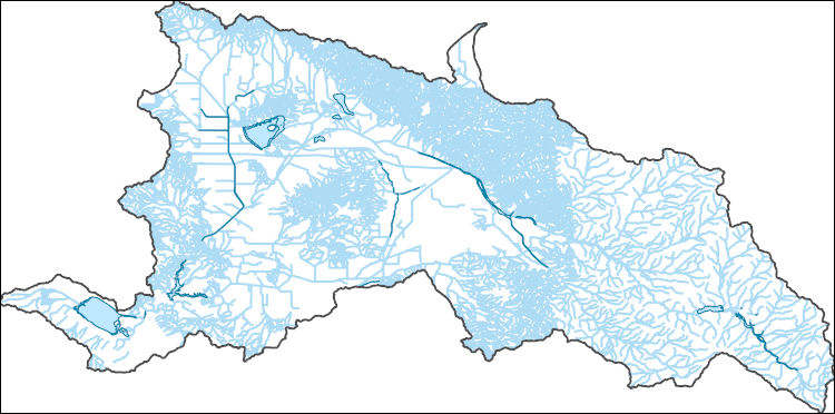
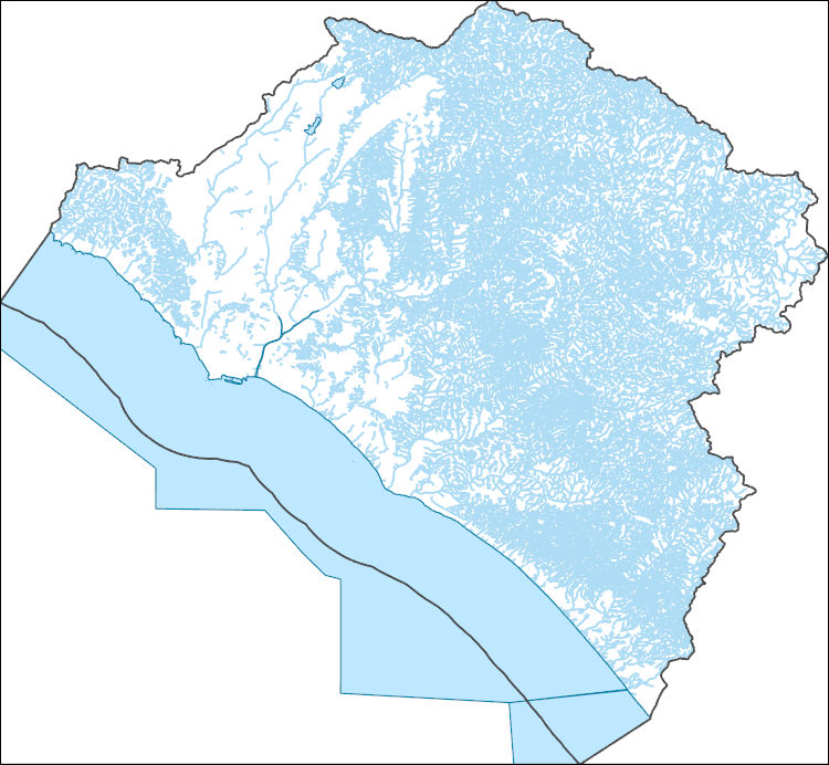
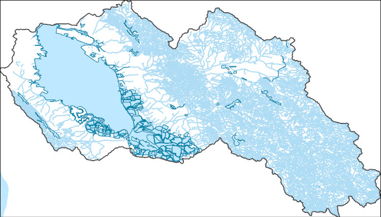
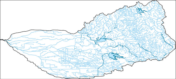
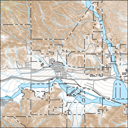
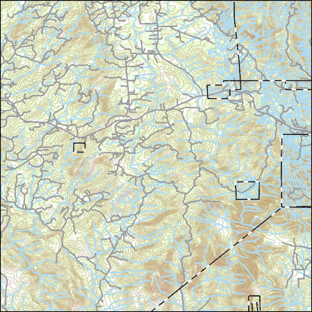
The National Hydrography Dataset (NHD) is a feature-based database that interconnects and uniquely identifies the stream segments or reaches that make up the nation's surface water drainage system. NHD data was originally developed at 1:100,000-scale and exists at that scale for the whole country. This high-resolution NHD, generally developed at 1:24,000/1:12,000 scale, adds detail to the original 1:100,000-scale NHD. (Data for Alaska, Puerto Rico and the Virgin Islands was developed at high-resolution, not 1:100,000 scale.) Local resolution NHD is being developed where partners and data exist. The NHD contains reach codes for networked features, flow direction, names, and centerline representations for areal water...
The National Hydrography Dataset (NHD) is a feature-based database that interconnects and uniquely identifies the stream segments or reaches that make up the nation's surface water drainage system. NHD data was originally developed at 1:100,000-scale and exists at that scale for the whole country. This high-resolution NHD, generally developed at 1:24,000/1:12,000 scale, adds detail to the original 1:100,000-scale NHD. (Data for Alaska, Puerto Rico and the Virgin Islands was developed at high-resolution, not 1:100,000 scale.) Local resolution NHD is being developed where partners and data exist. The NHD contains reach codes for networked features, flow direction, names, and centerline representations for areal water...
The National Hydrography Dataset (NHD) is a feature-based database that interconnects and uniquely identifies the stream segments or reaches that make up the nation's surface water drainage system. NHD data was originally developed at 1:100,000-scale and exists at that scale for the whole country. This high-resolution NHD, generally developed at 1:24,000/1:12,000 scale, adds detail to the original 1:100,000-scale NHD. (Data for Alaska, Puerto Rico and the Virgin Islands was developed at high-resolution, not 1:100,000 scale.) Local resolution NHD is being developed where partners and data exist. The NHD contains reach codes for networked features, flow direction, names, and centerline representations for areal water...
The National Hydrography Dataset (NHD) is a feature-based database that interconnects and uniquely identifies the stream segments or reaches that make up the nation's surface water drainage system. NHD data was originally developed at 1:100,000-scale and exists at that scale for the whole country. This high-resolution NHD, generally developed at 1:24,000/1:12,000 scale, adds detail to the original 1:100,000-scale NHD. (Data for Alaska, Puerto Rico and the Virgin Islands was developed at high-resolution, not 1:100,000 scale.) Local resolution NHD is being developed where partners and data exist. The NHD contains reach codes for networked features, flow direction, names, and centerline representations for areal water...
The National Hydrography Dataset (NHD) is a feature-based database that interconnects and uniquely identifies the stream segments or reaches that make up the nation's surface water drainage system. NHD data was originally developed at 1:100,000-scale and exists at that scale for the whole country. This high-resolution NHD, generally developed at 1:24,000/1:12,000 scale, adds detail to the original 1:100,000-scale NHD. (Data for Alaska, Puerto Rico and the Virgin Islands was developed at high-resolution, not 1:100,000 scale.) Local resolution NHD is being developed where partners and data exist. The NHD contains reach codes for networked features, flow direction, names, and centerline representations for areal water...
The National Hydrography Dataset (NHD) is a feature-based database that interconnects and uniquely identifies the stream segments or reaches that make up the nation's surface water drainage system. NHD data was originally developed at 1:100,000-scale and exists at that scale for the whole country. This high-resolution NHD, generally developed at 1:24,000/1:12,000 scale, adds detail to the original 1:100,000-scale NHD. (Data for Alaska, Puerto Rico and the Virgin Islands was developed at high-resolution, not 1:100,000 scale.) Local resolution NHD is being developed where partners and data exist. The NHD contains reach codes for networked features, flow direction, names, and centerline representations for areal water...
Layers of geospatial data include contours, boundaries, land cover, hydrography, roads, transportation, geographic names, structures, and other selected map features.
Layers of geospatial data include contours, boundaries, land cover, hydrography, roads, transportation, geographic names, structures, and other selected map features.
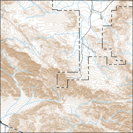
Layers of geospatial data include contours, boundaries, land cover, hydrography, roads, transportation, geographic names, structures, and other selected map features.
|

|
