Filters: Tags: Canada (X) > partyWithName: Conservation Biology Institute (X)
119 results (50ms)|
Filters
Date Range
Tag Schemes |

MC1 is a dynamic vegetation model for estimating the distribution of vegetation and associated ecosystem fluxes of carbon, nutrients, and water. It was created to assess the potential impacts of global climate change on ecosystem structure and function at a wide range of spatial scales from landscape to global. The model incorporates transient dynamics to make predictions about the patterns of ecological change. MC1 was created by combining physiologically based biogeographic rules defined in the MAPSS model with a modified version of the biogeochemical model, CENTURY. MC1 includes a fire module, MCFIRE, that mechanistically simulates the occurrence and impacts of fire events. Climate input data sources for this...

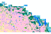
This dataset contains Canada's national forest inventory (CanFI) 2001 data for plots within the boreal region of the province of Quebec, Canada. The attribute displayed is percent forested. Refer to the "attributes" tab to view other attributes contained in this dataset. For more information, refer to the CanFI 2001 document at: http://dsp-psd.pwgsc.gc.ca/collection_2007/nrcan-rncan/Fo143-2-408E.pdf From CanFI: Canada's existing national forest inventory (CanFI) is compiled about every five years by aggregating provincial and territorial forest management inventories and reconnaissance level information. Stand-level data provided by the provincial and territorial management agencies are converted to a national...

This dataset contains Canada's national forest inventory (CanFI) 2001 data for plots within the boreal region of the province of Ontario, Canada. The attribute displayed is percent forested. Refer to the "attributes" tab to view other attributes contained in this dataset. For more information, refer to the CanFI 2001 document at: http://dsp-psd.pwgsc.gc.ca/collection_2007/nrcan-rncan/Fo143-2-408E.pdf From CanFI: Canada's existing national forest inventory (CanFI) is compiled about every five years by aggregating provincial and territorial forest management inventories and reconnaissance level information. Stand-level data provided by the provincial and territorial management agencies are converted to a national...

This dataset depicts the Level I ecological regions of North America, as compiled by the Commission for Environmental Cooperation (CEC). These draft files of of Level I, II, and III ecological regions of North America are an update and revision of files developed by Canada, the United States, and Mexico in the late 1990's in a cooperative project for the Commission for Environmental Cooperation (CEC 1997). The CEC was created under the North American Agreement on Environmental Cooperation (NAAEC) to address regional environmental concerns, help prevent potential trade and environmental conflicts and promote the effective enforcement of environmental law. The Agreement complements the environmental provisions established...

MC1 is a dynamic vegetation model for estimating the distribution of vegetation and associated ecosystem fluxes of carbon, nutrients, and water. It was created to assess the potential impacts of global climate change on ecosystem structure and function at a wide range of spatial scales from landscape to global. The model incorporates transient dynamics to make predictions about the patterns of ecological change. MC1 was created by combining physiologically based biogeographic rules defined in the MAPSS model with a modified version of the biogeochemical model, CENTURY. MC1 includes a fire module, MCFIRE, that mechanistically simulates the occurrence and impacts of fire events. Climate input data sources for this...
This dataset contains generalized landcover data for the Prairie Farm Rehabilitation Administration (PFRA) determined agricultural extent of Manitoba and Saskatchewan. This dataset was subset into two shapefiles. The other half of this dataset covers PFRA agricultural areas of Alberta and British Columbia. The Landcover Generalization process was undertaken to solve rendering problems of the original vectorized landcover data due to its unwieldy/overwhelming size. LANDSAT 7 imagery used in the process was collected during the WGTPP. This landcover imagery has a 30 meter resolution and is stored in over 1,100 vectorized 1:50,000 map sheet tiles. The data requires over seven gigabytes of disc space. If the user wishes...

The mapping of land capability for forestry is based on a national classification system comparable with the other Canada Land Inventory sectors. Land is rated according to seven classes on its capability to grow commercial timber in areas stocked with the optimum number and species of trees. This rating considers the land in its natural state, without improvements such as fertilization, drainage, or amelioration practices. This dataset contains Land Capability Ratings for the surveyed portions of the province of Alberta, for areas south of 56 degrees N latitude (Alberta is divided into two datasets due to file size constraints). Land ratings and classes may change, however, significant changes will only be achieved...

Digital polling division boundaries for 2008 were compared to polling division boundaries for 2006 and 2004 for select federal electoral districts. Polling divisions were identified by change type: larger than the comparison year, smaller than the comparison year, no change, and new division. Original polling division data was downloaded in December of 2009 from: http://geogratis.cgdi.gc.ca/geogratis/en/option/select.do?id=1169 NOTES: Be aware that polygons marked as no change that show boundary changes between the two comparison years can be 1) subdivided in one year and not the other, or 2) have an area difference of less than 1000 square meters. Polling divisions were identified based on the federal electoral...

A coal/CBM database was implemented by the Alberta Geological Survey to capture and manage information related to coalbed methane (CBM). The database is a compilation of data from many different sources and contains information on 7923 wells (15,200 formation picks; 37,357 coal picks; 495 coal analyses; and 363 vitrinite reflectance measurements). This is a subset of those wells that fall inside the coal zone.

A nationally compiled dataset containing provincial Forest Tenures/Forest Management Areas and other administrative areas where rights to establish, grow, harvest or remove timber from a particular area of land has been granted. Each province has different boundary definitions and/or harvesting practices which prevents this dataset from having a standard defined tenure unit for all of Canada (See data sources in metadata). British Columbia was the only province where tenure boundaries had to be complied from several different sources in order to have a definable tenure unit comparable to other provinces (see NOTES in metadata).

A nationally compiled dataset containing provincial Forest Tenures/Forest Management Areas and other administrative areas where rights to establish, grow, harvest or remove timber from a particular area of land has been granted. Each province has different boundary definitions and/or harvesting practices which prevents this dataset from having a standard defined tenure unit for all of Canada (See data sources in metadata). British Columbia was the only province where tenure boundaries had to be complied from several different sources in order to have a definable tenure unit comparable to other provinces (see NOTES in metadata).

Extent of disturbance directly related to oil sands surface mining activity up to 2008.

The datatset is a compilation of all permanent (legally established) protected areas in Ontario, Canada.

The datatset is a compilation of all permanent (legally established) protected areas in Nunavut, Canada.

This dataset depicts the administrative boundaries (exterior limits) of Canada Lands which includes Indian Reserves, Cree-Naskapi Category 1A and 1A-N Lands, Yukon First Nations Settlement Lands, and Kanesatake Mohawk Interim Land Base. Administrative boundaries were compiled from Canada Centre for Cadastral Management's cadastral datasets and survey records archived in the Canada Lands Survey Records.

This study focuses on Endangered Forests and the biological components of the High Conservation Value Forest concept. High Conservation Value and Endangered Forests are identified and mapped based on several ecological components that are globally, regionally, or locally important. These ecological components can be landscape level features or biodiversity related. These components sometimes overlap and at other times are mutually exclusive. Any one component can be enough to identify a specific forest area as a High Conservation Value or Endangered Forest depending on the circumstance, but a full assessment using readily available spatial data of all of the ecological components is warranted before a forest is...

This layer is part of the Geological Survey of Canada's earthquake monitoring network. There are some blank fields toward the beginning of the listing, from the time the network was being installed and hence parameters were often unknown. Also, all depths in the table are "fixed" to a depth which is an integer multiple of 5km, according to lowest obtainable residuals and known crustal structure. The number and magnitude of located events are also dependent on the time recorded, as the magnitude threshold lowered as more stations were installed. The larger, potentially damaging earthquakes, however, were likely recorded from the inception of the network as these events produce waves which reach the entire western...

Extent of disturbance directly related to oil sands surface mining activity up to 2002.
The datatset is a compilation of all permanent (legally established) protected areas in Quebec, Canada.

This dataset depicts known contaminated sites under the jurisdiction of Canada's federal agencies and consolidated Crown corporations, including non-federal sites for which the Government of Canada has accepted some or all financial responsibility. A contaminated sites is defined as "one at which substances occur at concentrations (1) above background (normally occurring) levels and pose or are likely to pose an immediate or long term hazard to human health or the environment, or (2) exceeding levels specified in policies and regulations." (http://www.tbs-sct.gc.ca/fcsi-rscf/home-accueil.aspx?Language=EN&sid=wu1281891127). This dataset was created by the Conservation Biology Institute using publicly available information...
|

|
