Filters: Tags: Cape Mendocino (X)
9 results (10ms)|
Filters
Contacts
(Less)
|
This data set contains imagery from the National Agriculture Imagery Program (NAIP). The NAIP program is administered by USDA FSA and has been established to support two main FSA strategic goals centered on agricultural production. These are, increase stewardship of America's natural resources while enhancing the environment, and to ensure commodities are procured and distributed effectively and efficiently to increase food security. The NAIP program supports these goals by acquiring and providing ortho imagery that has been collected during the agricultural growing season in the U.S. The NAIP ortho imagery is tailored to meet FSA requirements and is a fundamental tool used to support FSA farm and conservation programs....
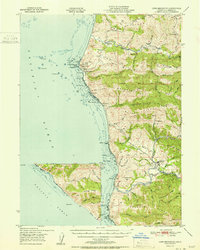
USGS Historical Quadrangle in GeoPDF.
This data release includes marine geophysical data collected on three research cruises conducted in 2010 and 2012 between Point Arena and Cape Mendocino. The overall goal of this research is to better understandthe northernmost section of the San Andreas Fault (SAF). In 2010, the USGS collected seismic-reflection profiles crossing the SAF at 1 km spacing from Point Arena to Fort Bragg (survey B-5-10-NC). Then, Oregon State University (OSU) and U.S. Geological Survey (USGS) jointly collected seismic-reflection data crossing the SAF at 1 km spacing from offshore Fort Bragg to Point Delgada (survey C-1-10-NC). In 2012, OSU and USGS jointly collected additional seismic-reflection and marine magnetic data west of the...

USGS Historical Quadrangle in GeoPDF.

USGS Historical Quadrangle in GeoPDF.

USGS Historical Quadrangle in GeoPDF.
This data set contains imagery from the National Agriculture Imagery Program (NAIP). The NAIP program is administered by USDA FSA and has been established to support two main FSA strategic goals centered on agricultural production. These are, increase stewardship of America's natural resources while enhancing the environment, and to ensure commodities are procured and distributed effectively and efficiently to increase food security. The NAIP program supports these goals by acquiring and providing ortho imagery that has been collected during the agricultural growing season in the U.S. The NAIP ortho imagery is tailored to meet FSA requirements and is a fundamental tool used to support FSA farm and conservation programs....

USGS Historical Quadrangle in GeoPDF.

USGS Historical Quadrangle in GeoPDF.
|

|
