Filters: Tags: Carpinteria (X)
30 results (31ms)|
Filters
Contacts
(Less)
|
We collected detailed spatial data on the density and size distribution of intertidal snails as part of a broader effort to understand food webs in California estuaries. The survey area was Carpinteria Salt Marsh, California USA, which comprises 9 Ha tidal channels, 2 Ha salt flats, 17 Ha upland habitat, 6 Ha tidal pans, 52 Ha vegetated marsh, 2 Ha tidal flats. Using nearly 4,000 transects in potential snail habitat, we mapped snails throughout the estuary. Specifically, we systematically placed transects at intervals stratified within targeted habitat types: channels, pans, or marsh (or planar habitat that was mixed marsh and pan). At a quarter of the quadrats, we also estimated snail size-frequency distributions....
Categories: Data;
Tags: California,
Carpinteria,
Carpinteria Salt Marsh Reserve,
Santa Barbara County,
USGS Science Data Catalog (SDC),
In 30 surveys, we mapped 21,486 birds comprising 88 species “interact with” the intertidal habitat. Each full “survey” represents a unique month-year-tide combination (but not necessarily a unique day). Specifically, for each of 15 months between January 2012 and March 2013 we conducted separate, but temporally adjacent high-tide and low-tide bird surveys (30 in total) throughout the intertidal habitats. Back to back surveys within the same month are not meant to be independent measures of bird abundance and should be averaged to get an idea of bird abundance in a particular month. Birds were counted if they were in the intertidal habitat. We also counted some species, like raptors, if they were perched in adjacent...
Categories: Data;
Types: Citation,
Downloadable,
Map Service,
OGC WFS Layer,
OGC WMS Layer,
Shapefile;
Tags: California,
Carpinteria,
Carpinteria Salt Marsh Reserve,
Santa Barbara County,
bird,
Digital elevation model outputs from wetland accreting rate model of ecosystem resilience (WARMER) at ten year intervals from 2010-2110. Baseline elevations were collected with RTK GPS units and LiDAR elevations in non-surveyed areas were also corrected using LEAN method. Historical accretion rates were collected at each salt marsh and used to parameterize WARMER, predicting future elevations. These data support the following publication: Rosencranz JA, Thorne KM, Buffington KJ, et al. Sea‐level rise, habitat loss, and potential extirpation of a salt marsh specialist bird in urbanized landscapes. Ecol Evol. 2018;00:1–11. https://doi.org/10.1002/ece3.4196
Types: Citation;
Tags: California,
Carpinteria,
Mugu Lagoon,
Remote Sensing,
Seal Beach National Wildlife Refuge,
This data set contains imagery from the National Agriculture Imagery Program (NAIP). The NAIP program is administered by USDA FSA and has been established to support two main FSA strategic goals centered on agricultural production. These are, increase stewardship of America's natural resources while enhancing the environment, and to ensure commodities are procured and distributed effectively and efficiently to increase food security. The NAIP program supports these goals by acquiring and providing ortho imagery that has been collected during the agricultural growing season in the U.S. The NAIP ortho imagery is tailored to meet FSA requirements and is a fundamental tool used to support FSA farm and conservation programs....
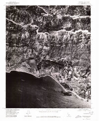
USGS Historical Quadrangle in GeoPDF.
USGS Historical Quadrangle in GeoPDF.

This part of DS 781 presents data for the transgressive contours for the Point Conception to Hueneme Canyon, California, region. The vector file is included in "TransgressiveContours_PointConceptionToHuenemeCanyon.zip," which is accessible from http://dx.doi.org/10.5066/F7891424. As part of the USGS's California State Waters Mapping Project, a 50-m grid of sediment thickness for the seafloor within the 3-nautical mile limit between Point Conception and Hueneme Canyon was generated from seismic-reflection data collected in 2014 (USGS activity 2014-632-FA) supplemented with outcrop and geologic structure (fault) information following the methodology of Wong (2012). Water depths determined from bathymetry data were...
Categories: Data;
Types: Citation,
Downloadable,
Map Service,
OGC WFS Layer,
OGC WMS Layer,
Shapefile;
Tags: Carpinteria,
Coal Oil Point,
Gaviota,
Hueneme Canyon,
Pacific Ocean,

This part of DS 781 presents data for the isopachs for the Point Conception to Hueneme Canyon, California, region. The vector data file is included in "Isopachs_PointConceptionToHuenemeCanyon.zip," which is accessible from https://doi.org/10.5066/F7891424. As part of the USGS's California State Waters Mapping Project, a 50-m grid of sediment thickness for the seafloor within the 3-nautical mile limit between Point Conception and Hueneme Canyon was generated from seismic-reflection data collected in 2014 (USGS activity 2014-632-FA) supplemented with outcrop and geologic structure (fault) information following the methodology of Wong (2012). This sediment thickness layer was merged with a previously published sediment...
Categories: Data;
Types: Citation,
Downloadable,
Map Service,
OGC WFS Layer,
OGC WMS Layer,
Shapefile;
Tags: Carpinteria,
Coal Oil Point,
Gaviota,
Hueneme Canyon,
Pacific Ocean,
Each month (except March 2012), we collected detailed data on the infection status of intertidal snails from ten fixed sites as part of a broader effort to understand food webs in California Estuaries. The study site was Carpinteria Salt Marsh Reserve, California USA, (University of California Natural Reserve System), which comprises 9 Ha tidal channels, 2 Ha salt flats, 17 Ha upland habitat, 6 Ha tidal pans, 52 Ha vegetated marsh, 2 Ha tidal flats. Each site was a fixed location in channel or flat habitat, with a diameter approximately 50 m in size, centered at the site location marker used in Kuris et al. (2008). At each site/month, we collected, measured, sexed, and dissected ~58 snails (11,643 dissections total,...
Categories: Data;
Tags: California,
Carpinteria,
Carpinteria Salt Marsh Reserve,
Santa Barbara County,
USGS Science Data Catalog (SDC),
Each month (except March 2012), we collected detailed data on the density, size distribution, and infection status of intertidal snails from ten fixed sites as part of a broader effort to understand food webs in California Estuaries. The study site was Carpinteria Salt Marsh Reserve, California USA, (University of California Natural Reserve System), which comprises 9 Ha tidal channels, 2 Ha salt flats, 17 Ha upland habitat, 6 Ha tidal pans, 52 Ha vegetated marsh, 2 Ha tidal flats. Each site was a fixed location in channel or flat habitat, with a diameter approximately 50m in size, centered at the site location marker used in Kuris et al. (2008). At each site/month, we collected, measured, sexed, and dissected ~58...
Categories: Data;
Tags: California,
Carpinteria,
Carpinteria Salt Marsh Reserve,
Santa Barbara County,
USGS Science Data Catalog (SDC),
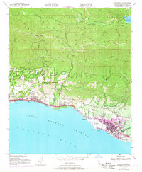
USGS Historical Quadrangle in GeoPDF.
This data set contains imagery from the National Agriculture Imagery Program (NAIP). The NAIP program is administered by USDA FSA and has been established to support two main FSA strategic goals centered on agricultural production. These are, increase stewardship of America's natural resources while enhancing the environment, and to ensure commodities are procured and distributed effectively and efficiently to increase food security. The NAIP program supports these goals by acquiring and providing ortho imagery that has been collected during the agricultural growing season in the U.S. The NAIP ortho imagery is tailored to meet FSA requirements and is a fundamental tool used to support FSA farm and conservation programs....
This data set contains imagery from the National Agriculture Imagery Program (NAIP). The NAIP program is administered by USDA FSA and has been established to support two main FSA strategic goals centered on agricultural production. These are, increase stewardship of America's natural resources while enhancing the environment, and to ensure commodities are procured and distributed effectively and efficiently to increase food security. The NAIP program supports these goals by acquiring and providing ortho imagery that has been collected during the agricultural growing season in the U.S. The NAIP ortho imagery is tailored to meet FSA requirements and is a fundamental tool used to support FSA farm and conservation programs....
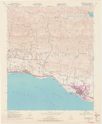
USGS Historical Quadrangle in GeoPDF.
USGS Historical Quadrangle in GeoPDF.
This data set contains imagery from the National Agriculture Imagery Program (NAIP). The NAIP program is administered by USDA FSA and has been established to support two main FSA strategic goals centered on agricultural production. These are, increase stewardship of America's natural resources while enhancing the environment, and to ensure commodities are procured and distributed effectively and efficiently to increase food security. The NAIP program supports these goals by acquiring and providing ortho imagery that has been collected during the agricultural growing season in the U.S. The NAIP ortho imagery is tailored to meet FSA requirements and is a fundamental tool used to support FSA farm and conservation programs....
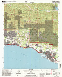
USGS Historical Quadrangle in GeoPDF.
USGS Historical Quadrangle in GeoPDF.
USGS Historical Quadrangle in GeoPDF.
Digital elevation model outputs from wetland accreting rate model of ecosystem resilience (WARMER) at ten year intervals from 2010-2110. Baseline elevations were collected with RTK GPS units and LiDAR elevations in non-surveyed areas were also corrected using LEAN method. Historical accretion rates were collected at each salt marsh and used to parameterize WARMER, predicting future elevations.
Types: Citation;
Tags: California,
Carpinteria,
biota,
dynamic salt marsh accretion model,
environment,
|

|
