Filters: Tags: Congress (X)
28 results (14ms)|
Filters
Date Range
Extensions (Less) Types (Less)
Contacts (Less)
Categories (Less) Tag Types Tag Schemes
|
This data set contains imagery from the National Agriculture Imagery Program (NAIP). The NAIP program is administered by USDA FSA and has been established to support two main FSA strategic goals centered on agricultural production. These are, increase stewardship of America's natural resources while enhancing the environment, and to ensure commodities are procured and distributed effectively and efficiently to increase food security. The NAIP program supports these goals by acquiring and providing ortho imagery that has been collected during the agricultural growing season in the U.S. The NAIP ortho imagery is tailored to meet FSA requirements and is a fundamental tool used to support FSA farm and conservation programs....
ADMMR map collection: Workings of the Congress mine on the Niagra vein; 1 in. to 200 feet; 23 x 17 in.
This data set contains imagery from the National Agriculture Imagery Program (NAIP). The NAIP program is administered by USDA FSA and has been established to support two main FSA strategic goals centered on agricultural production. These are, increase stewardship of America's natural resources while enhancing the environment, and to ensure commodities are procured and distributed effectively and efficiently to increase food security. The NAIP program supports these goals by acquiring and providing ortho imagery that has been collected during the agricultural growing season in the U.S. The NAIP ortho imagery is tailored to meet FSA requirements and is a fundamental tool used to support FSA farm and conservation programs....
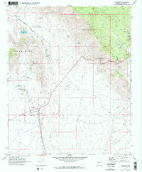
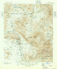
USGS Historical Quadrangle in GeoPDF.
This data set contains imagery from the National Agriculture Imagery Program (NAIP). The NAIP program is administered by USDA FSA and has been established to support two main FSA strategic goals centered on agricultural production. These are, increase stewardship of America's natural resources while enhancing the environment, and to ensure commodities are procured and distributed effectively and efficiently to increase food security. The NAIP program supports these goals by acquiring and providing ortho imagery that has been collected during the agricultural growing season in the U.S. The NAIP ortho imagery is tailored to meet FSA requirements and is a fundamental tool used to support FSA farm and conservation programs....
This data set contains imagery from the National Agriculture Imagery Program (NAIP). The NAIP program is administered by USDA FSA and has been established to support two main FSA strategic goals centered on agricultural production. These are, increase stewardship of America's natural resources while enhancing the environment, and to ensure commodities are procured and distributed effectively and efficiently to increase food security. The NAIP program supports these goals by acquiring and providing ortho imagery that has been collected during the agricultural growing season in the U.S. The NAIP ortho imagery is tailored to meet FSA requirements and is a fundamental tool used to support FSA farm and conservation programs....
This location is part of the Arizona Mineral Industry Location System (AzMILS), an inventory of mineral occurences, prospects and mine locations in Arizona. Mohave492A is located in T17N R14W Sec 30 NE in the Diamond Joe Peak - 7.5 Min quad. This collection consists of various reports, maps, records and related materials acquired by the Arizona Department of Mines and Mineral Resources regarding mining properties in Arizona. Information was obtained by various means, including the property owners, exploration companies, consultants, verbal interviews, field visits, newspapers and publications. Some sections may be redacted for copyright. Please see the access statement.
ADMMR map collection: Drill holes northeast of Niagra vein; 1 in. to 100 feet; 31 x 36 in.

USGS Historical Quadrangle in GeoPDF.

USGS Historical Quadrangle in GeoPDF.
This map layer portrays the Congressional districts of the United States clipped to the Northeast region, for the 113th Congress. Supplemental information about the National Atlas Web services can be found on the Web Map and Web Feature Services page; see http://nationalatlas.gov/infodocs/webservices.html Many states have more detailed Congressional district information available online; links for most states are provided under the source information. For states where a link is not listed, please contact the state government for further information.
Categories: Data;
Types: ArcGIS REST Map Service,
ArcGIS Service Definition,
Downloadable,
Map Service;
Tags: Boundaries,
Congress,
Congressional Districts,
Delegate Districts,
House of Representatives,
ADMMR map collection: Property of the Congress Gold Co.; 1 in. to 60 feet; 18 x 30 in.

USGS Historical Quadrangle in GeoPDF.
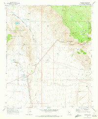
USGS Historical Quadrangle in GeoPDF.
ADMMR map collection: Drill holes northeast of Niagra vein; 1 in. to 100 feet; 30 x 36 in.
USGS Historical Quadrangle in GeoPDF.
This location is part of the Arizona Mineral Industry Location System (AzMILS), an inventory of mineral occurences, prospects and mine locations in Arizona. LaPaz350 is located in T8N R12W Sec 25 NW in the E C P Peak - 7.5 Min quad. This collection consists of various reports, maps, records and related materials acquired by the Arizona Department of Mines and Mineral Resources regarding mining properties in Arizona. Information was obtained by various means, including the property owners, exploration companies, consultants, verbal interviews, field visits, newspapers and publications. Some sections may be redacted for copyright. Please see the access statement.

A map service depicting the spatial representation of the United States Congressional Districts of the 113th Congress. It includes common identifiers for these entities so this data set can be used in conjunction with other data sets describing Congressionl Districts. This map service uses a generalized Congressional Districts layer for display at small scales. The data are an extract of the Census codes and boundaries from the following Census FTP site: ftp://ftp2.census.gov/geo/tiger. Since the Census data do not include the coastline detail, the coastal boundaries have been spatially clipped to the Health Resources and Services Administration (HRSA) coastline detail. This coastline detail was derived from the...
ADMMR map collection: Workings of the Congress mine on the Congress vein; 1 in. to 300 feet; 24 x 17 in.
|

|
