Filters: Tags: Corn (X)
11 results (9ms)|
Filters
Date Range
Extensions (Less) Types (Less) Contacts (Less)
Categories (Less) Tag Types
|

Layer displays major crops in the contiguous US for 2011 at a 1 square mile spatial resolution. This dataset is a resampled subset of the 2011 Cropland Data Layer (CDL), 2011_30m_cdls.img, obtained from United States Department of Agriculture (USDA), National Agricultural Statistics Service (NASS). Acreage for corn, soybeans, cotton, and wheat was reclassified from the original 30 meter data and down-sampled to 1 square mile resolution for display on small-scale maps, such as those showing the extent of the lower 48 states. The purpose of the Cropland Data Layer Program is to use satellite imagery to (1) provide acreage estimates to the Agricultural Statistics Board for the state's major commodities and (2) produce...
This data set contains imagery from the National Agriculture Imagery Program (NAIP). The NAIP program is administered by USDA FSA and has been established to support two main FSA strategic goals centered on agricultural production. These are, increase stewardship of America's natural resources while enhancing the environment, and to ensure commodities are procured and distributed effectively and efficiently to increase food security. The NAIP program supports these goals by acquiring and providing ortho imagery that has been collected during the agricultural growing season in the U.S. The NAIP ortho imagery is tailored to meet FSA requirements and is a fundamental tool used to support FSA farm and conservation programs....
Yields of winter wheat, silage maize and grain maize in the main arable areas of the European Union (E.U.) were calculated with a simulation model, WOFOST, using historical weather data and average soil characteristics. The sensitivity of the model to individual weather variables was determined.Subsequent analyses were made using climate change scenarios with and without the direct effects of increased atmospheric CO 2. The impact of crop management in a changed climate was also assessed. The various climate change scenarios used appear to yield considerably different changes in yield, both for each location and for the E.U. as a whole.
Categories: Publication;
Types: Citation;
Tags: Effects,
European Union,
climate change,
corn,
crops,
Nonrenewable energy consumption and greenhouse gas (GHG) emissions associated with ethanol (a liquid fuel) derived from corn grain produced in selected counties in Illinois, Indiana, Iowa, Michigan, Minnesota, Ohio, and Wisconsin are presented. Corn is cultivated under no-tillage practice (without plowing). The system boundaries include corn production, ethanol production, and the end use of ethanol as a fuel in a midsize passenger car. The environmental burdens in multi-output biorefinery processes (e.g., corn dry milling and wet milling) are allocated to the ethanol product and its various coproducts by the system expansion allocation approach. The nonrenewable energy requirement for producing 1 kg of ethanol...
Categories: Publication;
Types: Citation;
Tags: Allocation procedure,
Carbon sequestration,
Corn,
Data Visualization & Tools,
Ethanol,
A national assessment (NA) evaluated the potential consequences of climate change and variability on the agriculture, water resources, as well as other economic and natural resource sectors in the United States. As part of this process, we used scenarios of the HadCM2 GCM and the EPIC agroecosystem model to evaluate climate-change impacts on crop yields and ecosystem processes. Baseline climate data were obtained from national records for 1961–1990. The scenario runs for 2025–2034 and 2090–2099 were extracted from a HadCM2 run. EPIC was run on 204 representative farms under current climate and two 10-year periods centered on 2030 and 2095, each at CO2 concentrations of 365 and 560 ppm. Crops were simulated under...
Categories: Publication;
Types: Citation;
Tags: Alfalfa,
Corn,
Crop yield,
Data Visualization & Tools,
Erosion productivity impact calculator (EPIC),
This data set contains imagery from the National Agriculture Imagery Program (NAIP). The NAIP program is administered by USDA FSA and has been established to support two main FSA strategic goals centered on agricultural production. These are, increase stewardship of America's natural resources while enhancing the environment, and to ensure commodities are procured and distributed effectively and efficiently to increase food security. The NAIP program supports these goals by acquiring and providing ortho imagery that has been collected during the agricultural growing season in the U.S. The NAIP ortho imagery is tailored to meet FSA requirements and is a fundamental tool used to support FSA farm and conservation programs....
Categories: Publication;
Types: Citation;
Tags: Data Visualization & Tools,
Grasslands and Plains,
Landscapes,
North Central CASC,
North Dakota,
Maize (Zea mays) was a primary food crop for aboriginal societies of the arid American Southwest. Water used for maize production in these arid zones could have come from precipitation and runoff during the summer monsoon, from perennial streams and springs, or from stored soil water fed by snowmelt. The oxygen stable isotope ratio (?18O) of summer and winter precipitation on the Colorado Plateau naturally differ by more than 10? providing a powerful tool for distinguishing winter- from summer-derived water sources used in cultivation of maize. We investigated whether variation in ?18O of potential source waters is preserved in the ?18O of cellulose (?18Ocellulose) of maize cobs by growing four aboriginal and one...
Categories: Publication;
Types: Citation,
Journal Citation;
Tags: Journal of Archaeological Science,
corn,
irrigation,
source water,
stable isotope,
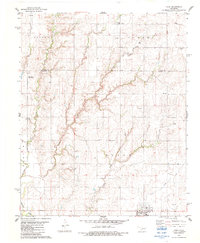
USGS Historical Quadrangle in GeoPDF.
This data set contains imagery from the National Agriculture Imagery Program (NAIP). The NAIP program is administered by USDA FSA and has been established to support two main FSA strategic goals centered on agricultural production. These are, increase stewardship of America's natural resources while enhancing the environment, and to ensure commodities are procured and distributed effectively and efficiently to increase food security. The NAIP program supports these goals by acquiring and providing ortho imagery that has been collected during the agricultural growing season in the U.S. The NAIP ortho imagery is tailored to meet FSA requirements and is a fundamental tool used to support FSA farm and conservation programs....
This data set contains imagery from the National Agriculture Imagery Program (NAIP). The NAIP program is administered by USDA FSA and has been established to support two main FSA strategic goals centered on agricultural production. These are, increase stewardship of America's natural resources while enhancing the environment, and to ensure commodities are procured and distributed effectively and efficiently to increase food security. The NAIP program supports these goals by acquiring and providing ortho imagery that has been collected during the agricultural growing season in the U.S. The NAIP ortho imagery is tailored to meet FSA requirements and is a fundamental tool used to support FSA farm and conservation programs....
|

|
