Filters: Tags: Crow (X)
65 results (23ms)|
Filters
Date Range
Types Contacts
Categories Tag Types Tag Schemes |
A tailings reprocessing leach plant north of Ash Peak.
Categories: Data;
Tags: 1990s,
Arizona,
Arthur Murphy,
Ash Peak metallic mineral dist.,
Black Beauty,
The Shamrock headframe shown with conveyor and mine buildings.
Categories: Data;
Tags: 1980s,
Arizona,
Arthur Murphy,
Ash Peak metallic mineral dist.,
Black Beauty,
Looking NW along strike of the Ash Peak vein.
Categories: Data;
Tags: 1980s,
Arizona,
Arthur Murphy,
Ash Peak metallic mineral dist.,
Black Beauty,
ADMMR map collection: Ash Peak Project Cross Section Through Hardy Shaft; 1 in. to 100 feet; 24 x 37 in.
ADMMR map collection: Ash Peak Project Plan Map; 1 in. to 500 feet; 45 x 30 in.
The 'Ash Peak: Long Hole Drilling Plan' file is part of the A. F. Budge Mining Ltd. Mining collection. A. F. Budge Mining Ltd., a British company owned by Tony Budge, controlled properties across several western U. S. states and northern Mexico. The company was active in Arizona during the 1980s and into the early 1990s. The collection consists of economic geologic information including maps, logs, reports and records. A few properties make up most of the collection: Vulture, United Verde Extension and Korn Kob.
Categories: Data;
Tags: 1980s,
Arizona,
Arthur Murphy,
Ash Peak metallic mineral dist.,
Black Beauty,
The 'Arizona Flux Mine Agreement' file is part of the A. F. Budge Mining Ltd. Mining collection. A. F. Budge Mining Ltd., a British company owned by Tony Budge, controlled properties across several western U. S. states and northern Mexico. The company was active in Arizona during the 1980s and into the early 1990s. The collection consists of economic geologic information including maps, logs, reports and records. A few properties make up most of the collection: Vulture, United Verde Extension and Korn Kob.
Categories: Data;
Tags: 1980s,
Arizona,
Arthur Murphy,
Ash Peak metallic mineral dist.,
Black Beauty,
This data set contains imagery from the National Agriculture Imagery Program (NAIP). The NAIP program is administered by USDA FSA and has been established to support two main FSA strategic goals centered on agricultural production. These are increase stewardship of America's natural resources while enhancing the environment, and to ensure commodities are procured and distributed effectively and efficiently to increase food security. The NAIP program supports these goals by acquiring and providing ortho imagery that has been collected during the agricultural growing season in the U.S. The NAIP ortho imagery is tailored to meet FSA requirements and is a fundamental tool used to support FSA farm and conservation programs....
A view east to the Shamrock Shaft and the silica crushing plant.
Categories: Data;
Tags: 1990s,
Arizona,
Arthur Murphy,
Ash Peak metallic mineral dist.,
Black Beauty,
Looking NW along the strike of the Ash Peak vein.
Categories: Data;
Tags: 1980s,
Arizona,
Arthur Murphy,
Ash Peak metallic mineral dist.,
Black Beauty,
An ore pass, underground at the Ash Peak mine with truck in the background.
Categories: Data;
Tags: 1990s,
Arizona,
Arthur Murphy,
Ash Peak metallic mineral dist.,
Black Beauty,
ADMMR map collection: Ash Peak Mines, Vertical Projection through Shafts; 1 in. to 200 feet; 50 x 26 in.
The 'Ash Peak Legal Agreements' file is part of the A. F. Budge Mining Ltd. Mining collection. A. F. Budge Mining Ltd., a British company owned by Tony Budge, controlled properties across several western U. S. states and northern Mexico. The company was active in Arizona during the 1980s and into the early 1990s. The collection consists of economic geologic information including maps, logs, reports and records. A few properties make up most of the collection: Vulture, United Verde Extension and Korn Kob.
Categories: Data;
Tags: 1980s,
Arizona,
Arthur Murphy,
Ash Peak metallic mineral dist.,
Black Beauty,
Close-up of a vein at the Ash Peak mine.
Categories: Data;
Tags: 1990s,
Arizona,
Arthur Murphy,
Ash Peak metallic mineral dist.,
Black Beauty,
View looking east of the Silica Crushing plant and the Shamrock headframe.
Categories: Data;
Tags: 1990s,
Arizona,
Arthur Murphy,
Ash Peak metallic mineral dist.,
Black Beauty,
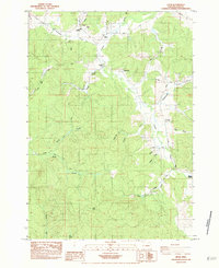
USGS Historical Quadrangle in GeoPDF.
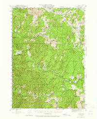
USGS Historical Quadrangle in GeoPDF.
The 'Ash Peak: SDS Drilling Bills' file is part of the A. F. Budge Mining Ltd. Mining collection. A. F. Budge Mining Ltd., a British company owned by Tony Budge, controlled properties across several western U. S. states and northern Mexico. The company was active in Arizona during the 1980s and into the early 1990s. The collection consists of economic geologic information including maps, logs, reports and records. A few properties make up most of the collection: Vulture, United Verde Extension and Korn Kob.
Categories: Data;
Tags: 1980s,
Arizona,
Arthur Murphy,
Ash Peak metallic mineral dist.,
Black Beauty,
The 'Ash Peak: Topos' file is part of the A. F. Budge Mining Ltd. Mining collection. A. F. Budge Mining Ltd., a British company owned by Tony Budge, controlled properties across several western U. S. states and northern Mexico. The company was active in Arizona during the 1980s and into the early 1990s. The collection consists of economic geologic information including maps, logs, reports and records. A few properties make up most of the collection: Vulture, United Verde Extension and Korn Kob.
Categories: Data;
Tags: 1980s,
Arizona,
Arthur Murphy,
Ash Peak metallic mineral dist.,
Black Beauty,
Wes Billingsley, mine manager, underground at the Ash Peak Mine.
Categories: Data;
Tags: 1990s,
Arizona,
Arthur Murphy,
Ash Peak metallic mineral dist.,
Black Beauty,
|

|
