Filters: Tags: Cutblocks (X) > partyWithName: Eve Flager (X)
1 result (9ms)|
Filters
Date Range
Tag Schemes |
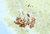
This is a spatial layer that reflects operational activities for cut blocks contained within harvesting authorities. The Forest Tenures Section (FTS) is responsible for the creation and maintenance of digital Forest Atlas files for the province of British Columbia encompassing Forest and Range Act Tenures. It also supports the forest resources programs delivered by MoFR. Each feature contains a Ministry of Forests and Range (MoFR) FEATURE_CLASS_SKEY (number) column that further defines the type of that feature. The layer contains cut block boundaries for the following feature classes: Forest Licence Cut Block (555), Licence to Cut Cut Block (616), Timber Licence Cut Block (810), Timber Sale Licence Major Cut Block...
|

|
