Filters: Tags: Disease (X)
144 results (96ms)|
Filters
|

This dataset is a compilation of forest insect, disease and abiotic damage mapped by aerial detection surveys on forested areas in the United States. At this time, the National Aerial Survey Data Standards require only mortality and defoliation data be collected and reported. However, many cooperators collect data on other types of damage and therefore, the national database has been designed to accommodate these data. Low-level flights, typically 1,000 to 2,000 feet above ground level, are used to map forest damage. Observers use paper maps, typically 1:100,000 scale USGS maps, upon which they record the damage. There is also a digital sketchmap system that may be used. The digital system uses GPS to display the...

This dataset shows the locations of forest dieback documented in the 2010 paper: Allen , C. D., Macalady, A. K., Chenchouni, H., Bachelet, D., McDowell, N, Vennetier, M , Kitzberger, T, Rigling, A, Breshears, D. D., Hogg, E.H., Gonzalez, P., Fensham, R., Zhang, Z. , Castro, J, Demidova, N., Lim, J. H., Allard, G., Running, S. W., Semerci, A., Cobb, N. 2010. A global overview of drought and heat-induced tree mortality reveals emerging climate change risks for forests. Forest Ecology and Management 259(4): 660-684

This dataset is a compilation of forest insect, disease and abiotic damage mapped by aerial detection surveys on forested areas in the United States. At this time, the National Aerial Survey Data Standards require only mortality and defoliation data be collected and reported. However, many cooperators collect data on other types of damage and therefore, the national database has been designed to accommodate these data. Low-level flights, typically 1,000 to 2,000 feet above ground level, are used to map forest damage. Observers use paper maps, typically 1:100,000 scale USGS maps, upon which they record the damage. There is also a digital sketchmap system that may be used. The digital system uses GPS to display the...

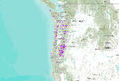
USFS Region 6 forest insect and disease aerial detection survey, including years 2007-11. Clipped to SWO. Each year, all forested federal, state and private land in Oregon and Washington are aerially surveyed for insect and disease damage. This survey is flown cooperatively by the Region 6 US Forest Service, Forest Insects and Diseases group; the Oregon Department of Forestry, Insect and Disease Section; and the Washington Department of Natural Resources. This data is collected to determine regional insect and disease trends and to serve as an indicator to land owners/managers on insect and disease activity in their area.
This map shows the classes, vegetation departure, current/future landscape intactness, current/future change agents, and potential for change for the Visual Resource Management (VRM) in the study area. These data are provided by Bureau of Land Management (BLM) "as is" and may contain errors or omissions. The User assumes the entire risk associated with its use of these data and bears all responsibility in determining whether these data are fit for the User's intended use. These data may not have the accuracy, resolution, completeness, timeliness, or other characteristics appropriate for applications that potential users of the data may contemplate. The User is encouraged to carefully consider the content of the...
This map shows the distribution, vegetation departure, current/future landscape intactness, current/future change agents, and potential for change of Northern Goshawk Habitat in the study area. These data are provided by Bureau of Land Management (BLM) "as is" and may contain errors or omissions. The User assumes the entire risk associated with its use of these data and bears all responsibility in determining whether these data are fit for the User's intended use. These data may not have the accuracy, resolution, completeness, timeliness, or other characteristics appropriate for applications that potential users of the data may contemplate. The User is encouraged to carefully consider the content of the metadata...
WHISPers stands for Wildlife Health Information Sharing Partnership - event reporting system. It is a web-based repository for sharing basic information about historic and ongoing wildlife mortality (death) and morbidity (illness) events. The system possesses a searchable archive of wildlife mortality and morbidity event data that is available to the public. The information is opportunistically collected and does not reflect all the mortality events that occur in North America.
The review provides an overview of the features of the North Sea and the Baltic Sea in their European geographical and socio-political context. To reach sustainability in the wider sense the common society has to meet the 7 tenets - that management actions have to be environmentally sustainable, economically viable, technologically feasible, socially desirable (or at least tolerable), legally permissible, administratively achievable and politically expedient. Each of these are explained and discussed using examples from the two seas including pollution control, physical resource exploitation (such as aggregates, habitat loss, renewable energy and oil and gas), and biological resources exploitation (fisheries and...
Categories: Publication;
Types: Citation;
Tags: Disease,
Population,
Sage-grouse,
conservation,
footprint,

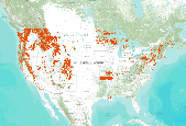
The 2006 National Insect and Disease Risk Map (NIDRM) Project integrates 188 individual risk models constructed within a common, consistent framework that accounts for regional variations in current and future forest health. The 2006 risk assessment, conducted within the contiguous United States and Alaska, provides a consistent, repeatable, transparent process through which interactive spatial and temporal risk assessments can be conducted at various scales to aid in the allocation of resources for forest health management. This modeling process is intended to increase the utilization of forest health risk maps within and outside the National Forest System and encourage development of future risk maps. NIDRM...
This dataset is a compilation of forest insect, disease and abiotic damage mapped by aerial detection surveys on forested areas in the United States. At this time, the National Aerial Survey Data Standards require only mortality and defoliation data be collected and reported. However, many cooperators collect data on other types of damage and therefore, the national database has been designed to accommodate these data. Low-level flights, typically 1,000 to 2,000 feet above ground level, are used to map forest damage. Observers use paper maps, typically 1:100,000 scale USGS maps, upon which they record the damage. There is also a digital sketchmap system that may be used. The digital system uses GPS to display the...
This dataset is a compilation of forest insect, disease and abiotic damage mapped by aerial detection surveys on forested areas in the United States. At this time, the National Aerial Survey Data Standards require only mortality and defoliation data be collected and reported. However, many cooperators collect data on other types of damage and therefore, the national database has been designed to accommodate these data. Low-level flights, typically 1,000 to 2,000 feet above ground level, are used to map forest damage. Observers use paper maps, typically 1:100,000 scale USGS maps, upon which they record the damage. There is also a digital sketchmap system that may be used. The digital system uses GPS to display the...

This dataset is a compilation of forest insect, disease and abiotic damage mapped by aerial detection surveys on forested areas in the United States. At this time, the National Aerial Survey Data Standards require only mortality and defoliation data be collected and reported. However, many cooperators collect data on other types of damage and therefore, the national database has been designed to accommodate these data. Low-level flights, typically 1,000 to 2,000 feet above ground level, are used to map forest damage. Observers use paper maps, typically 1:100,000 scale USGS maps, upon which they record the damage. There is also a digital sketchmap system that may be used. The digital system uses GPS to display the...

The acquisition of forest parameters by host species distributions is a significant factor in the identification of areas at risk of mortality to a particular agent. The most readily-available forest type maps do not contain enough location-specific information for insect and disease risk assessments, in particular species' age and stocking. Estimates for total and individual species' basal area (BA), quadratic mean diameter (QMD), stand density index (SDI), percent host composition, and predominant canopy position were developed for all 57 tree species and species groups modeled for the National Insect and Disease Risk Map. After extensively testing various interpolation methods, the Risk Map Integration Team...

This data represents areas of forest damage due to insect infestation, fire, flood, landslides, windthrow and other mortalities. The information was collected by aerial surveys by both the USFS and ADNR, Div. of Forestry in cooperation with the Forest Health Protection (FHP) project. Surveys are conducted in July and August so that pest "signatures" may be obtained during the optimal period for symptom development of ocular estimation. The aerial survey is coordinated with known pest outbreaks so that the maximum extent of recent bark beetle damage (fading trees) and insect defoliation (discoloration, foliage loss) patterns may be determined. Aerial survey flights are termed as "local" if they can be completed...

This data represents areas of forest damage due to insect infestation, fire, flood, landslides, windthrow and other mortalities. The information was collected by aerial surveys by both the USFS and ADNR, Div. of Forestry in cooperation with the Forest Health Protection (FHP) project. Surveys are conducted in July and August so that pest "signatures" may be obtained during the optimal period for symptom development of ocular estimation. The aerial survey is coordinated with known pest outbreaks so that the maximum extent of recent bark beetle damage (fading trees) and insect defoliation (discoloration, foliage loss) patterns may be determined. Aerial survey flights are termed as "local" if they can be completed...

This dataset provides a watershed index of surface drinking water importance, a watershed index of forest importance to surface drinking water, and a watershed index to highlight the extent to which development, fire, and insects and disease threaten forests important for surface drinking water. This tabular dataset is meant to be joined with the NRCS Watershed Boundary Dataset HUC-12. The results of this assessment provides information that can identify areas of interest for protecting surface drinking water quality. The spatial dataset can be incorporated into broad-scale planning, such as the State Forest Action Plans, and can be incorporated into existing decision support tools that currently lack spatial data...

The 2006 National Insect and Disease Risk Map (NIDRM) Project integrates 188 individual risk models constructed within a common, consistent framework that accounts for regional variations in current and future forest health. The 2006 risk map assessment, utilized within the contiguous United States and Alaska, provides a consistent, repeatable, transparent process through which interactive spatial and temporal risk assessments can be conducted at various scales to aid in the allocation of resources for forest health management. This modeling process is intended to increase the utilization of forest health risk maps within and outside the National Forest System and encourage development of future risk maps. NIDRM...
This map shows the distribution, vegetation departure, current/future landscape intactness, current/future change agents, and potential for change of Ferruginous Hawk Habitat in the study area. These data are provided by Bureau of Land Management (BLM) "as is" and may contain errors or omissions. The User assumes the entire risk associated with its use of these data and bears all responsibility in determining whether these data are fit for the User's intended use. These data may not have the accuracy, resolution, completeness, timeliness, or other characteristics appropriate for applications that potential users of the data may contemplate. The User is encouraged to carefully consider the content of the metadata...
The diagnosis of bacterial disease in freshwater unionid mussels has been hindered by a lack of baseline information regarding the microbial communities associated with these animals. In this study, we cultured and identified bacteria from the hemolymph of stable mussel populations from the upper Mississippi River basin and compared results to mussel populations associated with a mortality event in the Clinch River, VA and TN. Several bacterial genera were consistently identified across mussel species and locations, appearing to be part of the natural bacterial flora. One noteworthy isolate was identified from the Clinch River. Yokenella regensbergei was found with relatively high prevalence during the mortality...
Categories: Data;
Tags: Bacteria,
Clinch River, Virginia, USA,
Clinch River,Tennessee, USA,
Hemolymph,
USGS Science Data Catalog (SDC),
These data are associated with an article published in Global Ecology and Conservation (https://doi.org/10.1016/j.gecco.2020.e01173) that describes climate's cascading effects on disease, predation, and hatching sucess in the Yosemite toad (Anaxyrus canorus). The Yosemite toad currently is federally listed as threatened under the U.S. Endanered Species Act based upon reported population declines and vulnerability to climate and other global-change factors. The species occurs only in California’s central Sierra Nevada at medium to sub-alpine elevations. Lands throughout its range largely are protected from development, but climate and other global-change factors potentially can limit populations.
Categories: Data;
Tags: Inyo National Forest,
Saprolegnia diclina,
Sierra Nevada,
Sierra Nevada,
Tioga Pass, CA,
|

|
