Filters: Tags: Fall Creek (X)
52 results (58ms)|
Filters
Date Range
Extensions Types Contacts
Categories Tag Types
|
This data set contains imagery from the National Agriculture Imagery Program (NAIP). The NAIP program is administered by USDA FSA and has been established to support two main FSA strategic goals centered on agricultural production. These are, increase stewardship of America's natural resources while enhancing the environment, and to ensure commodities are procured and distributed effectively and efficiently to increase food security. The NAIP program supports these goals by acquiring and providing ortho imagery that has been collected during the agricultural growing season in the U.S. The NAIP ortho imagery is tailored to meet FSA requirements and is a fundamental tool used to support FSA farm and conservation programs....
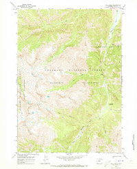
The Middle Fork Willamette River basin encompasses 3,548 square kilometers of western Oregon and drains to the mainstem Willamette River. Fall Creek basin encompasses 653 square kilometers and drains to the Middle Fork Willamette River. In cooperation with the U.S. Army Corps of Engineers, the U.S. Geological Survey evaluated geomorphic responses of downstream river corridors to annual drawdowns to streambed at Fall Creek Lake. This study of geomorphic change is focused on the major alluvial channel segments downstream of the U.S. Army Corps of Engineers’ dams on Fall Creek and the Middle Fork Willamette River, as well as the 736 hectare Fall Creek Lake. Reservoir erosion during streambed drawdown results in sediment...
Categories: Data;
Types: Downloadable,
GeoTIFF,
Map Service,
Raster;
Tags: Fall Creek,
Fall Creek Lake,
Jasper, Oregon,
Lane County,
Middle Fork Willamette River,
USGS Historical Quadrangle in GeoPDF.
This data is comprised of representative chloride values Seneca and Cayuga Lakes and their tributaries from many sources.
Data are the result of fixed-area, time-constrained searches for terrestrial salamanders within and nearby a wildfire-affected area of the Willamette National Forest, OR. The spatial extent of the study was within one kilometer of the border of the Clark fire that burned an area of 2,009 ha in 2003. Site surveys occurred during March and April, 2005. An important feature of the data is that 100m2 sub-plots (nested within plots) were repeatedly searched for terrestrial salamanders independently up to nine times so that variation in the probability of capture could be estimated and accounted for concurrent with estimates of occupancy probability.
This dataset contains raster grids of inundation depth for 15 modeled water-surface profiles at 5 flood frequencies (50- , 10- , 2- , 1- , and 0.2-percent annual exceedance probabilities, or 2- , 10- , 50- , 100- , and 500-year recurrence intervals) and 3 lake levels (representing average conditions, a 2-year-high condition, and a 100-year-high condition).
Categories: Data;
Types: Downloadable,
GeoTIFF,
Map Service,
Raster;
Tags: Cascadilla Creek,
Cayuga Inlet,
Cayuga Lake,
Fall Creek,
Inundation map,
The Middle Fork Willamette River Basin encompasses 3,548 square kilometers of western Oregon and drains to the mainstem Willamette River. Fall Creek Basin encompasses 653 square kilometers and drains to the Middle Fork Willamette River. In cooperation with the U.S. Army Corps of Engineers, the U.S. Geological Survey evaluated geomorphic responses of downstream river corridors to annual drawdowns to streambed at Fall Creek Lake. This study of geomorphic change is focused on the major alluvial channel segments downstream of the U.S. Army Corps of Engineers dams including the lowermost 11.5 km of Fall Creek and 27.3 km of the Middle Fork Willamette River, as well as Fall Creek Lake. GIS layers defining the landforms,...
This data set contains imagery from the National Agriculture Imagery Program (NAIP). The NAIP program is administered by USDA FSA and has been established to support two main FSA strategic goals centered on agricultural production. These are, increase stewardship of America's natural resources while enhancing the environment, and to ensure commodities are procured and distributed effectively and efficiently to increase food security. The NAIP program supports these goals by acquiring and providing ortho imagery that has been collected during the agricultural growing season in the U.S. The NAIP ortho imagery is tailored to meet FSA requirements and is a fundamental tool used to support FSA farm and conservation programs....
The Middle Fork Willamette River Basin encompasses 3,548 square kilometers of western Oregon and drains to the mainstem Willamette River. Fall Creek Basin encompasses 653 square kilometers and drains to the Middle Fork Willamette River. In cooperation with the U.S. Army Corps of Engineers, the U.S. Geological Survey evaluated geomorphic responses of downstream river corridors to annual drawdowns to streambed at Fall Creek Lake. This study of geomorphic change is focused on the major alluvial channel segments downstream of the U.S. Army Corps of Engineers dams including the lowermost 11.5 km of Fall Creek and 27.3 km of the Middle Fork Willamette River, as well as Fall Creek Lake. This dataset is delivered as one...
The Middle Fork Willamette River basin encompasses 3,548 square kilometers of western Oregon and drains to the mainstem Willamette River. Fall Creek basin encompasses 653 square kilometers and drains to the Middle Fork Willamette River. In cooperation with the U.S. Army Corps of Engineers, the U.S. Geological Survey evaluated geomorphic responses of downstream river corridors to annual drawdowns to streambed at Fall Creek Lake. This study of geomorphic change is focused on the major alluvial channel segments downstream of the U.S. Army Corps of Engineers’ dams on Fall Creek and the Middle Fork Willamette River, as well as the 736 hectare Fall Creek Lake. Reservoir erosion during streambed drawdown results in sediment...
USGS Historical Quadrangle in GeoPDF.
USGS Historical Quadrangle in GeoPDF.
In June 2017, Lake Sturgeon were observed spawning in Fall Creek, a tributary to Cayuga Lake, NY. The spawning site was just downstream of Ithaca Falls, the first impassible barrier. Data were collected to quantify the stream habitat use by the Lake Sturgeon. These were the first sturgeon observed spawning in a Cayuga Lake tributary recorded in the New York Department of Environmental Conservation historical fish records. Habitat and egg deposition data were collected at 10 stations on 15 cross stream transects, spaced at least 10 m apart. Eggs were collected with using 7 cm diameter core sampler at least 3 stations on each transect. Water depth, stream velocity, and substrate composition data were collected at...
Categories: Data;
Tags: Acipenser fulvescens,
Aquatic Biology,
Available Habitat,
Cayuga Lake,
Community Ecology,
This data set contains imagery from the National Agriculture Imagery Program (NAIP). The NAIP program is administered by USDA FSA and has been established to support two main FSA strategic goals centered on agricultural production. These are increase stewardship of America's natural resources while enhancing the environment, and to ensure commodities are procured and distributed effectively and efficiently to increase food security. The NAIP program supports these goals by acquiring and providing ortho imagery that has been collected during the agricultural growing season in the U.S. The NAIP ortho imagery is tailored to meet FSA requirements and is a fundamental tool used to support FSA farm and conservation programs....
The Middle Fork Willamette River basin encompasses 3,548 square kilometers of western Oregon and drains to the mainstem Willamette River. Fall Creek basin encompasses 653 square kilometers and drains to the Middle Fork Willamette River. In cooperation with the U.S. Army Corps of Engineers, the U.S. Geological Survey evaluated geomorphic responses of downstream river corridors to annual drawdowns to streambed at Fall Creek Lake. This study of geomorphic change is focused on the major alluvial channel segments downstream of the U.S. Army Corps of Engineers’ dams on Fall Creek and the Middle Fork Willamette River, as well as the 736 hectare Fall Creek Lake. Reservoir erosion during streambed drawdown results in sediment...
The Middle Fork Willamette River basin encompasses 3,548 square kilometers of western Oregon and drains to the mainstem Willamette River. Fall Creek basin encompasses 653 square kilometers and drains to the Middle Fork Willamette River. In cooperation with the U.S. Army Corps of Engineers, the U.S. Geological Survey evaluated geomorphic responses of downstream river corridors to annual drawdowns to streambed at Fall Creek Lake. This study of geomorphic change is focused on the major alluvial channel segments downstream of the U.S. Army Corps of Engineers’ dams on Fall Creek and the Middle Fork Willamette River, as well as the 736 hectare Fall Creek Lake. Reservoir erosion during streambed drawdown results in sediment...
This data set contains imagery from the National Agriculture Imagery Program (NAIP). The NAIP program is administered by USDA FSA and has been established to support two main FSA strategic goals centered on agricultural production. These are, increase stewardship of America's natural resources while enhancing the environment, and to ensure commodities are procured and distributed effectively and efficiently to increase food security. The NAIP program supports these goals by acquiring and providing ortho imagery that has been collected during the agricultural growing season in the U.S. The NAIP ortho imagery is tailored to meet FSA requirements and is a fundamental tool used to support FSA farm and conservation programs....
The Middle Fork Willamette River basin encompasses 3,548 square kilometers of western Oregon and drains to the mainstem Willamette River. Fall Creek basin encompasses 653 square kilometers and drains to the Middle Fork Willamette River. In cooperation with the U.S. Army Corps of Engineers, the U.S. Geological Survey evaluated geomorphic responses of downstream river corridors to annual drawdowns to streambed at Fall Creek Lake. This study of geomorphic change is focused on the major alluvial channel segments downstream of the U.S. Army Corps of Engineers’ dams on Fall Creek and the Middle Fork Willamette River, as well as the 736 hectare Fall Creek Lake. Reservoir erosion during streambed drawdown results in sediment...
This dataset contains inundation boundary polygons for 15 modeled water-surface profiles at 5 flood frequencies (50- , 10- , 2- , 1- , and 0.2-percent annual exceedance probabilities, or 2- , 10- , 50- , 100- , and 500-year recurrence intervals) and 3 lake levels (representing average conditions, a 2-year-high condition, and a 100-year-high condition).
Categories: Data;
Types: Downloadable,
Map Service,
OGC WFS Layer,
OGC WMS Layer,
Shapefile;
Tags: Cascadilla Creek,
Cayuga Inlet,
Cayuga Lake,
Fall Creek,
Inundation map,
In the Willamette River Basin in northwestern Oregon, stream temperature has been altered by 13 dams operated by the U.S. Army Corps of Engineers (USACE), negatively influencing threatened populations of native salmonids. CE-QUAL-W2, a two-dimensional, hydrodynamic water quality model, has been used to investigate temperature and heat patterns in the Willamette River and the downstream effects of dam operations and other anthropogenic effects on heat and stream temperature. This data release includes the input and output files for six CE-QUAL-W2 models that include Fall Creek downstream of Fall Creek Dam, the Row River downstream of Dorena Dam, the Coast Fork Willamette River downstream of Cottage Grove Dam, the...
Categories: Data Release - Revised;
Tags: Benton County,
CE-QUAL-W2 model,
Clackamas County,
Coast Fork Willamette River,
Fall Creek,
|

|
