Filters: Tags: Geographic Information System (X) > Date Range: {"choice":"month"} (X)
761 results (16ms)|
Filters
Date Types (for Date Range)
Types Contacts Categories Tag Types Tag Schemes |
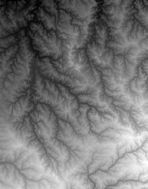
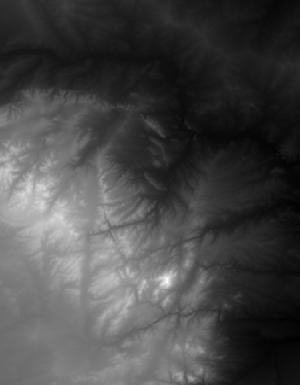
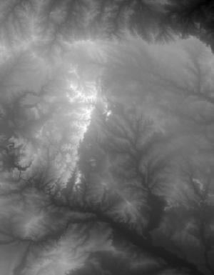
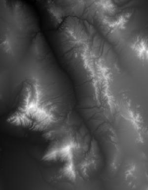
This tile of the 3D Elevation Program (3DEP) seamless products is 1 Arc Second resolution. 3DEP data serve as the elevation layer of The National Map, and provide basic elevation information for Earth science studies and mapping applications in the United States. Scientists and resource managers use 3DEP data for global change research, hydrologic modeling, resource monitoring, mapping and visualization, and many other applications. 3DEP data compose an elevation dataset that consists of seamless layers and a high resolution layer. Each of these layers consists of the best available raster elevation data of the conterminous United States, Alaska, Hawaii, territorial islands, Mexico and Canada. 3DEP data are updated...
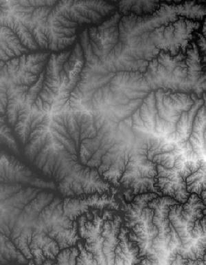
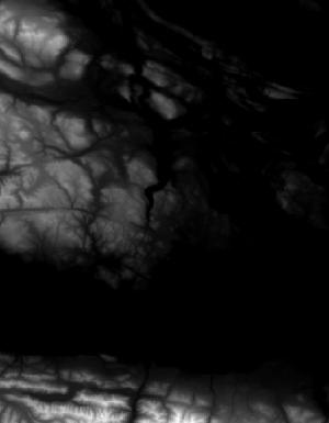
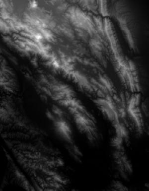
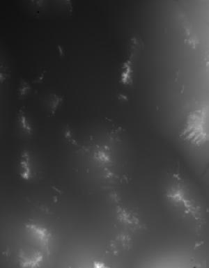
This tile of the 3D Elevation Program (3DEP) seamless products is 1/3 Arc Second resolution. 3DEP data serve as the elevation layer of The National Map, and provide basic elevation information for Earth science studies and mapping applications in the United States. Scientists and resource managers use 3DEP data for global change research, hydrologic modeling, resource monitoring, mapping and visualization, and many other applications. 3DEP data compose an elevation dataset that consists of seamless layers and a high resolution layer. Each of these layers consists of the best available raster elevation data of the conterminous United States, Alaska, Hawaii, territorial islands, Mexico and Canada. 3DEP data are updated...
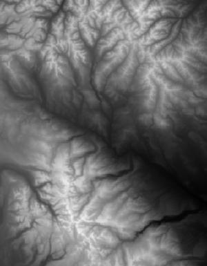
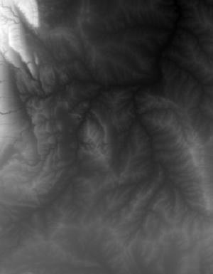
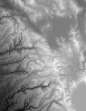
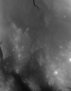
This tile of the 3D Elevation Program (3DEP) seamless products is 1/3 Arc Second resolution. 3DEP data serve as the elevation layer of The National Map, and provide basic elevation information for Earth science studies and mapping applications in the United States. Scientists and resource managers use 3DEP data for global change research, hydrologic modeling, resource monitoring, mapping and visualization, and many other applications. 3DEP data compose an elevation dataset that consists of seamless layers and a high resolution layer. Each of these layers consists of the best available raster elevation data of the conterminous United States, Alaska, Hawaii, territorial islands, Mexico and Canada. 3DEP data are updated...
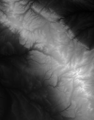
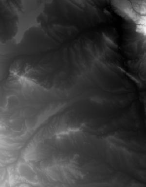
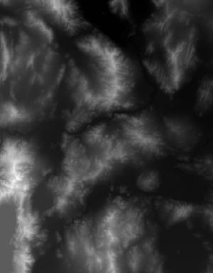
This tile of the 3D Elevation Program (3DEP) seamless products is 1 Arc Second resolution. 3DEP data serve as the elevation layer of The National Map, and provide basic elevation information for Earth science studies and mapping applications in the United States. Scientists and resource managers use 3DEP data for global change research, hydrologic modeling, resource monitoring, mapping and visualization, and many other applications. 3DEP data compose an elevation dataset that consists of seamless layers and a high resolution layer. Each of these layers consists of the best available raster elevation data of the conterminous United States, Alaska, Hawaii, territorial islands, Mexico and Canada. 3DEP data are updated...
This tile of the 3D Elevation Program (3DEP) seamless products is 1 Arc Second resolution. 3DEP data serve as the elevation layer of The National Map, and provide basic elevation information for Earth science studies and mapping applications in the United States. Scientists and resource managers use 3DEP data for global change research, hydrologic modeling, resource monitoring, mapping and visualization, and many other applications. 3DEP data compose an elevation dataset that consists of seamless layers and a high resolution layer. Each of these layers consists of the best available raster elevation data of the conterminous United States, Alaska, Hawaii, territorial islands, Mexico and Canada. 3DEP data are updated...
This tile of the 3D Elevation Program (3DEP) seamless products is 1 Arc Second resolution. 3DEP data serve as the elevation layer of The National Map, and provide basic elevation information for Earth science studies and mapping applications in the United States. Scientists and resource managers use 3DEP data for global change research, hydrologic modeling, resource monitoring, mapping and visualization, and many other applications. 3DEP data compose an elevation dataset that consists of seamless layers and a high resolution layer. Each of these layers consists of the best available raster elevation data of the conterminous United States, Alaska, Hawaii, territorial islands, Mexico and Canada. 3DEP data are updated...

This tile of the 3D Elevation Program (3DEP) seamless products is 13 arc-second resolution. 3DEP data serve as the elevation layer of The National Map, and provide basic elevation information for Earth science studies and mapping applications in the United States. Scientists and resource managers use 3DEP data for global change research, hydrologic modeling, resource monitoring, mapping and visualization, and many other applications. 3DEP data compose an elevation dataset that consists of seamless layers and a high resolution layer. Each of these layers consists of the best available raster elevation data of the conterminous United States, Alaska, Hawaii, territorial islands, Mexico and Canada. 3DEP data are updated...
This tile of the 3D Elevation Program (3DEP) seamless products is 1/3 Arc Second resolution. 3DEP data serve as the elevation layer of The National Map, and provide basic elevation information for Earth science studies and mapping applications in the United States. Scientists and resource managers use 3DEP data for global change research, hydrologic modeling, resource monitoring, mapping and visualization, and many other applications. 3DEP data compose an elevation dataset that consists of seamless layers and a high resolution layer. Each of these layers consists of the best available raster elevation data of the conterminous United States, Alaska, Hawaii, territorial islands, Mexico and Canada. 3DEP data are updated...
This tile of the 3D Elevation Program (3DEP) seamless products is 1/3 Arc Second resolution. 3DEP data serve as the elevation layer of The National Map, and provide basic elevation information for Earth science studies and mapping applications in the United States. Scientists and resource managers use 3DEP data for global change research, hydrologic modeling, resource monitoring, mapping and visualization, and many other applications. 3DEP data compose an elevation dataset that consists of seamless layers and a high resolution layer. Each of these layers consists of the best available raster elevation data of the conterminous United States, Alaska, Hawaii, territorial islands, Mexico and Canada. 3DEP data are updated...
This tile of the 3D Elevation Program (3DEP) seamless products is 1/3 Arc Second resolution. 3DEP data serve as the elevation layer of The National Map, and provide basic elevation information for Earth science studies and mapping applications in the United States. Scientists and resource managers use 3DEP data for global change research, hydrologic modeling, resource monitoring, mapping and visualization, and many other applications. 3DEP data compose an elevation dataset that consists of seamless layers and a high resolution layer. Each of these layers consists of the best available raster elevation data of the conterminous United States, Alaska, Hawaii, territorial islands, Mexico and Canada. 3DEP data are updated...
This tile of the 3D Elevation Program (3DEP) seamless products is 1 Arc Second resolution. 3DEP data serve as the elevation layer of The National Map, and provide basic elevation information for Earth science studies and mapping applications in the United States. Scientists and resource managers use 3DEP data for global change research, hydrologic modeling, resource monitoring, mapping and visualization, and many other applications. 3DEP data compose an elevation dataset that consists of seamless layers and a high resolution layer. Each of these layers consists of the best available raster elevation data of the conterminous United States, Alaska, Hawaii, territorial islands, Mexico and Canada. 3DEP data are updated...
Wetland restoration efforts conducted by the Coastal Wetlands Planning, Protection and Restoration Act (CWPPRA) in Louisiana rely on monitoring to determine the efficacy of these projects. The Coastwide Reference Monitoring System (CRMS) was developed to assist in a multiple-reference approach that uses aspects of hydrogeomorphic functional assessments and probabilistic sampling for monitoring. The CRMS program includes a suite of approximately 390 sites that encompass the range of hydrological and ecological conditions for each stratum. As part of CRMS, land and water classifications are created from Digital Orthophoto Quarter Quadrangles (DOQQs) approximately every three years at all CRMS sites. This dataset consists...
Categories: Data;
Types: Downloadable,
GeoTIFF,
Map Service,
Raster;
Tags: CRMS,
DOQQ,
Emergent Wetland,
Forested Wetland,
Geographic Information System,
This tile of the 3D Elevation Program (3DEP) seamless products is 1 Arc Second resolution. 3DEP data serve as the elevation layer of The National Map, and provide basic elevation information for Earth science studies and mapping applications in the United States. Scientists and resource managers use 3DEP data for global change research, hydrologic modeling, resource monitoring, mapping and visualization, and many other applications. 3DEP data compose an elevation dataset that consists of seamless layers and a high resolution layer. Each of these layers consists of the best available raster elevation data of the conterminous United States, Alaska, Hawaii, territorial islands, Mexico and Canada. 3DEP data are updated...
This tile of the 3D Elevation Program (3DEP) seamless products is 1/3 Arc Second resolution. 3DEP data serve as the elevation layer of The National Map, and provide basic elevation information for Earth science studies and mapping applications in the United States. Scientists and resource managers use 3DEP data for global change research, hydrologic modeling, resource monitoring, mapping and visualization, and many other applications. 3DEP data compose an elevation dataset that consists of seamless layers and a high resolution layer. Each of these layers consists of the best available raster elevation data of the conterminous United States, Alaska, Hawaii, territorial islands, Mexico and Canada. 3DEP data are updated...
This tile of the 3D Elevation Program (3DEP) seamless products is 1/3 Arc Second resolution. 3DEP data serve as the elevation layer of The National Map, and provide basic elevation information for Earth science studies and mapping applications in the United States. Scientists and resource managers use 3DEP data for global change research, hydrologic modeling, resource monitoring, mapping and visualization, and many other applications. 3DEP data compose an elevation dataset that consists of seamless layers and a high resolution layer. Each of these layers consists of the best available raster elevation data of the conterminous United States, Alaska, Hawaii, territorial islands, Mexico and Canada. 3DEP data are updated...

This tile of the 3D Elevation Program (3DEP) seamless products is 1 Arc Second resolution. 3DEP data serve as the elevation layer of The National Map, and provide basic elevation information for Earth science studies and mapping applications in the United States. Scientists and resource managers use 3DEP data for global change research, hydrologic modeling, resource monitoring, mapping and visualization, and many other applications. 3DEP data compose an elevation dataset that consists of seamless layers and a high resolution layer. Each of these layers consists of the best available raster elevation data of the conterminous United States, Alaska, Hawaii, territorial islands, Mexico and Canada. 3DEP data are updated...
|

|
