Filters: Tags: Grazing (X)
176 results (77ms)|
Filters
Date Range
Extensions (Less)
Types (Less)
Contacts (Less)
Categories (Less) Tag Types
|
Historical disturbance regimes are often considered a critical element in maintaining native plant communities. However, the response of plant communities to disturbance may be fundamentally altered as a consequence of invasive plants, climate change, or prior disturbances. The appropriateness of historical disturbance patterns under modern conditions and the interactions among disturbances are issues that ecologists must address to protect and restore native plant communities. We evaluated the response of Artemisia tridentata ssp. wyomingensis (Beetle & A. Young) S.L. Welsh plant communities to their historical disturbance regime compared to other disturbance regimes. The historical disturbance regime of these...
We investigated experimental warming and simulated grazing (clipping) effects on rangeland quality, as indicated by vegetation production and nutritive quality, in winter-grazed meadows and summer-grazed shrublands on the Tibetan Plateau, a rangeland system experiencing climatic and pastoral land use changes. Warming decreased total aboveground net primary productivity (ANPP) by 40 g.m?�.yr?� at the meadow habitats and decreased palatable ANPP (total ANPP minus non-palatable forb ANPP) by 10 g.m?�.yr?� at both habitats. The decreased production of the medicinal forb Gentiana straminea and the increased production of the non-palatable forb Stellera chamaejasme with warming also reduced rangeland quality. At the shrubland...
Categories: Publication;
Types: Citation,
Journal Citation;
Tags: Ecological Applications,
Tibetan Plateau,
climate warming,
experimental warming,
forage quality,

The RMU_UNIT feature class depicts the boundaries of the range allotments, general resource areas, and wild horse and burro territories on the Prescott National Forest and is part of the USFS Southwestern Region Core Data Project. This project is designed to generate and maintain 15 vertically integrated resource data layers which are standardized across the Southwestern Region. These 15 layers are derived from a Master Arc coverage which maintains vertical integration.The RMU_UNIT feature class depicts the boundaries of the range allotments, general resource areas, and wild horse and burro territories on the Prescott National Forest and is part of the USFS Southwestern Region Core Data Project. This project is...

This data has been collected by the U.S. Bureau of Land Management (BLM) in New Mexico at both the New Mexico State Office and the various field offices. Collection began in the 1980's using the BLM's ADS software to digitize data m the original case files. In the mid to late 1990's the data was converted from ADS to ArcInfo software. Collection continued into the 1990s and has been updated regularly until June 2000 when it was merged into a statewide coverage. In this edition, all updates were made in the area managed by the Carlsbad Field Office. Allotments not included in the first edition were added using on-screen digitizing from case file maps at various scales. Corrections were also made to many allotment...
Tags: allotments,
grazing
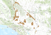
This is an aggregate dataset for the DRECP 12 km buffer region, depicting the geographic boundaries of Grazing Allotments within BLM managed public lands. An allotment is an area of land designated and managed for grazing of livestock (43 CFR 4100.0-5). An allotment may include private, state, and public lands under the jurisdiction of the Bureau of Land Management and/or other federal agencies. An allotment may be subdivided into pastures. Range improvement projects are not depicted within this dataset.
Zonal statistic was used to determine the percentage of Level 2 large Intact Blocks in a grazing allotment.
Grasslands comprise a small part of the Chihuahuan Desert but are vital to the biological diversity of the ecoregion. Characteristic grasses of the Chihuahuan Desert are tobosa (Pleuraphis mutica) and black grama (Bouteloua eriopoda) but other common species include alakali sacaton (Sporobolus airoides), big alkali sacaton (S. wrightii), mesa dropseed (S. flexuosus), blue grama (B. gracilis), sideoats grama (B. curtipendula ), hairy grama (B. hirsuta), slender grama (B. filiformis), chino grama (B. brevista), spruce top grama (B. chondrosioides), bush muhly (Muhlenbergia porteri), several three awns (Aristida spp.), and fluff grass (Dasyochloa pulchela) (Johnson 1974, Dinerstein et al. 2000). Many of the sites discussed...
Categories: Publication;
Types: Citation,
Map Service,
OGC WFS Layer,
OGC WMS Layer,
OGC WMS Service;
Tags: English,
Madrean,
Spanish,
agriculture,
assessment,
This file represents the final version of an assessment of the extent, condition, and distribution of grassland types in Arizona as indicated by expert interviews and field verification. Coverage includes the state of Arizona, Southwestern portions of the state of New Mexico, and the Northern portion of Sonora, Mexico.
Categories: Publication;
Types: Citation,
Map Service,
OGC WFS Layer,
OGC WMS Layer,
OGC WMS Service;
Tags: English,
GIS,
Madrean,
US,
assessment,
What are current conditions for important park natural resources? What are the critical data and knowledge gaps? What are some of the factors that are influencing park resource conditions? Natural Resource Condition Assessments (NRCAs) evaluate and report on the above for a subset of important natural resources in national park units (hereafter, parks). Focal study resources and indicators are selected on a park-by-park basis, guided by use of structured resource assessment and reporting frameworks. Considerations include park resource setting and enabling legislation (what are this park's most important natural resources?) and presently available data and expertise (what can be evaluated at this time?). In addition...
Categories: Data;
Types: ArcGIS REST Map Service,
Map Service,
OGC WFS Layer,
OGC WMS Layer,
OGC WMS Service;
Tags: Chihuahuan Desert,
English,
GIS,
Madrean,
Mojave Desert,
ARS scientists publish results of their research projects in many formats. Listed below are the publications from research projects conducted at this location. Clicking on a publication title will take you to more information on the publication. Clicking on the reprint icon will take you to the publication reprint.
Types: Map Service,
OGC WFS Layer,
OGC WMS Layer,
OGC WMS Service;
Tags: GIS,
climate,
erosion,
fire,
grassland,
Welcome to the Wind and Wildlife Landscape Assessment Tool (LAT), a collaboration organized by the American Wind Wildlife Institute (AWWI) and The Nature Conservancy (TNC). The LAT is designed as a landscape-level planning tool to identify sensitive wildlife habitat and areas that are likely to have low wildlife risk where wind energy development could be prioritized. Although the siting of individual wind energy projects will require on-the-ground surveys to verify data shown here, our hope is that this tool will provide stakeholders with information that facilitates the siting of wind energy in areas with minimal impacts to wildlife, as well as the development of conservation plans, monitoring plans and mitigation...
Types: Map Service,
OGC WFS Layer,
OGC WMS Layer,
OGC WMS Service;
Tags: English,
GIS,
US,
agriculture,
amphibian,
The National Forest Management Act (NFMA) of 1976 requires every national forest or grassland managed by the U.S. Forest Service to develop and maintain a Land and Resource Management Plan (often referred to as a forest plan). The forest plan is the principle long-range guidance document for each forest or grassland, providing direction for project and activity decision making. Forest plans articulate goals and objectives, the kinds of uses that are suitable for areas of a national forest, management standards and guidelines that apply to different kinds of activities, and the designation of special areas like Research Natural Areas. Forest plans are strategic in nature and do not compel any action or authorize...
Types: Map Service,
OGC WFS Layer,
OGC WMS Layer,
OGC WMS Service;
Tags: Arizona,
New Mexico,
desert,
fire,
grassland,
A battery of questions was developed and applied to different stakeholders immersed in knowledge of the condition and the use of grazing of grasslands. One hundred people were surveyed amongst livestock producers (both from private ranches and from communal ejidos), and students and researchers at regional institutions involved in agricultural sciences in different states of Mexico: Coahuila, Durango, San Luis Potosí, and Jalisco. The objective of the survey was to determine aspects of stakeholders’ interpretation of the condition of grasslands in their region under conditions of extensive grazing, such as soil condition, harvest efficiency, vegetation condition, openness to community organizing of grazing, capacity...
Types: Map Service,
OGC WFS Layer,
OGC WMS Layer,
OGC WMS Service;
Tags: Mexico,
Spanish,
cultural,
desertification,
economic,
Maintaining the native prairie lands of the Northern Great Plains (NGP), which provide an important habitat for declining grassland species, requires anticipating the effects of increasing atmospheric carbon dioxide (CO2) concentrations and climate change on the region’s vegetation. Specifically, climate change threatens NGP grasslands by increasing the potential encroachment of native woody species into areas where they were previously only present in minor numbers. This project used a dynamic vegetation model to simulate vegetation type (grassland, shrubland, woodland, and forest) for the NGP for a range of projected future climates and relevant management scenarios. Comparing results of these simulations illustrates...
Categories: Project;
Types: Map Service,
OGC WFS Layer,
OGC WMS Layer,
OGC WMS Service;
Tags: 2012,
Biology,
CASC,
Climate change,
Completed,
The dataset describes rangeland monitoring results from the Hanksville, UT (USA) area. Monitoring results consist of canopy cover of plant species and functional types according to ecological site group from 1967 to 2013. The study area is bordered on the north by the Wayne-Emery County line, on the west by Capitol Reef National Park, and on the south and east by the Colorado River, Glen Canyon National Recreation Area, and Canyonlands National Park. Cover was estimated every 1 to 5 years (except the last measurement that had a 12 year interval) from 1967 to 2013 at 36 permanently marked sites in 15 livestock grazing allotments/pastures. Canopy cover of perennial plant species was estimated to the nearest tenth...
Types: Citation;
Tags: Climate change,
Colorado Plateau,
Ecological sites,
Garfield County,
Grazing,
Annotated bibliography of grazing effects on amphibians and their habitats (ver. 2.0, February 2022)
This database contains literature citations and associated summaries pertaining to livestock grazing effects on amphibians and their habitats, with an emphasis on the Oregon spotted frog (Rana pretiosa) and other listed/sensitive wetland-breeding amphibians in the western United States. This is not meant to be an exhaustive list, nor did we perform a systematic meta-analysis; rather, literature records were included based on topical relevance. *HINT: If you are looking for the database SEARCH TOOL, scroll down to 'Attached Files' and download 'Annotated_bibliography_with_search_tool.accdb.' Open the database file to enter the search form.* This data release supersedes Rowe, J.C., Pearl, C.A., Adams, M.J., and McCreary,...
Categories: Data;
Tags: Aquatic Biology,
Ecology,
Land Use Change,
USGS Science Data Catalog (SDC),
Wildlife Biology,
The distribution of the greater sage-grouse (hereafter sage-grouse; Centrocercus urophasianus) has declined to 56% of its pre-settlement distribution (Schroeder et al. 2004) and abundance of males attending leks has decreased substantially over the past 50 years throughout the species’ range (Garton et al. 2011, Garton et al. 2015, WAFWA 2015). Livestock grazing is a common land use within sage-grouse habitat, and livestock grazing has been implicated by some experts as one of numerous factors contributing to sage-grouse population declines (Beck and Mitchell 2000, Schroeder et al. 2004). However, there are also numerous mechanisms by which livestock grazing might benefit sage-grouse (Beck and Mitchell 2000, Crawford...

This dataset depicts the boundaries of therange allotments, General Resource Areas, and Wild Horse and Burro territorieson the Coronado National Forests. Eachallotment is a designated area of land available for livestock grazing,and may be subdivided into pastures necessary for grazing management.General resource areas are boundaries outside of an established allotment.It is part of the USFS Southwestern Region Core Data Project. Thisproject is designed to generate and maintain 15 vertically integratedresource data layers which are standardized across the Southwestern Region.Associated National Application: Infrastructure (INFRA) RangeINFRA Web Page: http://infra.wo.fs.fed.us/infra/ This dataset was obtained...

This dataset depicts livestock grazing range allotments for the Tiller and Diamond Lake districts on the Umpqua National Forest in Oregon.
This website provides access to active links for data collected at the Santa Rita Experimental Range. Included in the links are access to shapefiles, excel files, raster and other forms of data on precipitation, vegetation, animals and other subjects.
|

|
