Filters: Tags: Great Bend (X)
57 results (14ms)|
Filters
Date Range
Extensions Types Contacts
Categories Tag Types
|
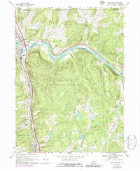
USGS Historical Quadrangle in GeoPDF.
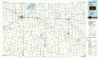
USGS Historical Quadrangle in GeoPDF.
USGS Historical Quadrangle in GeoPDF.
This data set contains imagery from the National Agriculture Imagery Program (NAIP). The NAIP program is administered by USDA FSA and has been established to support two main FSA strategic goals centered on agricultural production. These are, increase stewardship of America's natural resources while enhancing the environment, and to ensure commodities are procured and distributed effectively and efficiently to increase food security. The NAIP program supports these goals by acquiring and providing ortho imagery that has been collected during the agricultural growing season in the U.S. The NAIP ortho imagery is tailored to meet FSA requirements and is a fundamental tool used to support FSA farm and conservation programs....
This data set contains imagery from the National Agriculture Imagery Program (NAIP). The NAIP program is administered by USDA FSA and has been established to support two main FSA strategic goals centered on agricultural production. These are increase stewardship of America's natural resources while enhancing the environment, and to ensure commodities are procured and distributed effectively and efficiently to increase food security. The NAIP program supports these goals by acquiring and providing ortho imagery that has been collected during the agricultural growing season in the U.S. The NAIP ortho imagery is tailored to meet FSA requirements and is a fundamental tool used to support FSA farm and conservation programs....
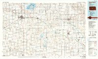
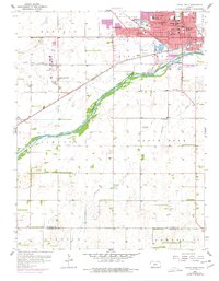
USGS Historical Quadrangle in GeoPDF.
USGS Historical Quadrangle in GeoPDF.
The Lake Powell Coring Project was a USGS research effort, in cooperation with the Utah Department of Environmental Quality, U.S. Bureau of Reclamation, and U.S. National Park Service. In the fall of 2018, hydraulic piston cores targeted sediment that had been deposited in Lake Powell. This large reservoir on the Colorado River in Utah and Arizona was created after the completion of Glen Canyon Dam in 1963. Retrieval and analysis of cores was undertaken in response to the Gold King mine release from the Bonita Peak Mining District in Colorado on August 5, 2015. This event resulted in the containment loss of three-million gallons of mine-impacted waters which flowed from the Animas River into the San Juan River,...
On August 25, 2020, the U.S. Geological Survey conducted a bathymetry survey of a 550 meter long reach of the Black River near Great Bend, New York. The study reach began approximately 1,000 meters upstream from the State Route 26 bridge in Great Bend, New York. Depth data were collected primarily with a 1,200 kilohertz Teledyne RD Instruments RioPro acoustic Doppler current profiler (ADCP) with position data from differential global navigation satellite system (GNSS) Hemisphere V102 DGPS antenna (any use of trade, firm, or product names is for descriptive purposes only and does not imply endorsement by the U.S. Government). Water surface elevations were established using real-time kinematic (RTK) GNSS surveys;...
Categories: Data;
Types: Downloadable,
Map Service,
OGC WFS Layer,
OGC WMS Layer,
Shapefile;
Tags: Black River,
Fort Drum,
GPS measurement,
Geomorphology,
Geospatial Applications,
This data set contains imagery from the National Agriculture Imagery Program (NAIP). The NAIP program is administered by USDA FSA and has been established to support two main FSA strategic goals centered on agricultural production. These are, increase stewardship of America's natural resources while enhancing the environment, and to ensure commodities are procured and distributed effectively and efficiently to increase food security. The NAIP program supports these goals by acquiring and providing ortho imagery that has been collected during the agricultural growing season in the U.S. The NAIP ortho imagery is tailored to meet FSA requirements and is a fundamental tool used to support FSA farm and conservation programs....

USGS Historical Quadrangle in GeoPDF.
High-resolution geophysical mapping of Lake Powell in the Glen Canyon National Recreation Area in Utah and Arizona was conducted between October 8 and November 15, 2017, as part of a collaborative effort between the U.S. Geological Survey and the Bureau of Reclamation to provide high-quality data needed to reassess the area-capacity tables for the Lake Powell reservoir. Seismic data collected during this survey can help to define the rates of deposition within the San Juan and Colorado Rivers, which are the main inflows to Lake Powell. These new data are intended to improve water budget management decisions that affect the natural and recreational resources of the reservoir. Multibeam echosounder bathymetry and...
Categories: Data;
Types: Downloadable,
Map Service,
OGC WFS Layer,
OGC WMS Layer,
Shapefile;
Tags: Antelope Canyon,
BOR,
Bullfrog,
Bullfrog Bay,
Bureau of Reclamation,
This section of the data release includes core log and spectrophotometry data in the format of a comma-separated value (CSV) file (2018LakePowellCoring_CoreLogData.csv). It is Part 3 (of four) in this data release and provides geophysical core logs at 0.5-cm intervals from a Multi-Sensor Core Logger and Konica Minolta spectrophotometer. This CSV includes the depth in section and hole for each logged point, p-wave amplitude and velocity, gamma density, loop- and point-sensor magnetic susceptibility, electrical resistivity, colorspace data, and measured reflectance wavelengths. Drillhole information, such as location and total recovery, are outlined in “Part 1 – Drillhole information from the 2018 coring project in...
Categories: Data;
Types: Map Service,
OGC WFS Layer,
OGC WMS Layer,
OGC WMS Service;
Tags: Animas River,
Antelope Canyon,
Bears Ears National Monument,
Bullfrog,
Bullfrog Bay,
This section of the data release includes core and core section information in the format of a comma-separated value (CSV) file (2018LakePowellCoring_CoreSectionInfo.csv). It is Part 2 (of four) in this data release and provides detailed core information. Complete recovery of a core resulted in approximately 3 m of sediment, which was sectioned into lengths not exceeding 1.5 m shipboard. Thus, all cores with >50% recovery contain multiple sections. This CSV includes drillhole, core, and core section identifiers, section lengths, section tops and bottoms, scaled section tops and bottoms, filenames for corresponding core images, and drilling comments. Drillhole information, such as location and total recovery, are...
Categories: Data;
Types: Map Service,
OGC WFS Layer,
OGC WMS Layer,
OGC WMS Service;
Tags: Animas River,
Antelope Canyon,
Bears Ears National Monument,
Bullfrog,
Bullfrog Bay,
USGS Historical Quadrangle in GeoPDF.
USGS Historical Quadrangle in GeoPDF.
USGS Historical Quadrangle in GeoPDF.
USGS Historical Quadrangle in GeoPDF.
USGS Historical Quadrangle in GeoPDF.
USGS Historical Quadrangle in GeoPDF.
|

|
