Filters: Tags: Great Lakes (X)
385 results (72ms)|
Filters
Date Range
Extensions Types
Contacts
Categories
Tag Types
|
This dataset is a polygon shapefile of woody debris in an approximately 500 meter (m) reach of the Kalamazoo River upstream of Plainwell, Michigan (MI). The woody debris was identified using terrestrial lidar data collected in October 2021. The lidar point cloud was classified as ground, water, and vegetation returns by a combination of automated and manual methods. Woody debris points in the channel were manually classified with the aid of imagery that was collected concurrently with the lidar data. These points were used to generate polygons defining the outline of woody debris in the channel. Because lidar does not penetrate the water surface, fully submerged debris could not be detected and only vegetation extending...
Categories: Data;
Types: Downloadable,
Map Service,
OGC WFS Layer,
OGC WMS Layer,
Shapefile;
Tags: Great Lakes,
elevation,
f26077 = Kalamazoo,
geomorphology,
geospatial datasets,
This dataset is part of the U.S. Geological Survey (USGS) Great Lakes Coastal Wetland Restoration Assessment (GLCWRA) initiative. These data represent the location of dikes within the Green Bay Restoration Assessment (GBRA) study area. An ArcGIS model (Python script) identified dikes as having a difference in elevation above a certain threshold. If the elevation difference was below a certain threshold, the area was not considered a dike. However, if the difference in elevation between two points was significantly high, then the area was marked as a dike. Areas continuous with each other were considered part of the same dike. Data underwent quality control (QC) procedures by having Subject Matter Experts and those...
The elevation contours in this dataset have a 2-foot (ft) interval and were derived from a digital elevation model (DEM) of beach topography and nearshore bathymetry of Lake Superior at Minnesota Point, Duluth, Minnesota. The DEM has a 1 meter (m; 3.28084 ft) cell size and was created from Lidar data representing beach topography and sonar data representing bathymetry extending approximately 700-800 m offshore. The data cover an approximately 1.75 square kilometer survey area. Lidar data were collected August 22, 2022 using a boat mounted Velodyne VLP-16 unit and methodology similar to that described by Huizinga and Wagner (2019). Multibeam sonar data were collected August 22-23, 2022 using a Norbit integrated wide...
Categories: Data;
Types: Downloadable,
Map Service,
OGC WFS Layer,
OGC WMS Layer,
Shapefile;
Tags: Bathymetry and Elevation,
DEM,
Duluth,
Great Lakes,
Hydroacoustic,
Assessment of egg deposition is widely used to provide an index of spawning efforts for lithophilic-spawning fishes. However, little is known about the collection techniques efficacy and bias when collecting fish eggs. We conducted a literature review to assess egg collection methods and evaluate egg retention and capture on egg mats. The literature review provided a summary of different gear types used to collect fish eggs, possible bias from the gears, and egg 'abundance' reporting strategies.
This data set represents the average annual runoff (mm) from McCabe and Wolock's Runoff Model 1951-2000 value compiled for two spatial components of the NHDPlus version 2 data suite (NHDPlusv2) for the conterminous United States; 1) individual reach catchments and 2) reach catchments accumulated upstream through the river network (i.e., watersheds). This dataset can be linked to the NHDPlus version 2 data suite by the unique identifier COMID. The source data were produced by McCabe and Wolock (in review). Units for the average annual runoff (mm) from McCabe and Wolock's Runoff Model 1951-2000 are millimeters per year. Reach catchment information characterizes data at the local scale. Reach catchments accumulated...
Types: Citation;
Tags: Arkansas-White_Red,
California,
Catchment,
Conterminous United States,
Great Lakes,
This project addressed regional climate change effects on aquatic food webs in the Great Lakes. We sought insights by examining Lake Erie as a representative system with a high level of anthropogenic impacts, strong nutrient gradients, seasonal hypoxia, and spatial overlap of cold- and cool-water fish guilds. In Lake Erie and in large embayments throughout the Great Lakes basin, this situation is a concern for fishery managers, as climate change may exacerbate hypoxia and reduce habitat volume for some species. We examined fish community composition, fine-scale distribution, prey availability, diets, and biochemical tracers for dominant fishes from study areas with medium-high nutrient levels (mesotrophic, Fairport...
Categories: Data,
Project;
Types: Map Service,
OGC WFS Layer,
OGC WMS Layer,
OGC WMS Service;
Tags: 2012,
Academics & scientific researchers,
CSC,
Climate Change,
Conservation NGOs,
Control of invasive sea lamprey recruitment from tributary streams is a major management objective in the Great Lakes, and benefits from barriers that prevent access to spawning habitat. As society moves toward removal of more tributary barriers due to concerns about native migratory fishes, aging infrastructure, and vulnerability to climate-driven flooding, it is important to assess the costs of alternative options for sea lamprey control. This project is integrating cost estimates for application of a lamprey-specific pesticide into cost-benefit optimization models used to support decisions about barrier removals that maximize restoration of habitat for native species. By integrating lamprey control options...
Categories: Data,
Project;
Types: Map Service,
OGC WFS Layer,
OGC WMS Layer,
OGC WMS Service;
Tags: 2015,
Applications and Tools,
EARTH SCIENCE > LAND SURFACE > LANDSCAPE,
Federal resource managers,
Great Lakes,
For management agencies, there is a growing need to understand (1) how climate change affects and will continue to affect wildlife populations of conservation concern, and (2) how the negative Upper Midwest Great Lakes Landscape Conservation Cooperative Request for Funding 2013 demographic effects of climate change can be mitigated through management strategies. Climate Change Vulnerability Assessment (CCVA) integrates available data and scientific understanding in a transparent process, details assumptions and uncertainties, and ultimately projects population-level responses of target species to future climate change. Climate change is already influencing distributions and abundances of species throughout North...
Categories: Data,
Project;
Types: Map Service,
OGC WFS Layer,
OGC WMS Layer,
OGC WMS Service;
Tags: 2010,
2011,
2013,
2013,
Academics & scientific researchers,
This project will improve tribal and First Nation engagement in cooperative natural resource conservation efforts. Researchers are fostering networking among tribes, First Nations and other relevant partners in the upper Midwest – Great Lakes region, and engaging tribal and First Nation representatives in the development of a set of principles and strategies for their authentic, robust inclusion in regional resource conservation cooperative frameworks. The project is conducting an environmental scan of current climate and landscape change planning initiatives as well as mitigation and resilience-building projects being implemented by tribes and First Nations in the region. The results will lead to broader inclusion...
Categories: Data,
Project;
Types: Map Service,
OGC WFS Layer,
OGC WMS Layer,
OGC WMS Service;
Tags: 2011,
2011,
2012,
2012,
2013,
The concept of adaptive management provides a set of good business principles to guide strategic habitat conservation, but these principles are only useful if they are put into practice through a complimentary set of business operations. To that end, if conservation is going to be successful operating at landscape scales, the conservation community must start thinking and functioning like a conservation enterprise. Much more emphasis must be placed on developing and supporting business operations that facilitate the flow of information and other resources at landscape scales. Just like successful national and global businesses, we need to develop an information supply chain to support the communication, coordination,...
Categories: Data;
Types: Map Service,
OGC WFS Layer,
OGC WMS Layer,
OGC WMS Service;
Tags: 2010,
2011,
2012,
2013,
Applications and Tools,
This dataset maps the connectivity and bottlenecks among habitat patches within a six-kilometer ribbon along the United States terrestrial coastline of the Great Lakes. Each pixel represents the relative value that cell contributes to connectivity between and among habitat patches. When aggregated the pixel values produce a map of all possible pathways between habitat patches providing the end user with an understanding of each pathways potential to facilitate or impede species movement. The relative contribution values are determined using the National Land Cover Dataset, where each land use pixel is converted into a value representing its resistance to movement. That is, how easily or difficult movement through...
Hydroacoustic estimates of fish density are used for fisheries management in central Lake Erie. Hydroacoustic data were collected along 10, randomly-selected, 5-kilometer transects and two cross-basin transects between the US and Canadian shorelines in central Lake Erie during July 2021. Software-generated raw variables were used for calculating estimates of hydroacoustic fish densities presented here in tabular form. These data are related to a longer-term data set from 2010-2019, and a data set from 2020.
Categories: Data;
Tags: Aquatic Biology,
Ecology,
Great Lakes,
Lake Erie,
USGS Science Data Catalog (SDC),
Low-altitude (80-100 meters above ground level) digital images were obtained from a camera mounted on a 3DR Solo quadcopter, a small unmanned aerial system (UAS), along the Lake Ontario shoreline in New York during July 2017. These data were collected to document and monitor effects of high lake levels, including shoreline erosion, inundation, and property damage in the vicinity of Sodus Bay, New York. This data release includes images tagged with locations determined from the UAS GPS; tables with updated estimates of camera positions and attitudes based on the photogrammetric reconstruction; tables listing locations of the base stations, ground control points, and transect points; geolocated, RGB-colored point...
Low-altitude (80-100 meters above ground level) digital images were obtained from a camera mounted on a 3DR Solo quadcopter, a small unmanned aerial system (UAS), along the Lake Ontario shoreline in New York during July 2017. These data were collected to document and monitor effects of high lake levels, including shoreline erosion, inundation, and property damage in the vicinity of Sodus Bay, New York. This data release includes images tagged with locations determined from the UAS GPS; tables with updated estimates of camera positions and attitudes based on the photogrammetric reconstruction; tables listing locations of the base stations, ground control points, and transect points; geolocated, RGB-colored point...
Categories: Data;
Tags: 3DR Solo quadcopter,
Agisoft Photoscan,
CMGP,
Coastal and Marine Geology Program,
Federal Emergency Management Agency,
Low-altitude (80-100 meters above ground level) digital images were obtained from a camera mounted on a 3DR Solo quadcopter, a small unmanned aerial system (UAS), along the Lake Ontario shoreline in New York during July 2017. These data were collected to document and monitor effects of high lake levels, including shoreline erosion, inundation, and property damage in the vicinity of Sodus Bay, New York. This data release includes images tagged with locations determined from the UAS GPS; tables with updated estimates of camera positions and attitudes based on the photogrammetric reconstruction; tables listing locations of the base stations, ground control points, and transect points; geolocated, RGB-colored point...
Trends in nutrient fluxes and streamflow for selected tributaries in the Lake Erie watershed were calculated using monitoring data at 10 locations. Trends in flow-normalized nutrient fluxes were determined by applying a weighted regression approach called WRTDS (Weighted Regression on Time, Discharge, and Season). Site information and streamflow and water-quality records are contained in 3 zipped files named as follows: INFO (site information), Daily (daily streamflow records), and Sample (water-quality records). The INFO, Daily (flow), and Sample files contain the input data, by water-quality parameter and by site as .csv files, used to run trend analyses. These files were generated by the R (version 3.1.2) software...

Habitat suitability was estimated for invasive Phragmites in the coastal Great Lakes region (shoreline to 10 km inland). These estimates were based on current distribution patterns and environmental conditions. Phragmites presence or absence was defined based on a distribution map produced by cooperative research between the GLSC and Michigan Technical Research Institute. Environmental variables were processed in a Geographic Information System (GIS) and came from existing publicly available sources. Variables include descriptors of soils, nutrients, topography, ecoregion, anthropogenic disturbance, and climate. Environmental conditions and Phragmites presence/absence were sampled in a GIS at points established...
Categories: Data;
Types: Map Service,
OGC WMS Layer;
Tags: Accountability,
GLRI,
Great Lakes,
Great Lakes Restoration Initiative,
Invasive Species,
The U.S. Geological Survey (USGS) GLRI effort is being coordinated and managed by the USGS Midwest Area in accordance with the USGS science strategy - one that is driven by cross-disciplinary integrative science and conducted in collaboration with partners to provide resource managers with the information and decision-making tools they need to help restore the Great Lakes.
Categories: Data;
Types: Downloadable,
Map Service,
OGC WFS Layer,
OGC WMS Layer,
Shapefile;
Tags: GLRI,
Great Lakes,
Great Lakes Restoration Initiative,
Great Lakes Restoration Initiative
Chemical composition of fish bones can be used to trace fish migrations and other movements (e.g., use of tributaries for spawning). Chemical composition of water is required to be able to trace fish migrations or movements to particular rivers or streams. Because water chemistry can change over time due to changes in land use, tectonic movements that alter groundwater pathways, pollution, industrial activity, and potentially other sources, periodic re-assessment of water chemistry is required. Here we present data on concentrations of common elements for several tributary streams to Lake Michigan, Lake Erie, and Lake Ontario collected in 2017 and 2018. These data will be useful to anyone desiring to track fish...
Categories: Data;
Types: Map Service,
OGC WFS Layer,
OGC WMS Layer,
OGC WMS Service;
Tags: Aquatic Biology,
Geochemistry,
Great Lakes,
Hydrology,
Lake Erie,
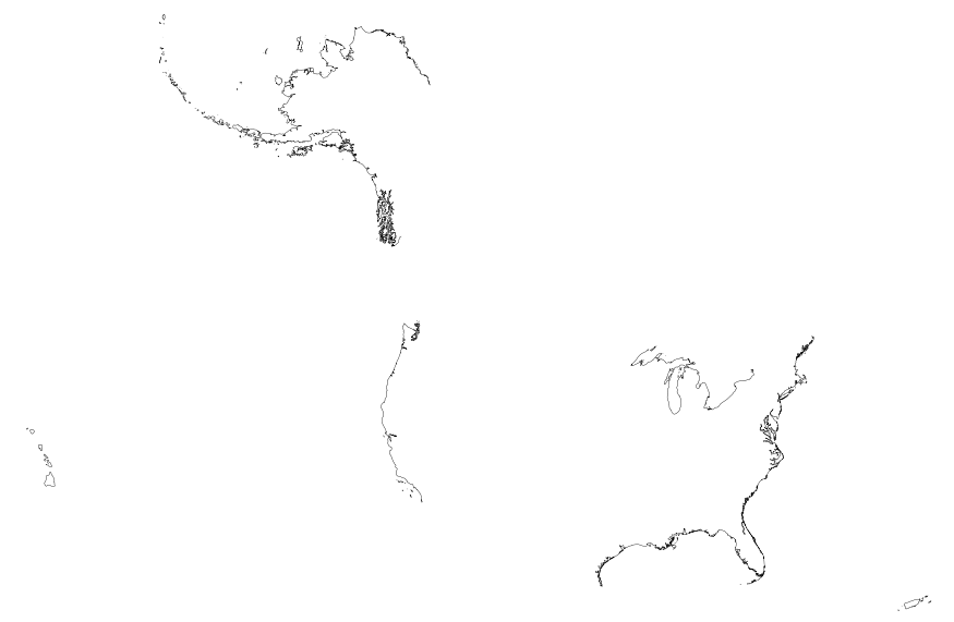
This map layer includes Global Map data showing the coastline of the United States, Puerto Rico, and the U.S. Virgin Islands. The United States shoreline of the Great Lakes is also included. The data are a modified version of the National Atlas of the United States 1:1,000,000-Scale Coastline of the United States.
|

|
