Filters: Tags: Green River (X)
499 results (8ms)|
Filters
Contacts
(Less)
|
This data set contains imagery from the National Agriculture Imagery Program (NAIP). The NAIP program is administered by USDA FSA and has been established to support two main FSA strategic goals centered on agricultural production. These are, increase stewardship of America's natural resources while enhancing the environment, and to ensure commodities are procured and distributed effectively and efficiently to increase food security. The NAIP program supports these goals by acquiring and providing ortho imagery that has been collected during the agricultural growing season in the U.S. The NAIP ortho imagery is tailored to meet FSA requirements and is a fundamental tool used to support FSA farm and conservation programs....
Floodplains are presumed to be important rearing habitat for the endangered razorback sucker (Xyrauchen texanus). To help recover this endemic Colorado River Basin species, the Upper Colorado River Endangered Fish Recovery Program implemented a floodplain acquisition and enhancement program. Levee removal was initiated in 1996 as one component of this floodplain restoration program. The goal of the Levee Removal Study was to evaluate the system responses to levee removal and make specific recommendations concerning the value of floodplain/river reconnecting for endangered species (specifically razorback sucker) recovery.
Categories: Publication;
Types: Citation;
Tags: Green River,
age-1,
flood,
floodplain depressions,
flows,
These data were compiled for a manuscript in which 1) we develop a water temperature model for the major river segments and tributaries of the Colorado River basin, including the Colorado, Green, Yampa, White, and San Juan rivers; 2) we link modeled water temperature to fish population data to predict the probability native and nonnative species will be common in the future in a warming climate; and 3) assess the degree to which dams create thermal discontinuity in summer in river segments across the western US. Per goal #1, we developed a water temperature model using data spanning 1985-2015 that predicts water temperature every 1 mile (1.6-km) in rivers both now and in the future due to the potential influence...
Climatic data are from Daymet (Thornton and others, 2016) and include maximum daily air temperature and total daily precipitation on a 1-km resolution; these data replace and update the original climate data used for the tool (Williamson and others, 2009).
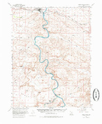
USGS Historical Quadrangle in GeoPDF.
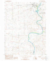
USGS Historical Quadrangle in GeoPDF.
Core Research Center, core U602, from well operated by U S BUREAU LAND MGMTRaw Properties from download, web scrape, MapServer, and Macrostrat API{"Lib Num": "U602", "API Num": null, "Operator": "U S BUREAU LAND MGMT", "Well Name": "DH 1 TRIANGULATION STATION", "Field": null, "State": "CO", "County": "GARFIELD", "Type": "SPLIT", "Photos": "F", "Thin Sec": "F", "Analysis": "F", "Latitude": "39.439376", "Longitude": "-108.170461", "coordinates_geohash": "9x506e8xj8d3", "Source": "FROM STATE RECORDS", "Security Flag": "NO SPECIAL RESTRICTIONS", "crc_collection_name": "core", "sb_parent_id": "4f4e49dae4b07f02db5e0486", "intervals": [{"Formation": "GREEN RIVER", "Age": "TERT", "Min Depth": "0", "Max Depth": "801"}],...
Categories: Physical Item;
Tags: Evacuation Creek Member,
Evacuation Creek Member of the Green River Formation,
GREEN RIVER,
TERT,
Tertiary,
Core Research Center, core U854, from well operated by ALLIED CHEMICALRaw Properties from download, web scrape, MapServer, and Macrostrat API{"Lib Num": "U854", "API Num": null, "Operator": "ALLIED CHEMICAL", "Well Name": "AC-5A", "Field": null, "State": "WY", "County": "SWEETWATER", "Type": "FULL", "Photos": "F", "Thin Sec": "F", "Analysis": "F", "Latitude": "41.575587", "Longitude": "-109.740098", "coordinates_geohash": "9x3uwb9eq7hh", "Source": "FROM STATE RECORDS", "Security Flag": "NO SPECIAL RESTRICTIONS", "crc_collection_name": "core", "sb_parent_id": "4f4e49dae4b07f02db5e0486", "intervals": [{"Formation": "GREEN RIVER", "Age": "TERT", "Min Depth": "1505", "Max Depth": "1676"}], "crcwc_url": "https://my.usgs.gov/crcwc/core/report/16436",...
Categories: Physical Item;
Tags: Bridger A,
Bridger Formation, Bridger A of the Blacks Fork Member,
GREEN RIVER,
TERT,
claystone,
Core Research Center, core U555, from well operated by SINCLAIR OIL & GASRaw Properties from download, web scrape, MapServer, and Macrostrat API{"Lib Num": "U555", "API Num": null, "Operator": "SINCLAIR OIL & GAS", "Well Name": "1 SKYLINE", "Field": null, "State": "CO", "County": "RIO BLANCO", "Type": "SLABBED", "Photos": "F", "Thin Sec": "F", "Analysis": "T", "Latitude": "39.939896", "Longitude": "-108.358008", "coordinates_geohash": "9x4gnqb4g2jp", "Source": "FROM STATE RECORDS", "Security Flag": "NO SPECIAL RESTRICTIONS", "crc_collection_name": "core", "sb_parent_id": "4f4e49dae4b07f02db5e0486", "intervals": [{"Formation": "GREEN RIVER", "Age": "TERT", "Min Depth": "789", "Max Depth": "2913"}], "crcwc_url": "https://my.usgs.gov/crcwc/core/report/15424",...
Categories: Physical Item;
Tags: Evacuation Creek Member,
Evacuation Creek Member of the Green River Formation,
GREEN RIVER,
TERT,
Tertiary,
Core Research Center, core U876, from well operated by STAUFFER CHEMICALRaw Properties from download, web scrape, MapServer, and Macrostrat API{"Lib Num": "U876", "API Num": null, "Operator": "STAUFFER CHEMICAL", "Well Name": "23 BIG ISLAND", "Field": null, "State": "WY", "County": "SWEETWATER", "Type": "SPLIT", "Photos": "F", "Thin Sec": "F", "Analysis": "F", "Latitude": "41.69246", "Longitude": "-109.672244", "coordinates_geohash": "9x6j0mgh5mze", "Source": "FROM STATE RECORDS", "Security Flag": "NO SPECIAL RESTRICTIONS", "crc_collection_name": "core", "sb_parent_id": "4f4e49dae4b07f02db5e0486", "intervals": [{"Formation": "GREEN RIVER", "Age": "TERT", "Min Depth": "640", "Max Depth": "1105"}], "crcwc_url": "https://my.usgs.gov/crcwc/core/report/16456",...
Categories: Physical Item;
Tags: Alluvial deposits,
GREEN RIVER,
Holocene and Pleistocene,
TERT,
colluvium
Core Research Center, core U816, from well operated by UNION PACIFIC RRRaw Properties from download, web scrape, MapServer, and Macrostrat API{"Lib Num": "U816", "API Num": null, "Operator": "UNION PACIFIC RR", "Well Name": "WB-5C", "Field": null, "State": "WY", "County": "SWEETWATER", "Type": "SLABBED", "Photos": "F", "Thin Sec": "F", "Analysis": "F", "Latitude": "41.302536", "Longitude": "-108.684764", "coordinates_geohash": "9x6dyyfhtqy0", "Source": "FROM STATE RECORDS", "Security Flag": "NO SPECIAL RESTRICTIONS", "crc_collection_name": "core", "sb_parent_id": "4f4e49dae4b07f02db5e0486", "intervals": [{"Formation": "GREEN RIVER", "Age": "TERT", "Min Depth": "140", "Max Depth": "516"}], "crcwc_url": "https://my.usgs.gov/crcwc/core/report/16247",...
Core Research Center, core E041, from well operated by EXXON MINERALSRaw Properties from download, web scrape, MapServer, and Macrostrat API{"Lib Num": "E041", "API Num": null, "Operator": "EXXON MINERALS", "Well Name": "6 WEST WILLOW", "Field": null, "State": "CO", "County": "RIO BLANCO", "Type": "SLABBED", "Photos": "F", "Thin Sec": "F", "Analysis": "F", "Latitude": "39.753322", "Longitude": "-108.348561", "coordinates_geohash": "9x4fnkygzs36", "Source": "FROM STATE RECORDS", "Security Flag": "NO SPECIAL RESTRICTIONS", "crc_collection_name": "core", "sb_parent_id": "4f4e49dae4b07f02db5e0486", "intervals": [{"Formation": "GREEN RIVER", "Age": "TERT", "Min Depth": "382", "Max Depth": "1565"}], "crcwc_url": "https://my.usgs.gov/crcwc/core/report/11776",...
Categories: Physical Item;
Tags: Evacuation Creek Member,
Evacuation Creek Member of the Green River Formation,
GREEN RIVER,
TERT,
Tertiary,
Core Research Center, core U640, from well operated by ARCORaw Properties from download, web scrape, MapServer, and Macrostrat API{"Lib Num": "U640", "API Num": null, "Operator": "ARCO", "Well Name": "FIGURE FOUR 17-1", "Field": null, "State": "CO", "County": "RIO BLANCO", "Type": "SLABBED", "Photos": "F", "Thin Sec": "F", "Analysis": "F", "Latitude": "39.6958", "Longitude": "-108.52459", "coordinates_geohash": "9x4cf6qucc2w", "Source": "CENTER OF QUARTER SECTION", "Security Flag": "NO SPECIAL RESTRICTIONS", "crc_collection_name": "core", "sb_parent_id": "4f4e49dae4b07f02db5e0486", "intervals": [{"Formation": "GREEN RIVER", "Age": "TERT", "Min Depth": "528", "Max Depth": "696"}], "crcwc_url": "https://my.usgs.gov/crcwc/core/report/14892",...
Categories: Physical Item;
Tags: Evacuation Creek Member,
Evacuation Creek Member of the Green River Formation,
GREEN RIVER,
TERT,
Tertiary,
Core Research Center, core U589, from well operated by U S NAVYRaw Properties from download, web scrape, MapServer, and Macrostrat API{"Lib Num": "U589", "API Num": null, "Operator": "U S NAVY", "Well Name": "20 NOSR 1", "Field": null, "State": "CO", "County": "GARFIELD", "Type": "SLABBED", "Photos": "F", "Thin Sec": "F", "Analysis": "F", "Latitude": "39.610091", "Longitude": "-108.028503", "coordinates_geohash": "9x51mfb192ju", "Source": "FROM STATE RECORDS", "Security Flag": "NO SPECIAL RESTRICTIONS", "crc_collection_name": "core", "sb_parent_id": "4f4e49dae4b07f02db5e0486", "intervals": [{"Formation": "GREEN RIVER", "Age": "TERT", "Min Depth": "630", "Max Depth": "1920"}], "crcwc_url": "https://my.usgs.gov/crcwc/core/report/15605",...
Categories: Physical Item;
Tags: Evacuation Creek Member,
Evacuation Creek Member of the Green River Formation,
GREEN RIVER,
TERT,
Tertiary,
Core Research Center, core U544, from well operated by USGSRaw Properties from download, web scrape, MapServer, and Macrostrat API{"Lib Num": "U544", "API Num": null, "Operator": "USGS", "Well Name": "78-8 CORE HOLE", "Field": null, "State": "CO", "County": "RIO BLANCO", "Type": "SLABBED", "Photos": "F", "Thin Sec": "F", "Analysis": "F", "Latitude": "40.046356", "Longitude": "-108.599759", "coordinates_geohash": "9x4gbf0nfjy6", "Source": "DERIVED FROM MAPPED LOCATION", "Security Flag": "NO SPECIAL RESTRICTIONS", "crc_collection_name": "core", "sb_parent_id": "4f4e49dae4b07f02db5e0486", "intervals": [{"Formation": "GREEN RIVER", "Age": "TERT", "Min Depth": "20", "Max Depth": "630"}], "crcwc_url": "https://my.usgs.gov/crcwc/core/report/15414",...
Categories: Physical Item;
Tags: Eocene,
GREEN RIVER,
Green River Fm--Lower Part,
Green River Formation,
TERT,
Core Research Center, core U641, from well operated by WHITE RIVER SHALERaw Properties from download, web scrape, MapServer, and Macrostrat API{"Lib Num": "U641", "API Num": null, "Operator": "WHITE RIVER SHALE", "Well Name": "X-4", "Field": null, "State": "UT", "County": "UINTAH", "Type": "THICK SLAB", "Photos": "F", "Thin Sec": "F", "Analysis": "F", "Latitude": "39.94339", "Longitude": "-109.18811", "coordinates_geohash": "9x475r7xhes4", "Source": "FROM STATE RECORDS", "Security Flag": "NO SPECIAL RESTRICTIONS", "crc_collection_name": "core", "sb_parent_id": "4f4e49dae4b07f02db5e0486", "intervals": [{"Formation": "GREEN RIVER", "Age": "TERT", "Min Depth": "660", "Max Depth": "958"}], "crcwc_url": "https://my.usgs.gov/crcwc/core/report/15634",...
Categories: Physical Item;
Tags: Eocene, Uintan,
GREEN RIVER,
TERT,
Uinta Formation,
member A of Uinta Formation
Core Research Center, core U832, from well operated by USGSRaw Properties from download, web scrape, MapServer, and Macrostrat API{"Lib Num": "U832", "API Num": null, "Operator": "USGS", "Well Name": "1 MASSACRE HILLS", "Field": null, "State": "WY", "County": "SWEETWATER", "Type": "FULL", "Photos": "F", "Thin Sec": "F", "Analysis": "F", "Latitude": "41.390729", "Longitude": "-109.618693", "coordinates_geohash": "9x653wfn7r45", "Source": "FROM STATE RECORDS", "Security Flag": "NO SPECIAL RESTRICTIONS", "crc_collection_name": "core", "sb_parent_id": "4f4e49dae4b07f02db5e0486", "intervals": [{"Formation": "GREEN RIVER", "Age": "TERT", "Min Depth": "44", "Max Depth": "248"}], "crcwc_url": "https://my.usgs.gov/crcwc/core/report/16418",...
Categories: Physical Item;
Tags: Eocene,
GREEN RIVER,
Green River Formation - Laney Member,
Laney Member,
TERT,
Core Research Center, core W225, from well operated by CAMERON/ MARATHONRaw Properties from download, web scrape, MapServer, and Macrostrat API{"Lib Num": "W225", "API Num": "4903707140", "Operator": "CAMERON/ MARATHON", "Well Name": "CARL TOMICH 1", "Field": null, "State": "WY", "County": "SWEETWATER", "Type": "SLABBED", "Photos": "F", "Thin Sec": "F", "Analysis": "F", "Latitude": "42.04048", "Longitude": "-109.41953", "coordinates_geohash": "9x6pnj5ps1kz", "Source": "FROM STATE RECORDS", "Security Flag": "NO SPECIAL RESTRICTIONS", "crc_collection_name": "core", "sb_parent_id": "4f4e49dae4b07f02db5e0486", "intervals": [{"Formation": "GREEN RIVER", "Age": "TERT", "Min Depth": "366", "Max Depth": "668"}], "crcwc_url":...
Categories: Physical Item;
Tags: Eocene,
GREEN RIVER,
Laney Member,
Laney Shale Member of Green River Formation,
TERT,
Core Research Center, core U625, from well operated by MAPCO INCORPORATEDRaw Properties from download, web scrape, MapServer, and Macrostrat API{"Lib Num": "U625", "API Num": null, "Operator": "MAPCO INCORPORATED", "Well Name": "1 SHRINE HOSPITAL", "Field": null, "State": "UT", "County": "DUCHESNE", "Type": "SLABBED", "Photos": "T", "Thin Sec": "F", "Analysis": "F", "Latitude": "40.5718", "Longitude": "-112.3917", "coordinates_geohash": "9x0nf3yggedq", "Source": "UNKNOWN", "Security Flag": "NO SPECIAL RESTRICTIONS", "crc_collection_name": "core", "sb_parent_id": "4f4e49dae4b07f02db5e0486", "intervals": [{"Formation": "GREEN RIVER", "Age": "TERT", "Min Depth": "4140", "Max Depth": "4147"}, {"Formation": "GREEN RIVER",...
Categories: Physical Item;
Tags: GREEN RIVER,
GREEN RIVER,
Holocene to late Pleistocene,
Lacustrine and alluvial deposits, undivided,
TERT,
Core Research Center, core R961, from well operated by EQUITY OILRaw Properties from download, web scrape, MapServer, and Macrostrat API{"Lib Num": "R961", "API Num": "0510305051", "Operator": "EQUITY OIL", "Well Name": "SOUTH SULPHUR 3", "Field": "BOIES RANCH/SULPHUR CREEK", "State": "CO", "County": "RIO BLANCO", "Type": "SPLIT", "Photos": "F", "Thin Sec": "F", "Analysis": "F", "Latitude": "39.773002", "Longitude": "-108.481011", "coordinates_geohash": "9x4f72qw90zq", "Source": "FROM STATE RECORDS", "Security Flag": null, "crc_collection_name": "core", "sb_parent_id": "4f4e49dae4b07f02db5e0486", "intervals": [{"Formation": "GREEN RIVER", "Age": null, "Min Depth": "11", "Max Depth": "21"}, {"Formation": "GREEN RIVER",...
|

|
