Filters: Tags: Greenlee County (X)
221 results (101ms)|
Filters
|
The 'Ash Peak: News Release' file is part of the A. F. Budge Mining Ltd. Mining collection. A. F. Budge Mining Ltd., a British company owned by Tony Budge, controlled properties across several western U. S. states and northern Mexico. The company was active in Arizona during the 1980s and into the early 1990s. The collection consists of economic geologic information including maps, logs, reports and records. A few properties make up most of the collection: Vulture, United Verde Extension and Korn Kob.
Categories: Data;
Tags: 1980s,
Arizona,
Arthur Murphy,
Ash Peak metallic mineral dist.,
Black Beauty,
Heinrichs Geoexploration Co. Maps: Black Jack Anomoly, Magnetic Survey Line No. 4; 1 in. to 200 feet; 11 x 8 in.
The 'Dover Property Greenlee County, AZ' file is part of the Grover Heinrichs mining collection. Grover was the Vice President of Heinrichs GEOEXploration, located in Tucson, Arizona. The collection contains over 1,400 folders including economic geology reports, maps, photos, correspondence, drill logs and other related materials. The focus of much of the information is on the western United States, particularly Arizona, but the collection also includes files on mining activity throughout the United States, foreign countries, and 82 mineral commodities.
Categories: Data;
Tags: 1950s,
Arizona,
Clifton - 15 Min,
Copper,
Copper Mountain metallic mineral dist.,
The 'Ash Peak: Drill Hole Assays' file is part of the A. F. Budge Mining Ltd. Mining collection. A. F. Budge Mining Ltd., a British company owned by Tony Budge, controlled properties across several western U. S. states and northern Mexico. The company was active in Arizona during the 1980s and into the early 1990s. The collection consists of economic geologic information including maps, logs, reports and records. A few properties make up most of the collection: Vulture, United Verde Extension and Korn Kob.
Categories: Data;
Tags: 1980s,
Arizona,
Arthur Murphy,
Ash Peak metallic mineral dist.,
Black Beauty,
ADMMR map collection: Morenci Mine Bit Shop; 1 in. to 10 feet; 23 x 20 in.
Categories: Data;
Tags: Abrasive, Garnet Andra,
Arizona,
Arizona Central,
Bon Ton,
Calcium, Limestone,
ADMMR map collection: Morenci Inclined Top-Slice System; 24 x 14 in.
Categories: Data;
Tags: Abrasive, Garnet Andra,
Arizona,
Arizona Central,
Bon Ton,
Calcium, Limestone,
ADMMR map collection: Fourth of July Mine, Strategic Minerals Investigations Preliminary Map; 1 in. to 20 feet; 32 x 26 in.
Categories: Data;
Tags: 1940s,
Arizona,
Arizona Eastern Fluorspar Corp,
Arizona Fluorspar,
Black Bird,
Heinrichs Geoexploration Co. Maps: Cuprite Area Geology; 2 in. to 1 mile; 12 x 13 in.
A.F. Budge Mining Ltd. Maps: Essex-Morenci Claim Map; 1 in. to 400 feet; 18 x 20 in.
Categories: Data;
Tags: 1970s,
Arizona,
Clifton - 15 Min,
Copper Mountain metallic mineral dist.,
Dataset,
Heinrichs Geoexploration Co. Maps: Black Jack Anomoly, Magnetic Survey Line No. 6; 1 in. to 200 feet; 11 x 8 in.
Heinrichs Geoexploration Co. Maps: Black Jack Anomoly, Magnetic Survey Line No. 12; 1 in. to 200 feet; 11 x 8 in.
The 'Preliminary Investigation, Feasibility of Development of Mine Water Supply, Greenlee County' file is part of the Grover Heinrichs mining collection. Grover was the Vice President of Heinrichs GEOEXploration, located in Tucson, Arizona. The collection contains over 1,400 folders including economic geology reports, maps, photos, correspondence, drill logs and other related materials. The focus of much of the information is on the western United States, particularly Arizona, but the collection also includes files on mining activity throughout the United States, foreign countries, and 82 mineral commodities.
The 'Ash Peak Mine Update for Canamin Resources Ltd.' file is part of the A. F. Budge Mining Ltd. Mining collection. A. F. Budge Mining Ltd., a British company owned by Tony Budge, controlled properties across several western U. S. states and northern Mexico. The company was active in Arizona during the 1980s and into the early 1990s. The collection consists of economic geologic information including maps, logs, reports and records. A few properties make up most of the collection: Vulture, United Verde Extension and Korn Kob.
Categories: Data;
Tags: 1980s,
Arizona,
Arthur Murphy,
Ash Peak metallic mineral dist.,
Black Beauty,
The 'Ash Peak: Canamin Progress Report' file is part of the A. F. Budge Mining Ltd. Mining collection. A. F. Budge Mining Ltd., a British company owned by Tony Budge, controlled properties across several western U. S. states and northern Mexico. The company was active in Arizona during the 1980s and into the early 1990s. The collection consists of economic geologic information including maps, logs, reports and records. A few properties make up most of the collection: Vulture, United Verde Extension and Korn Kob.
Categories: Data;
Tags: 1980s,
Arizona,
Arthur Murphy,
Ash Peak metallic mineral dist.,
Black Beauty,
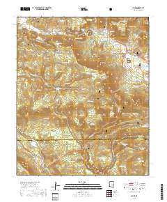
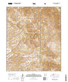
Layered geospatial PDF 7.5 Minute Quadrangle Map. Layers of geospatial data include orthoimagery, roads, grids, geographic names, elevation contours, hydrography, and other selected map features. This map is derived from GIS (geospatial information system) data. It represents a repackaging of GIS data in traditional map form, not creation of new information. The geospatial data in this map are from selected National Map data holdings and other government sources.
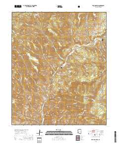
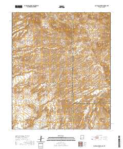
Layered geospatial PDF 7.5 Minute Quadrangle Map. Layers of geospatial data include orthoimagery, roads, grids, geographic names, elevation contours, hydrography, and other selected map features. This map is derived from GIS (geospatial information system) data. It represents a repackaging of GIS data in traditional map form, not creation of new information. The geospatial data in this map are from selected National Map data holdings and other government sources.
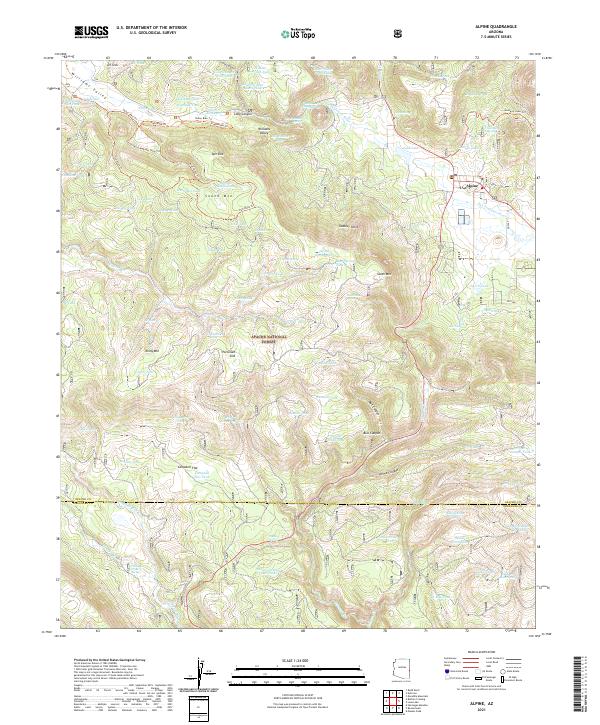
Layered geospatial PDF 7.5 Minute Quadrangle Map. Layers of geospatial data include orthoimagery, roads, grids, geographic names, elevation contours, hydrography, and other selected map features. This map is derived from GIS (geospatial information system) data. It represents a repackaging of GIS data in traditional map form, not creation of new information. The geospatial data in this map are from selected National Map data holdings and other government sources.
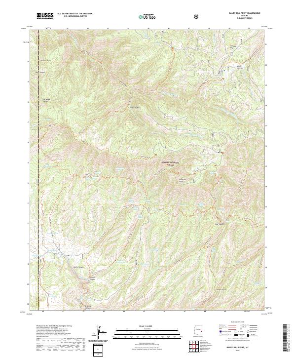
Layered geospatial PDF 7.5 Minute Quadrangle Map. Layers of geospatial data include orthoimagery, roads, grids, geographic names, elevation contours, hydrography, and other selected map features. This map is derived from GIS (geospatial information system) data. It represents a repackaging of GIS data in traditional map form, not creation of new information. The geospatial data in this map are from selected National Map data holdings and other government sources.
Layered geospatial PDF 7.5 Minute Quadrangle Map. Layers of geospatial data include orthoimagery, roads, grids, geographic names, elevation contours, hydrography, and other selected map features. This map is derived from GIS (geospatial information system) data. It represents a repackaging of GIS data in traditional map form, not creation of new information. The geospatial data in this map are from selected National Map data holdings and other government sources.
Layered geospatial PDF 7.5 Minute Quadrangle Map. Layers of geospatial data include orthoimagery, roads, grids, geographic names, elevation contours, hydrography, and other selected map features. This map is derived from GIS (geospatial information system) data. It represents a repackaging of GIS data in traditional map form, not creation of new information. The geospatial data in this map are from selected National Map data holdings and other government sources.
|

|
